
Weekly Trail Update Five: April 23 – April 29, 2018
Welcome back for another trail update!
Day 29: Chestnut Knob Shelter to random spot @ mm594 – 24.8mi
As I mentioned before, the shelter last night was great. Although it was windy outside, we felt none of it thanks to the closed door that kept things gust-free inside. I got up at about 6:15 and quietly packed, making it on the trail at 7. Since it’s getting light earlier in the day, the sun was rising as I hit the trail and I didn’t need my headlamp.
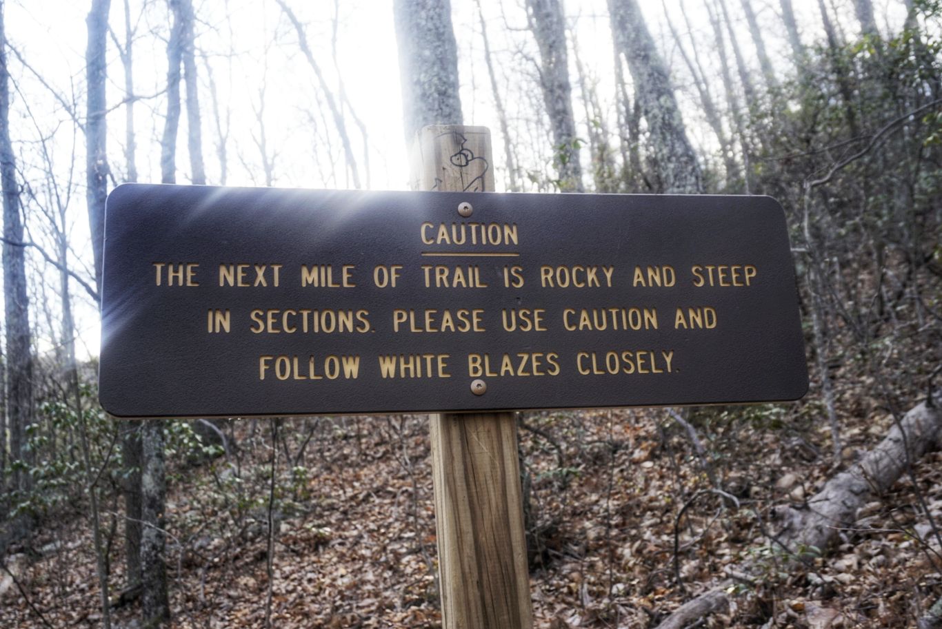
The first 8mi of the trail today were along a ridgeline that was rocky and technical. It didn’t take long before I was cursing the stones while simultaneously struggling to keep my footing. One thing none of the guidebooks include, which would be awesome, is an indicator of terrain difficulty – when planning daily mileage you never know if it’s going to be smooth going along tightly packed dirt or scrambling over rocks. It can make a serious difference in the mileage one is able to do and would help immensely.
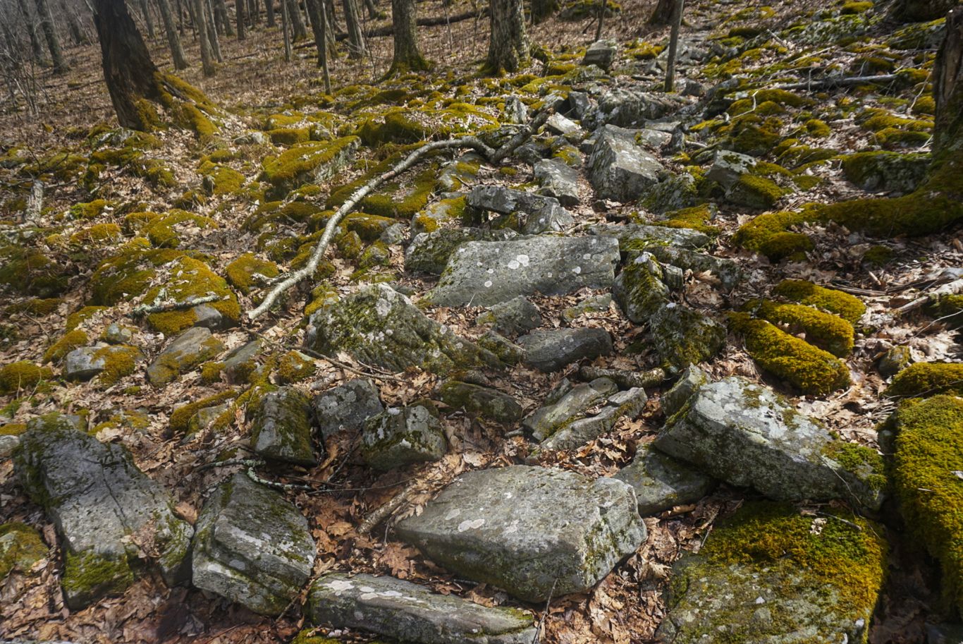
Not my favorite terrain.
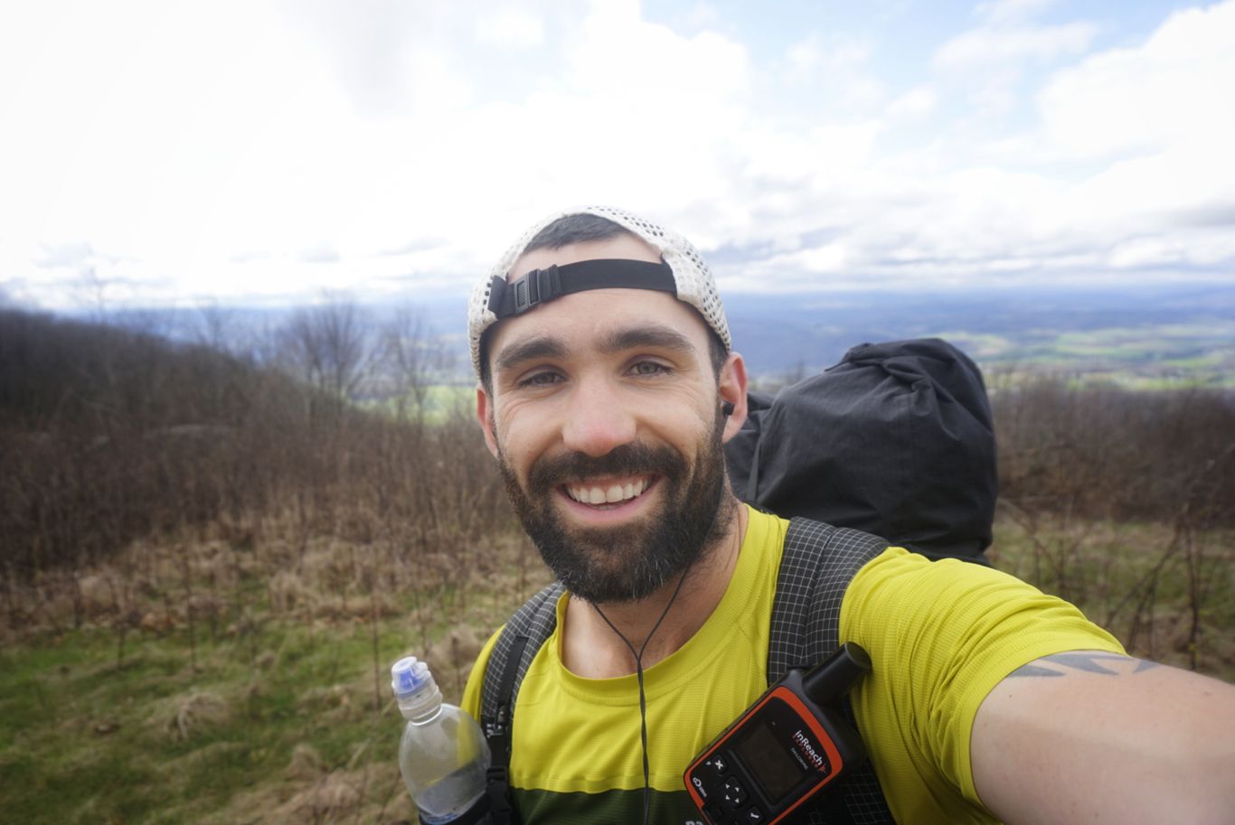
I took it slow along the rocky section and by the time that part was finished my feet were already hurting. I stopped next to a stream to refill my water bottles and took the opportunity to take my shoes off and let my feet breathe. The weather was excellent all day and perfect to hike in.
A little while later, I was passed by Honeybun (he was in the shelter last night as well) and he was trying to make it to a store about 10 miles up so he could resupply. I read about the store (Brushy Mountain Outpost) and found out it serves food. I figured I’d stop by too, if it was open. With it being Sunday, you never know what the hours might be.
The trail was nice for that whole stretch. Nothing extreme in any direction. My feet were pretty raw, though, so I made a couple more stops along the way to let them rest. I eventually reached the Outpost at just before 5pm, and it was closed. It’s only open until 4pm on Sundays, so I had missed it by an hour. Oh well. I felt bad for Honeybun, too, because I don’t think he made it in time either.
From there, it was only about 2.5mi to the shelter. I saw on the guidebook that the shelter is nearly half a mile off the trail, which bugs me (I hate wasting mileage – every step counts!), so I decided not to stay and instead set up shop at the next flat spot. Due to the nature of the trail at this point, such a spot never really presented itself so I made my own. It’ll do.
Tomorrow I’ve got another 24mi day ahead. It’s supposed to start raining around 10am and not let up until Wednesday, so I’m hoping to be able to stay in the shelter and not get too soaked. Also, because I’ve taken longer than expected to reach my next resupply point (in 2 days), I’ve run out of my oatmeal and dehydrated dinners. I have enough food to get me there, but I’m going to miss my hot dinners for the next couple of nights!
Day 30: Camping spot to Wapiti Shelter – 24mi
I got up a little early this morning to try and get some miles behind me before the rain started. I knew it was set to begin sometime in the afternoon so I was on the trail at 630.
The terrain all day was excellent – easy rolling hills with very few technical parts. By 11am I had already done about half the day’s distance and was feeling good.
It started to sprinkle at about 1pm and the died off for a bit before coming back with a full-force rainstorm starting around 2pm. I had my poncho on and was able to stay relatively dry underneath, but my hands were frozen and my feet soaked. At about 4pm I stopped to get some water (which felt odd as I was already wearing least a gallon) and rest my feet, which were throbbing.
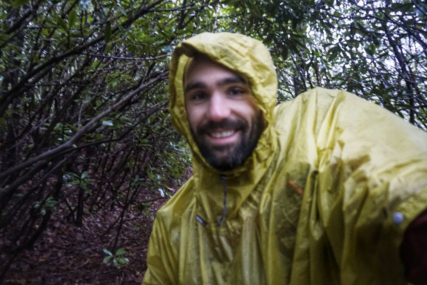
Embracing the suck.
Right after I got up, I ran into Homebound, one of the guys in the group I had been hiking with after Damascus. He and most of the others had put in some long days and caught up, planning to stay at the same shelter as me and the same hostel the night after. We hiked the last mile together which helped me get out of my funk, and luckily there were only a couple others there so we both got a spot. One by one the others showed up until the shelter was full and there were 5 or 6 tents set up. It continued raining for most of the evening, but at least the temperature is supposed to stay above freezing.
Also, fun fact about this shelter: it’s where two hikers from Maine were murdered in 1981. Apparently the original shelter has been dismantled and this one is about a mile from the where the other one sat, but why would they keep the same name?!
Anyway, tomorrow we have a 7mi hike to Woods Hole Hostel. It’s supposed to rain all day and through the night and then clear up on Wednesday, so hopefully we’ll be inside for the worst of it tomorrow.
Day 31: Wapiti Shelter to Woods Hole Hostel – 7.2mi
Last night I was very thankful to be in the shelter. I could hear the rain pouring down most of the night and I felt bad for the 15 or so others that had to pitch their tents. But, we’ve all been there – it wasn’t long ago that I was bailing the water out of my tent by the bucketload myself. At least this time the wind wasn’t bad.
Most of us were up and on the trail by just after 7. It wasn’t raining when we left, but I wore my poncho anyway and sure enough it was pouring within an hour. We only had 7mi to hike in order to make it to the hostel (which is half a mile off the trail), and it went by pretty fast. The trail was quite rocky in some places, and with the rain it was very slick. I had a couple of close calls where I almost ended up falling on my face, but I held it together.

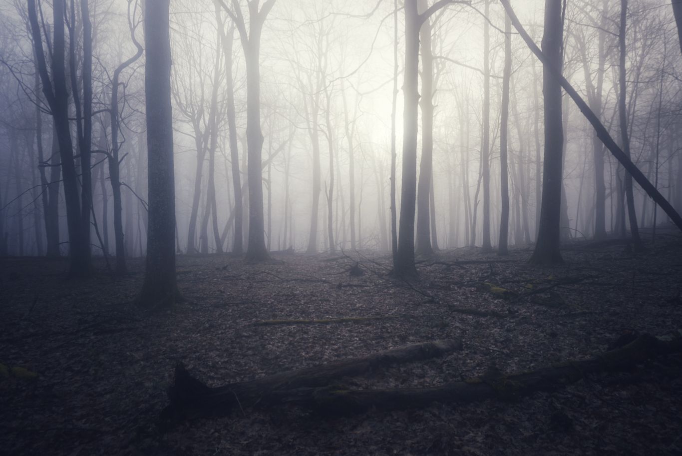
The wet, green tunnel.
By the time I reached the hostel, the rain was blowing sideways and directly into my face. My gloves, wind pants, and shoes were totally waterlogged, but I was warm and dry otherwise. Most of us from the shelter arrived between 10 and 11am,which is pretty early for check-in, but they let us in anyway. Some people were still packing up to head out, but the bunkhouse was mostly clear. It was a mad dash for the showers, but I took my time and let the guys who had slept outside the night before have first crack. I then broke open my resupply box and hung my wet items up to dry. I did eventually shower, of course, and it was great to have access to hot water while it was literally pissing down outside.
The hostel here is a bit unique in that it’s focused around sustainable living, so they grow a lot of their own food and rely on “work for stay” assistance from other hikers to get a lot of their projects and administrative work done. The place is run by a woman named Neville and her husband, who took over from her grandmother who opened the doors in the 80s, making it one of the oldest hostels on the trail. They don’t allow any kind of drugs or alcohol on site, much to the chagrin of some hikers but to the delight of most. I prefer it that way, honestly, as hikers can get pretty loud and annoying even when vices aren’t involved. I certainly wouldn’t have minded cracking a beer, but I have a feeling it could have gotten rowdy, which is annoying when you’re in a confined space and can’t get away from it. This place is also unique because it offers communal dinners and breakfasts, which are homemade using lots of items from their garden. They also offer massages, yoga classes, and various other holistic services. It is quite an experience.
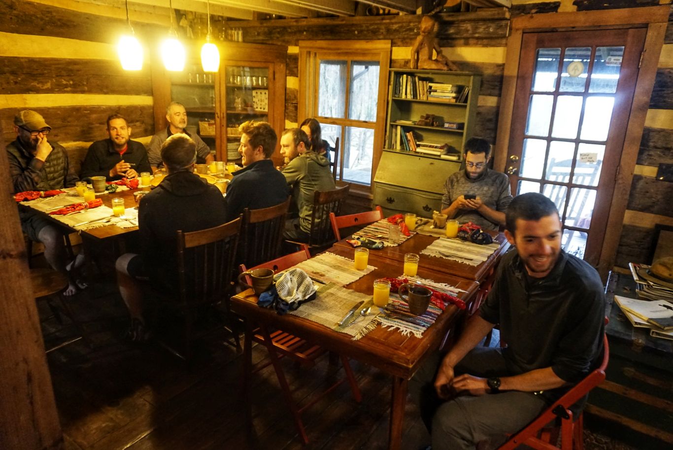
Dining room.
For dinner we had fresh salad, hummus, pickles, egg salad, and a Mai. It is course of chili with rice and cheese, followed by cookies for dessert. Everything was homemade and hikers pitched in to help assemble the meal. It was the best meal I’ve had on trail and totally worth the $14. We even held hands and went around the table to say what we were thankful for before eating, which was quite different from our usual meals on trail. I suspect it will be something similar tomorrow for breakfast.
After checking out tomorrow, I’m hoping to put in 20-22mi. According to the weather report I saw there’s only a 30% chance of rain in the morning followed by a 10% chance by 1pm, so it seems like it shouldn’t be too wet.
As of now, I’m three days behind my original schedule which isn’t too bad. I don’t want to jinx it, but I haven’t had any serious IT band / knee pain in the past four days. I think the stretches are really working, which is fantastic. My feet, however, continue to hold me back. I can’t seem to get used to the new shoes I’m wearing – my feet are completely toasted by mile 22 and the last couple of days it’s been really tough pushing to 24. I need to be able to push closer to 30 mile days, like I was at the start, in order to fully get backed on track and I may have to switch shoes again if I can’t get it done with these. We’ll see.
Day 32: Woods Hole Hostel to Campsite @ mm650.6 – 26.3mi
I slept in until 7am at the hostel this morning. They were serving breakfast at 8 so there was no rush to get up and out, which was nice. We all packed up and did our various morning routines before heading to the main house for coffee just before 8. As with dinner, breakfast was served communally, which meant help was needed to set the table, cook, portion each plate, and serve. I helped out by bringing the plates out to the dining room once they had been made. We had eggs with some ground beef, pineapple, and peach cobbler. And of course, lots of fresh bread with homemade apple and strawberry jam. It was delicious. We all had our fill and then people started to take off once they settled up.
I retrieved a package I had sent there, which I ordered in Atkins – an IT band brace for my leg. Now that I know what the issue is, I also know that the brace I had wasn’t doing anything so I put it in the hiker box for someone else to use.
I checked the weather forecast one last time and it damn near promise it wasn’t going to rain. I then paid my tab, which came to $47 – not a bad deal for two excellent meals, a comfortable bed, and a few snacks I bought.
I headed out soon after, making the half mile trek back to the trail, and I didn’t even don my poncho. The trail went upward and although it wasn’t raining currently, there was lots of runoff. The trail turned into a stream with water running right down the center, so I had to make some quick jumps back and forth to avoid soaking my feet. The terrain varied throughout this section for the next 10mi, sloping upward but at an easy grade.
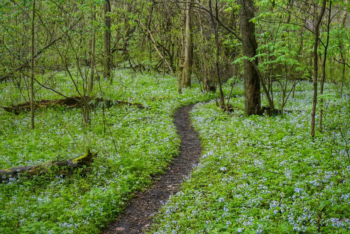
A lovely stretch of trail.
After 10mi, the trail meets a road which can be taken to the town of Pearisburg (pronounced “Paris-burg”, but you can rest assured there’s no Eiffel Tower). Everyone else from the hostel except for me was heading into town, either to resupply, buy booze, or escape the weather (which was fine by then). I continued on, coming to another road crossing about a mile later that had a parking lot for the trail. In the lot was an older couple sitting in their pickup truck, and when I passed by they rolled down their window to chat. Apparently they come to that lot several times per week and sit there to eat lunch and talk to hikers. They do some hiking themselves, but they seem to really enjoy just listening to the stories of those passing by. They offered me a ride to town, but I politely declined as I explained that I didn’t need to go, and after a while I was on my way again. The generosity and courtesy of people on and associated with the AT never ceases to amaze me.
I wasn’t sure how far I’d make it today, as it depended on whether or not the weather, my feet, and my knee held up. Luckily, all three behaved quite well so I decided to push for my longest day since Damascus. The trail was mostly flat and not very rocky most of the time, which helped immensely in meeting the goal. I arrived at a nice little campsite just before 8pm and was able to get set up before it got dark. The rain held off most of the day, with just a couple of short showers here and there.
Tomorrow I hope to do similar mileage.
Day 33: Campsite @ mm650.6 to campsite at mm680 – 30mi
I awoke this morning to foggy and drizzly weather which, combined with condensation, had wetted the inside of my tent. I guess that’s the price you pay for single-walled tents that only weigh a pound. I was on the trail by 7 and determined to put in some good miles. It was no longer raining, so I worked my way down the ridgeline, easily taking the downhills without trouble.
Drizzly mornings on the ridgeline.
However, my luck with nice and smooth trails soon ran out, and I proceeded up one of three ass-kicking climbs I would face throughout the day. I made it to the top, passing by Bailey Gap shelter along the way which still had sleeping hikers in nearby tents, and then quickly descended down the other side. This is what is known on the trail as a “PUD” – a Pointless Up and Down – where you literally spend a ton of time and energy to climb a peak only to go right back down again. The descent here was extremely technical and had rocks everywhere. This is the most frustrating terrain because you can’t really get into a rhythm as it’s constantly being interrupted by a large rock here, a mud puddle there. At one point I rolled my ankle and went tumbling, but after dusting myself off I was good to go.
At the bottom, I passed by War Spur shelter which also had a few stragglers hanging out. I must have passed 10 people by now, all of whom were barely out of bed by 10am.
I then began my second PUD of the day up to Kelly Knob. This climb was longer and steeper than the last (climbing 1,800ft in about 2.5mi) and took what felt like forever to climb. There was a stretch toward the end that was just a long, straight, and steep dirt road. These are the worst since you can see that no end is in sight. Again, I came crashing down the other side with another hiker right behind me. I passed by the Laurel Creek shelter, where the other hiker was headed, and stopped to fill my water bottles at the nearby stream. Just then, it began to sprinkle. It had been beautiful weather all day and I didn’t think more rain was in the forecast, but when I checked it again on my InReach I was surprised to see that they were indeed calling for rain throughout the evening. Crap. I had planned to find a stealth camping spot somewhere near the next shelter, which was 6mi ahead, as I’d be getting to the shelter itself too late (there’s an unspoken rule that if you arrive at a shelter after “hiker midnight” – 9pm – you should put up your tent to avoid disturbing the others). It was already close to 6pm so I decided to make the push and see how long it took. The rain wasn’t expected to be heavy, so it was easily managed by my poncho.
The next 6mi brought me through farm fields and up my third ass-kicking climb of the day. This one was about a mile and a half long and almost completely vertical. I was stopping every 100ft to catch my breath. The rain picked up a bit when I got to the ridgeline on top, and I finally settled on a flat spot I found just before the shelter, arriving at 830pm. Setting up your tent in the rain is never enjoyable, especially when it’s still wet from the night before, but it’s all part of the experience. Luckily, the rain is expected clear up overnight and I should have another nice day of hiking tomorrow.
Overall, I’m pleased with the day as it was my longest in forever and also one of the toughest thanks to the rocks and PUDs. I’m hoping to do about the same mileage tomorrow, which would get me to Daleville a day earlier than expected. That would help inch me back toward being on schedule, so I’m hoping to get it done.
Day 35: Campsite at mm680 to Johns Spring Shelter – 30.4mi
I mentioned that it was raining yesterday evening and was, according to the forecast, going to do so all night. Sure enough, it did. Sleeping in a wet tent is annoying, but what is even less fun is getting into a damp sleeping bag that is only getting more moist. I had the idea of wrapping the lower part of my sleeping bag in my pack liner (a trash compactor bag) to block any moisture from seeping in, as my tent (which is already small) was sagging a bit and touching my bag. Unfortunately, it completely wetted out overnight and I had a new film of moisture on the footbox of my bag when I woke up. Luckily, just as forecasted, the rain stopped at about 6am. I packed all my wet gear and hit the trail.
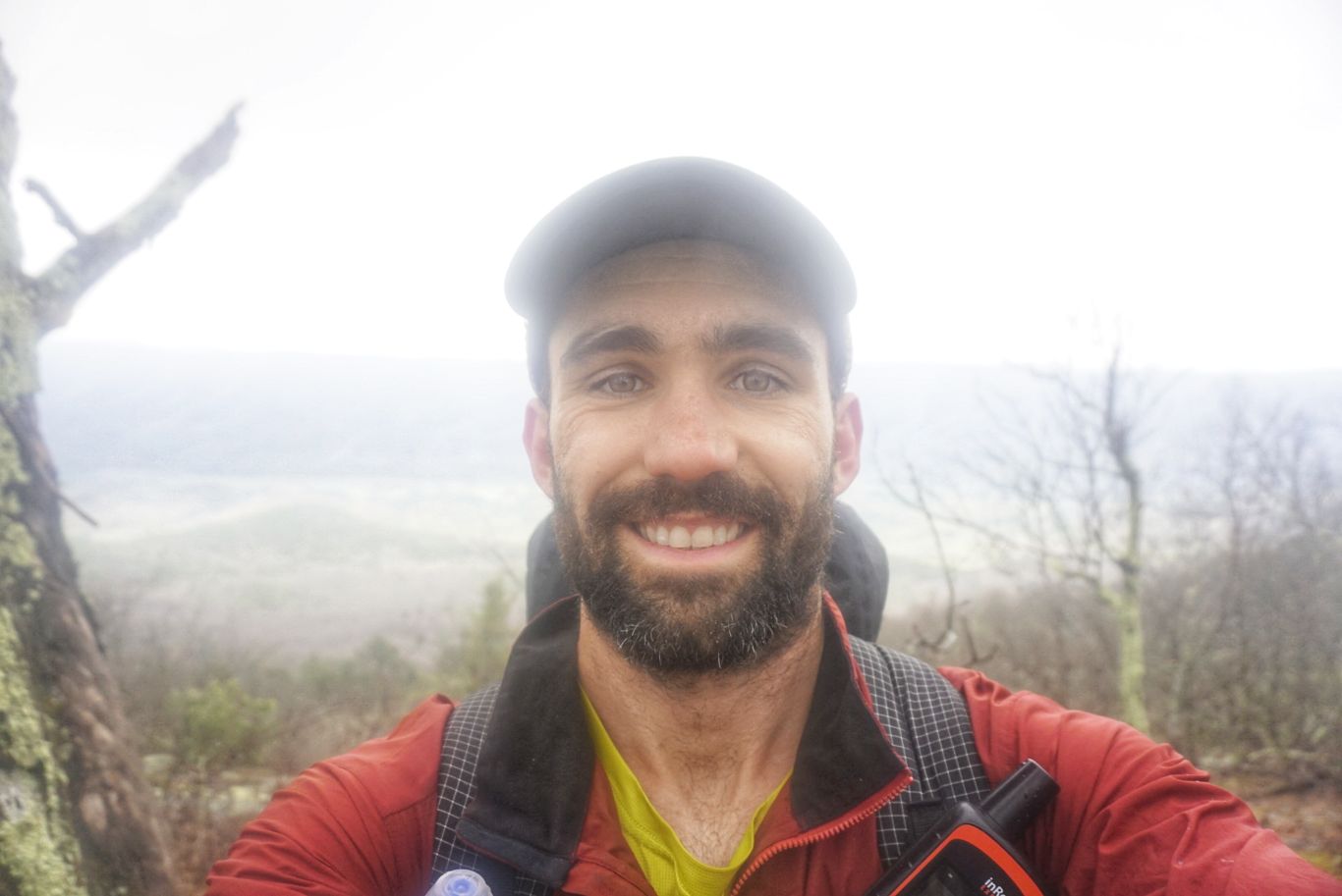
Rain is clearing up!
My hope was to get in 30mi for the day, and right off the bat I knew it would be a challenge. Once again I had stayed atop a ridgeline and the theme of these areas is that they are rocky and unkempt. This particular ridgeline had the additional challenge of huge angled slabs of rock over which the trail navigated. Because of the night’s rain, they were slick as ice and I had to really take my time to avoid slipping off the mountain. After successfully circumventing that section, there was a long downhill that allowed me to regain some time. Of course, it was then followed by an equally steep uphill, at the top of which was a monument to Audie Murphy, the most decorated WWII veteran. He died in a plane crash near the mountain top in 1971.
The next few miles were uneventful – a couple of short PUDs but nothing drastic. Then, the terrain got increasingly technical until I reached the top of Cove Mountain, where there’s a huge monolith called The Dragon’s Tooth. It required a short diversion from the trail, but it was worth seeing the spectacle and the view of the valley behind it.
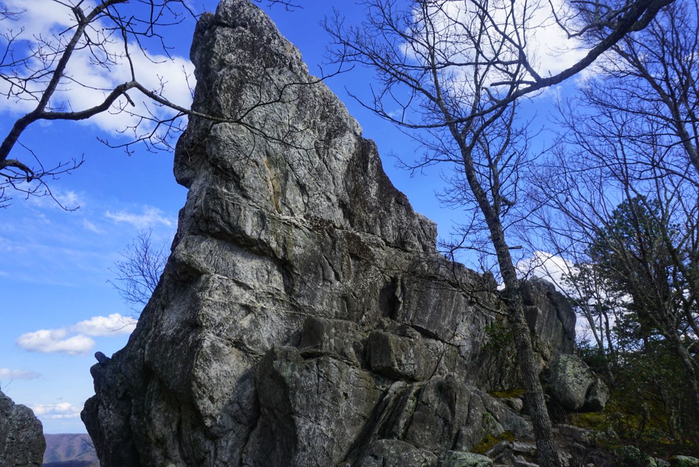
Dragon’s Tooth.
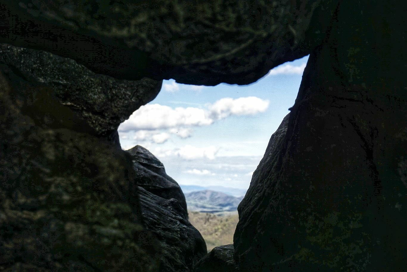
Tooth within the tooth.
Then, it was on to descending the other side of the mountain. This section was, by far, the most technical and difficult of the entire trail so far. It was ledge after ledge with small footholds, lots of pooled water, and quick and steep descents. There were even ladder rungs on some parts. Although only about a mile in distance, it took me well over an hour to complete. Having already hiked close to 20mi on tired feet, it took a lot out of me.
No s#$@!
The terrain got only slightly better in the following few miles until eventually smoothing out significantly as the trail ran through some cow pastures. A couple more climbs and another ibuprofen later, I was within a couple miles of my destination. It was getting late and I was seriously fatigued, so I planned to stop at the next flat spot I could find but none existed. I ended up hoofing it all the way to the shelter and arrived just before 10pm – my longest day yet (14.5 hours).
I thought yesterday knocked me down a peg, but today was even worse. There was one fewer climb, but Dragon’s Tooth chewed me up and spat me out.
The idea of doing big miles these last couple of days was to get to Troutville tomorrow instead of on Sunday as originally planned. Doing 30mi today sets me up for a nice 18mi day into town tomorrow, by which I should be able to arrive in the afternoon. I’m also passing by McAfee Knob in the morning, which is one of the most iconic scenes on the AT so I’d like to be able to enjoy it for a few minutes.
That’s all for this week!

This website contains affiliate links, which means The Trek may receive a percentage of any product or service you purchase using the links in the articles or advertisements. The buyer pays the same price as they would otherwise, and your purchase helps to support The Trek's ongoing goal to serve you quality backpacking advice and information. Thanks for your support!
To learn more, please visit the About This Site page.