
Weekly Trail Update Seven: Day 43 – 49
Welcome back for another trail update!
Day 43: Zero Day in Waynesboro
I took today off, and boy did I need it. The last 100 or so miles have been the most grueling of the trail between the unseasonably hot days and extremely strenuous terrain, and I was fading fast. By the end, my legs felt heavy and every hill seemed insurmountable regardless of its rigor. That, and the soles of my feet felt like ground sausage underfoot and were tender to every step. One day off won’t solve all my aches and pains, but it should provide some overall relief.
My goals for the day were to publish a couple of blog posts, which I haven’t had adequate service to do lately, and to keep off my feet as much as possible. I began the day by chatting with Veronica for a while and then proceeded to make a massive breakfast of items I picked up last night, including 6 scrambled eggs with cheese, half a package of bacon, half an avocado, and two English muffins with butter and jam. I wasn’t full after finishing, but I was satisfied.

Breakfast of champions. Or a hungry hiker.
I then got ahold of Stanimal’s laptop, which he graciously let me borrow, and got to work on my blog posts. Although they look pretty amateur, it takes a surprisingly long time to get the formatting right, insert photos, and fix mistakes caused by fat fingerings or autocorrect (I write each day’s post on my phone, which is hit or miss on the spelling).
I took my time finishing the posts and drank lots of coffee until just after noon. Then I put my shoes on and headed across the street to Dollar General to pick up a couple of things I needed, including some velcro (to attach my gaiters to my new shoes) and a sewing kit for making minor repairs (I broke my only needle when fixing the strap on my food bag). DG had neither of the above, so I tried my luck across the street at Family Dollar, not expecting much, and was able to find both things I needed, plus a couple that I didn’t (i.e. candy). A nice surprise!
I came back to the hostel and made lunch, which were half-assed turkey quesadillas. Someone had left some tortillas in the hiker box so I just layered them with sliced turkey breast, tomato, and cheese and put them in the toaster oven for a few minutes. It is Cinco de Mayo, after all!
I then repacked my food bag with all the items from my resupply box, got rid of a few extras I didn’t need, and hung around. In the afternoon, more hikers began showing up including 2 Clicks and HomeBound, two guys from the group I started hiking with out of Damascus. It was nice to catch up with them. They’re going to take a zero here tomorrow, so I’ll once again get ahead, but they’re pulling big miles so I’m sure I’ll see them again soon.
The rest of the afternoon and evening was spent watching Netflix, screwing around on my phone, and just generally doing things that I don’t get the opportunity to when on the trail. For dinner I cooked the second ribeye steak that I had picked up from Walmart along with some broccoli and a sweet potato, which was wonderful. I polished off the remaining beers I had while we all watched Borat in the living room, and then I did a little housekeeping of my crap before settling into bed.
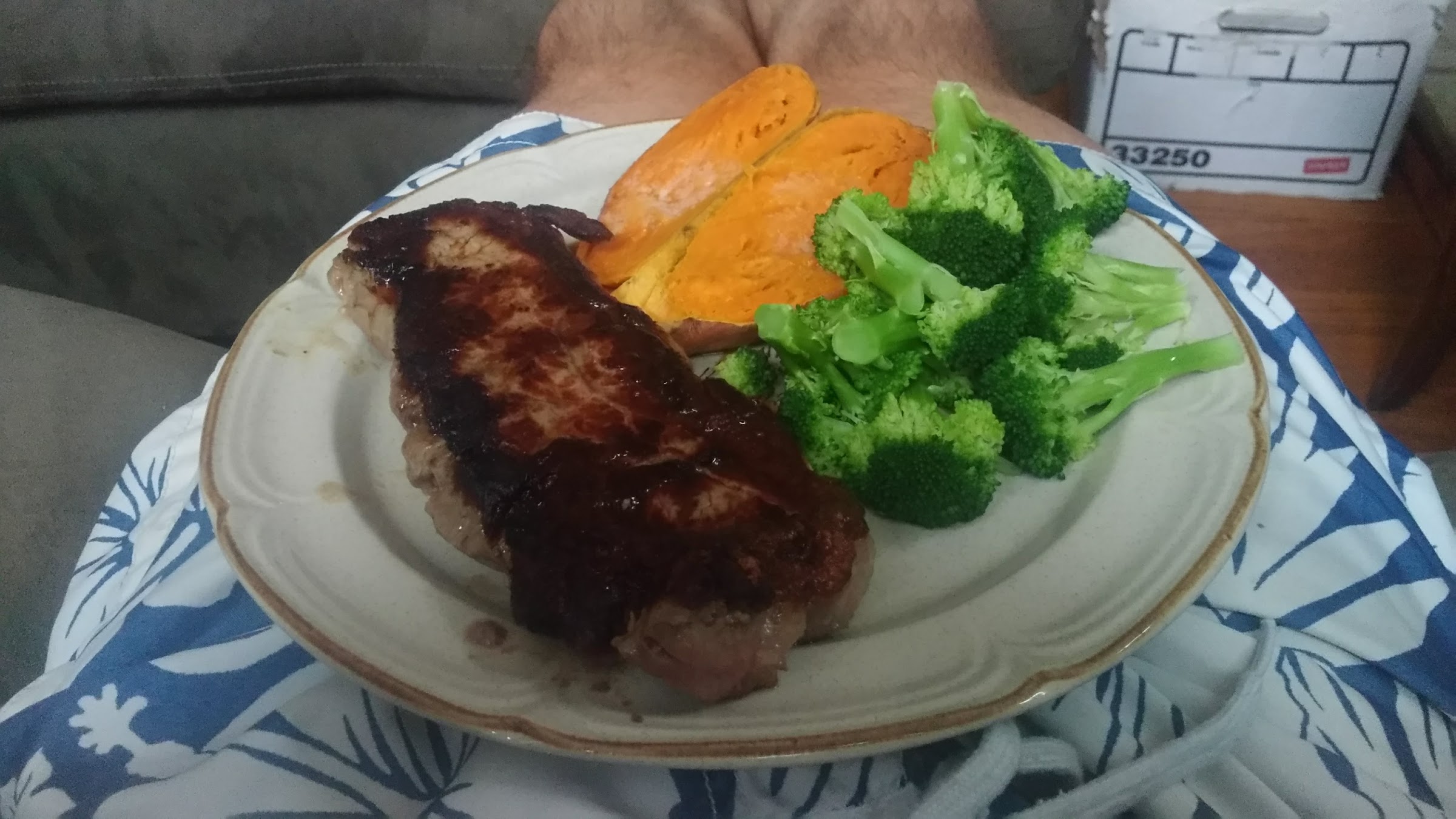
One of my best dinners on the trail!
Tomorrow Stanimal is bringing us back to Rockfish Gap at 7, so I’ll get up at 6 to make another big breakfast before heading out. There’s supposed to be intermittent rain, but not too much accumulation. I’m not exactly sure how far ill go, but I’m hoping to get in about 26mi as I’d like to get to Front Royal in 4 days (just over 100mi) and then to Harper’s Ferry two days later. Should be doable, especially because the trail through Shenandoah is supposed to be much nicer than what I’ve just been through. Three Ridges, the last hellacious climb I did two days ago, is the last ascents of that size until the White Mountains in New Hampshire, which I am thankful for. If my feet can hold up and improve, this week shouldn’t be too bad.
Day 44: Waynesboro to Campsite at mm890 – 27.0mi
I got up at 6am and headed into the kitchen to whip up a nice big breakfast to scarf down before heading back to the trail. It was the same as the day before and once again I had little trouble finishing it. There was one other hiker hanging out in the kitchen and I heard him tell someone that he really needed to zero because it was his first one and he’d made it to the there from Georgia in 19 days. 860mi in 19 days?! The speed record for the trail is 45 days, so if what this guy said is true then he’s averaging 45mi every single day and is on the same pace as the record holder. Not sure if that’s the case or not, but its incredibly impressive if so. I didn’t get a chance to talk to him and figure out the story, unfortunately, as we had to get on the road. Stanimal took me and another hiker, Craft-E, back to Rockfish Gap at about 7 so we could get on our way.
With a heavy pack and new shoes, I stepped back on the path in high spirits following my day off. My feet weren’t 100% renewed (and likely won’t be until several weeks after I finish), but I could already tell that the new shoes were helping. I didn’t feel anywhere near the same pain as I’d been putting up with for the last three weeks and I was cursing myself for going against my better judgment and moving away from lightweight trailrunning footwear. These are here to stay for me, that’s for sure. I also love having my gaiters back after gluing the velcro strips (which I got at Family Dollar) to the heels. They really do make a big difference by keeping leaves, rocks, and sticks out of my shoes which in turn keeps my socks and feet cleaner (and better smelling, relatively).
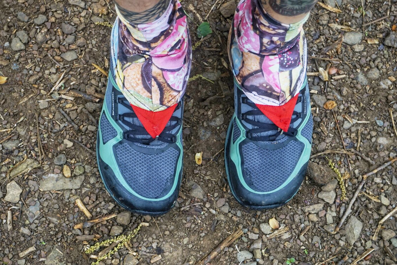
New kicks with old gaiters. Carpe donut!
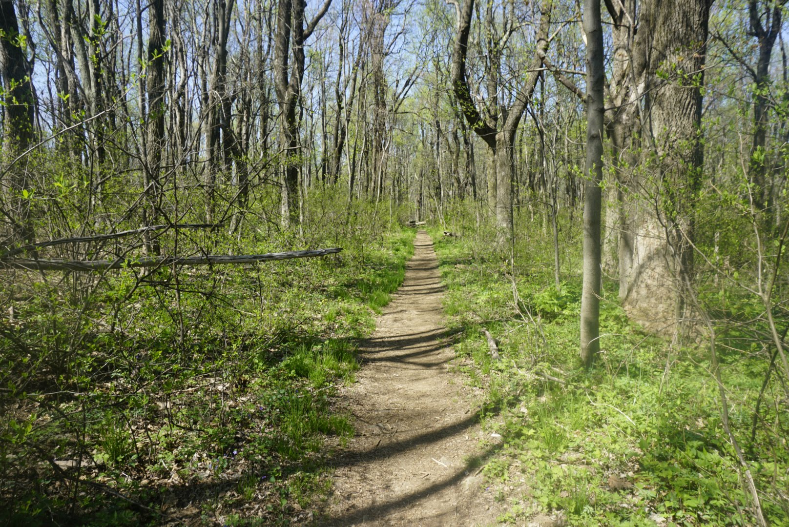
The terrain was a bit rocky and hilly in the beginning, but nowhere near the difficultly of what I’d been dealing with before. There were many flat sections with nicely groomed single-track trail that I breezed through. It felt like I was cheating. I went up and over Bear Mountain, Calf Mountain, and Turk Mountain all before lunch.
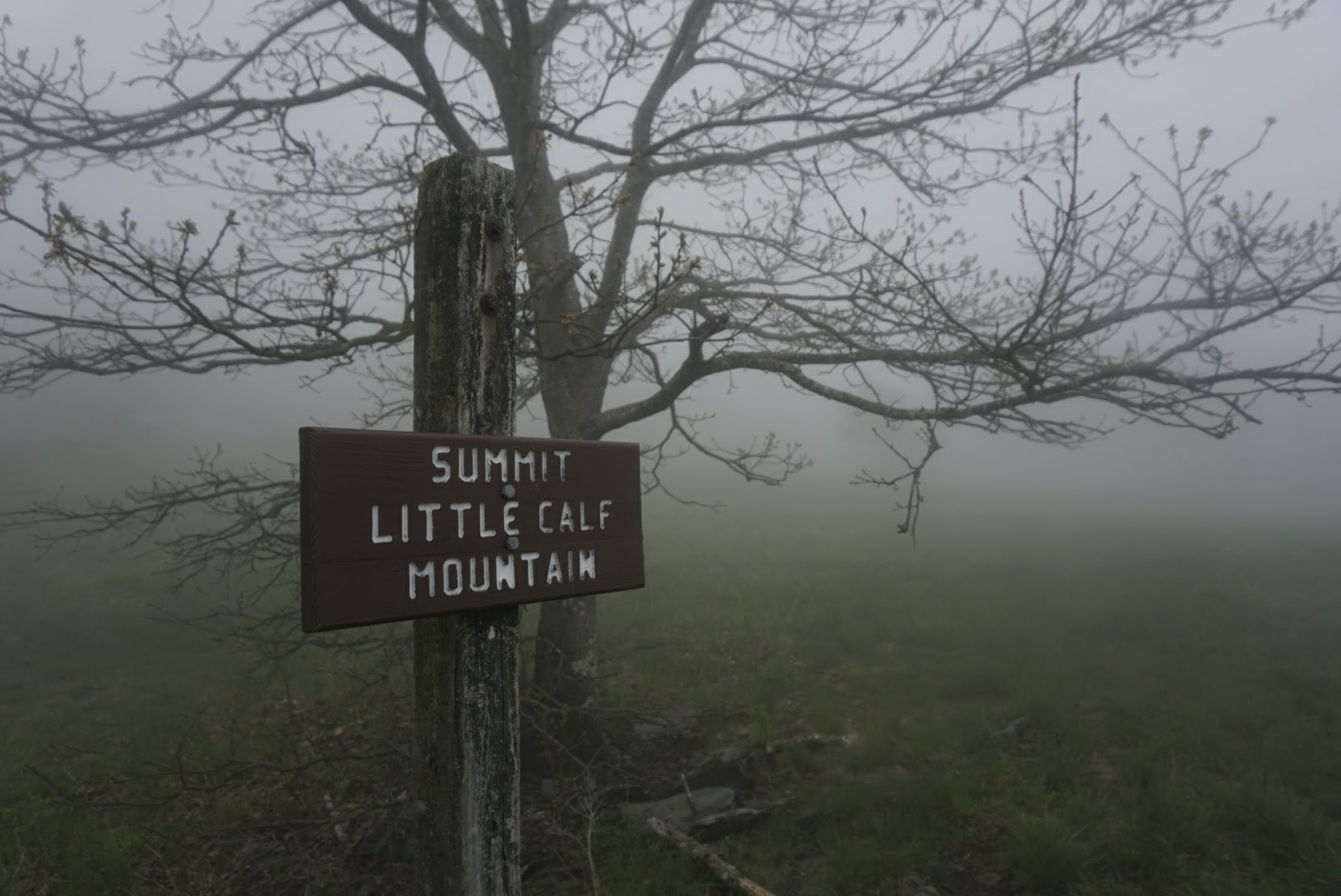
First summit of the day.
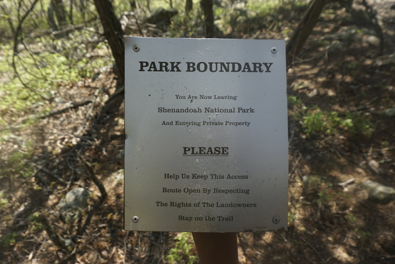
Now that I’m in Shenandoah National Park, the trail crisscrosses Skyline Drive (the main thoroughfare through the park) a total of 29 times. When I lived in northern Virginia, I used to make the trip out here several times per year to ride my motorcycle up and down Skyline, as it has some of the twistiest and best-maintained roads in the area. It was a great time and I haven’t been back since, so it was nice to reminisce.
The second half of the day was pretty similar to the first in both terrain and difficulty. The weather forecast said there was a 60% chance of rain in the afternoon, but I only experienced a sprinkle. It was sunny and warm most of the day, and the temperature had dropped to a much more manageable 70 degrees.
I’m planning to get through the park and into Front Royal in 4 days, which requires an average of 26mi per day. I knew that Loft Mountain Campground was right around 27mi from Waynesboro, so I intended to camp nearby (rather than pay the campground’s $15 tenting fee). I ended up finding a great little spot right off the trail and overlooking some mountains. It’ll do just fine. I plan to do similar mileage tomorrow.
Day 45: Campsite at mm890 to Campsite atop Bearfence Mountain – 28.3mi
My campsite last night was so close to the actual campground that I could hear people talking and the beeps of their car doors as they were locked and unlocked. I slept very well and was reluctant to get out of my cozy sleeping bag when the alarm went off at 6, so I snoozed for another 15 minutes.
I was on the trail just after 7 and feeling good. The trail brought me up and down some hills and across Skyline Drive several times, as expected. The biggest and longest climb of the day was Hightop Mountain at 3,533ft (but the ascent started at 2,300ft) that I hit just before lunch. All the climbs were low-to-medium in difficulty – hard enough to get me sweating and breathing hard, but not so much that I wanted to empty the contents of my stomach (looking at you, Three Ridges!).
Soon after that climb and a rest, there were some rain showers. I didn’t think rain was expected and I double checked the forecast – not called for so I figured it would be brief, and it was. I strolled through the woods, my pace gradually slowing as I got worn down and my feet began to ache. These new shoes are working exceptionally well, but even if I were walking on marshmallows my feet would start to hurt after 20mi.
I read on Guthook’s AT guide (an app that has maps and info about the trail which hikers can leave comments on) that there was a nice stealth campsite atop Bearfence Mountain, so I decided that would be my destination. Despite the easier terrain, it still took over 12 hours to get the miles in today and I’m pretty beat. My plan is to get to the “Mountain Home Cabbin” hostel in two days, which is 52 mi from here. As long as I can average 26mi each day I should be fine!
Day 46: Campsite atop Bearfence Mountain to Campsite at mm946.6 – 28.2mi
I slept well on the mountain and couldn’t believe it when my alarm was going off at 6 – I could have sworn I just laid down! I refused to acknowledge it until 620 and then finally got to work.
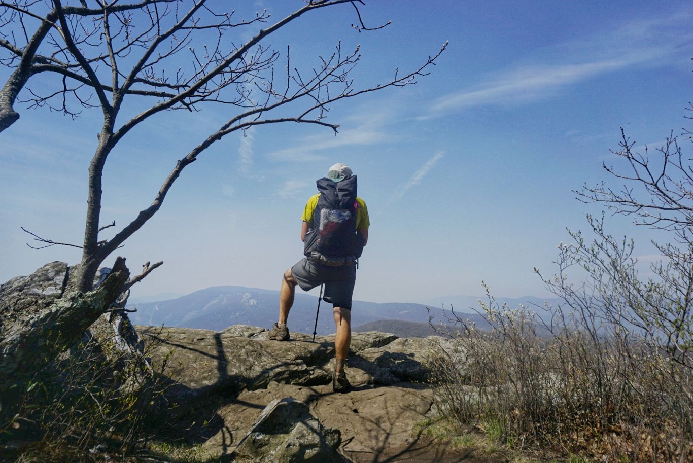
I had camped just off the AT on a “blue blaze” trail, which usually leads to an overlook or some other attraction that is not part of the main trail. This particular trail led to the “Bearfence Rock Scramble”, and all the comments on Guthook’s app indicated that this was not to be missed. Although I generally pass on the side trails, this one was less than a quarter of a mile long and promised a great view, so I went for it. It was a relatively short climb to the vista, but it sure was a doosey. It was far too technical for trekking poles, so I held them in one hand and stabilized myself with the other, feeling a bit off balance with my pack. To my surprise, there was another hiker up on the crest eating a bologna sandwich. At 7am. I didn’t ask any questions. The view up there, though, was indeed spectacular. It offered a complete 360-degree panorama of the entire surrounding valley and it looked great in the morning sun. I took it all in for a few minutes before descending down the other side and reconnecting to the AT.
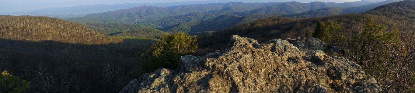
View from atop Bearfence Mountain. Worth the scramble!
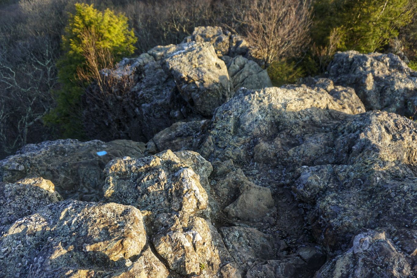
The treacherous descent.
I had read on Gutook’s app that someone was doing trail magic at Big Meadows campground and that they’d be there until Thursday. I was about 7.5mi from there and figured I’d check it out – even though I’d probably arrive around 10am I was hoping they’d be up.
I took my time getting to the campground. The trail was nice and easy, and I stopped for water along the way. When I was nearby, I took a side trail to the campground and began walking in circles trying to find the right campsite. When I finally found it (after an embarrassingly long time), I was greeted by Scabs – a woman of about my age who had hiked the PCT a couple years ago and drives down from Ohio a couple of times per year to do trail magic on the AT. There were two other thru-hikers there, Ripple and Charlie, who had arrived the night before and stayed over. Scabs told me to have a seat by the fire and had pressed a cold PBR into my hand before I even sat down.
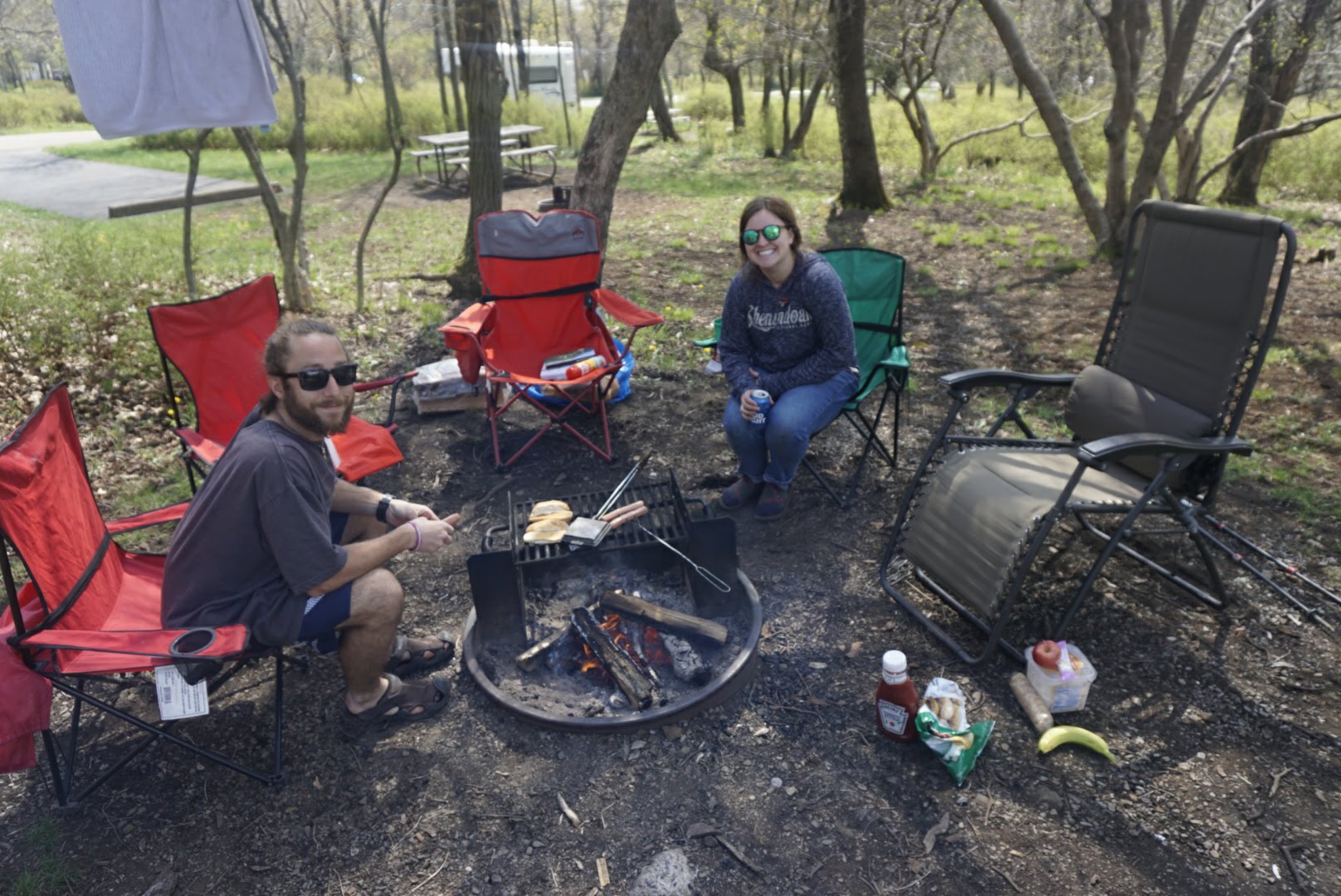
Scabs’ (R) setup. A real trail magic professional!
This trail magic was the bomb. Because the campground had shower and laundry facilities on site, Scabs had packed loaner clothes and detergent for hikers to use. Then, there was the food. She had three large coolers on wheels that were filled with beer, hotdogs, buns, and other goodies. We chatted around the fire while I stuffed my face with the following: three hot dogs with buns, half a large bag of chips, half a quart of macaroni salad, a sleeve of girl scout cookies, a banana, an apple, three cupcakes, four sausage links, and two beers. I guess hiker hunger is in full effect! I regret nothing.
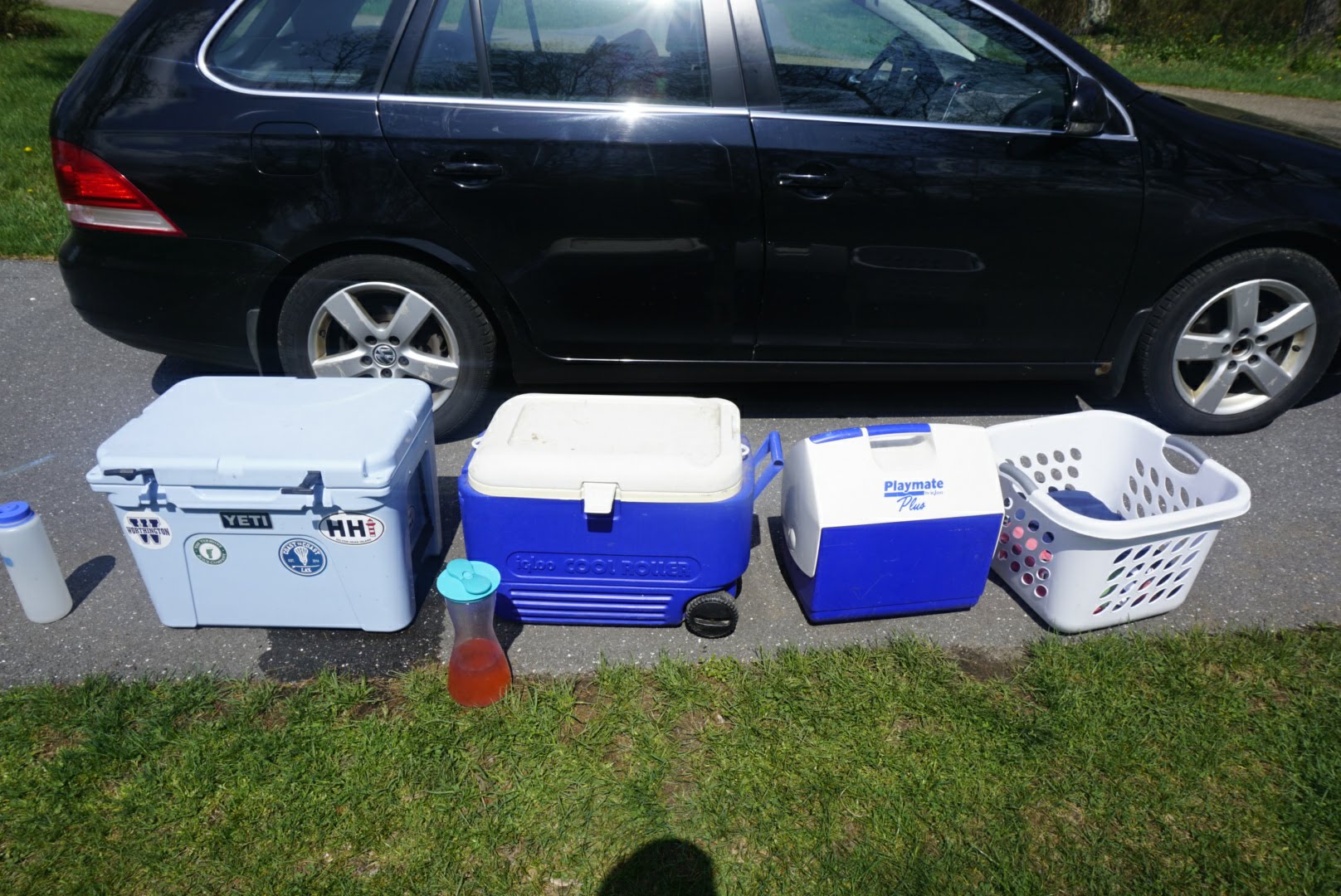
Trail magic supplies.
I hung out for over an hour until I felt the need to get back on the trail, so I thanked Scabs again for the wonderful hospitality an made my way back to the white blazes thinking “man, what a great experience that was!”.
Back on the trail, I continued toward my first of several climbs of the day. I was up and down without much trouble and keeping a good pace, although the trail got progressively more rocky as the day went on, reminding me of some of terrain in Tennessee.
Because of my long break in the morning, I was a bit behind schedule and realized I’d have to do some night hiking in order to get where I needed to be. Totally worth it. I hiked and hiked through the afternoon and into the evening, taking only short breaks to refill water or give my feet some relief. I finally reached my destination just after 9pm and set up camp near a water spring.
Tomorrow I’m heading to the Mountain Home Cabbin (yes, they sell it with two ‘b’s for some reason) where I’ll have a nice bed and a shower before continuing to Harper’s Ferry.
Day 47: Campsite at mm946.6 to Mountain Home Cabbin – 25.5mi
I had a good night’s rest and was on the trail just after 7. This was to be my last day in Shenandoah National Park and I was sad already – this has been one of (if not THE) best part of the trail for me so far. The grade of the trail, the nice people and the views have all been very memorable.
Nooo! I’ll miss you, Shenandoah.
Today was much like the last couple have been (minus the epic trail magic from yesterday) in that there were a few climbs, lots of road crossings, and great weather. However, I had trouble get started in the morning because my feet were in quite a bit of pain. Ever since I started the trail (and before, actually, but not severe) I’ve had recurring pain on the outside of my pinky toes. Pain shoots up my leg if I take anything close to an uneven step or if the side of my foot catches a rock. This really slows me down when it happens (some days it doesn’t bother me at all, oddly) and today was one of those times. About half an hour into the day I was getting frustrated with the pain and all the spider webs I was walking through (silly, but it was pissing me off) so I popped an ibuprofen and plopped down on a log to Google my symptoms and see if I could figure out what this crap was. After a quick search, I came across what are known as “tailor’s bunions”, which seemed to be exactly what I am experiencing. To help relieve the pain, you can buy these little silicone sleeves that go over your pinky toe that have padding around the area. I hopped on to Amazon and bought some, having them shipped to me in Harper’s Ferry. It’d be nice if these worked! Because of my sore feet, I sometimes feel like a Ferrari driving through wet cement – the engine wants to go but the wheels just won’t turn. My feet have been the only thing holding me back now that my IT band issue is under control, but as I’ve said before I doubt they’ll improve much unless I stop hiking altogether.
I continued on and had a pleasant day (once the ibuprofen kicked in!). The trail was great and there were a couple of nice views from the top of Hogback Mountain and North Mount Marshall. Otherwise, it was uneventful.
I had a bed booked at the Mountain Home Cabbin hostel and wanted to get there as soon as possible as I could despite having a full day of hiking. I managed to arrive at about 6pm, as the property is just steps from the AT. I met Scott, one of the owners and a thru-hiker himself, and he showed me around. It turns out that this place is a historical home that had fallen onto disrepair. He and his wife live up in McLean but plan to move down here permanently in a few years. They aim to have a full B&B in the main house, and the hostel is in a little brick house in the front yard. It has a small kitchen and 6 beds total – 5 of which are occupied for the night so it’s a good thing I reserved!
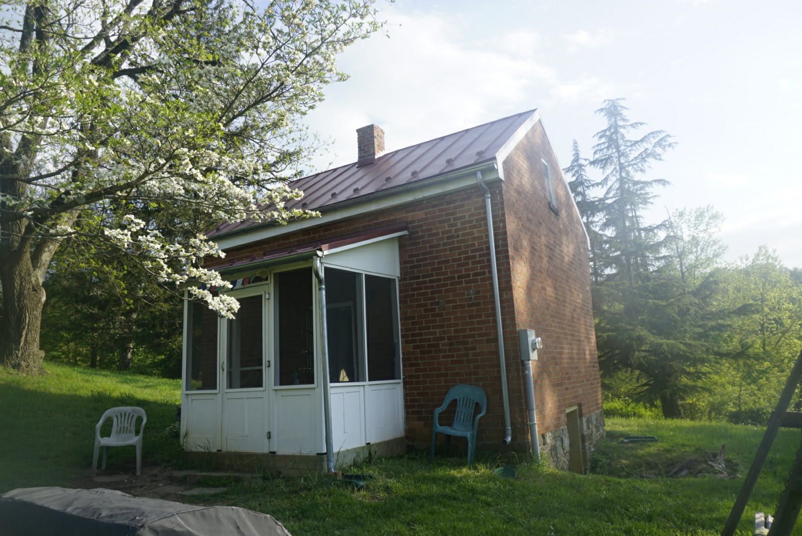
The Cabbin.
I got to talking to one of the other hikers and he had a pretty interesting story. He just aged out of the Secret Service where he was a Special Agent for 20 years and now is doing bits and pieces of the trail. We decided we’d head into Front Royal for dinner together and Scott gave us a ride. We ate burgers and had a beer at the Blue Wing Frog restaurant and traded stories of life as a federal employee. The burgers were expensive and not very memorable, but the conversation was entertaining. We called Scott for a ride back and returned to the Cabbin at about 930.
Tomorrow Scott is making everyone breakfast at 645 and then I’ll hit the trail so after. Harper’s Ferry is 53mi from here so I’ll need to keep my average the same as it’s been lately in order to arrive on Friday as planned.
Day 48: Mountain Home Cabbin to Campsite at mm999.5 – 28.5mi
It was great to sleep in a warm bed and awake to the sounds of coffee being brewed and eggs being fried. We all had breakfast downstairs in the common area of the cabbin where we learned even more about the history of the property. As it turns out, the cabbin has been slave quarters, a magistrate’s court, a surveyor’s office, and a couple other things in its lifetime. Very interesting place.
I packed up, thanked the host, and said my farewells to the other hikers as I made the 120-step commute back to the trailhead. I left a little late so I didn’t get started until just before 8. The forecast was calling for scattered thunderstorms so I made sure to keep my poncho at the ready. About 5mi in, I passed what is commonly known as the best shelter on the AT – the “Jim & Molly Denton Shelter”. I stopped by just to take a look, as it’s known to have some cool amenities. It has a solar-heated shower, a covered pavilion with picnic table, and a porch with Adirondack chairs. It was incredible! I had originally planned to stay there for a night, but it didn’t fit with my new mileage plan, so I just had a snack there and moved on. By then it had started to rain so I put my poncho on headed out. The rain only lasted a few minutes, so before I knew it I had taken it off again.
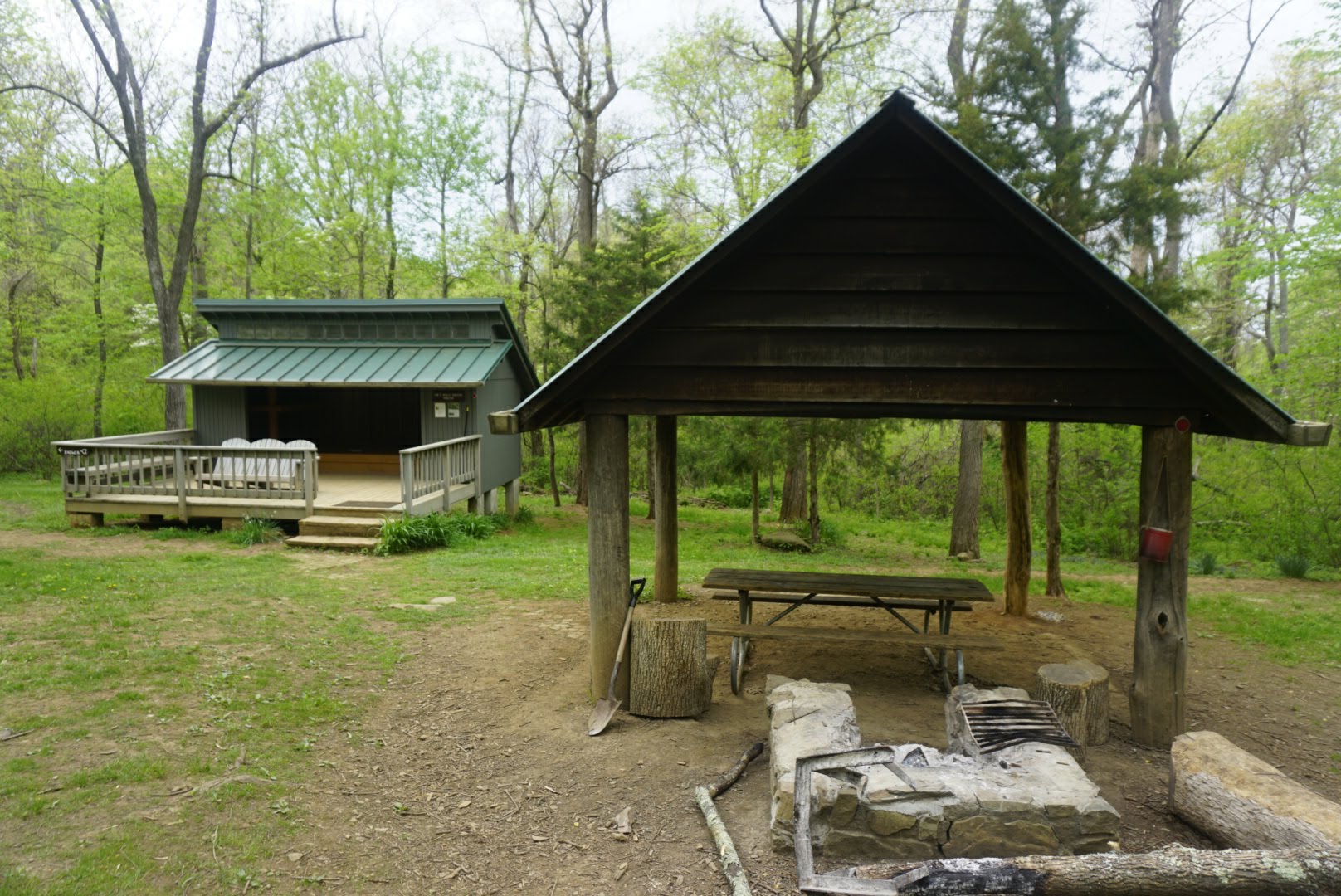
Best shelter on the AT!
A couple miles after leaving the shelter, I heard a big rustling in the woods and looked to the left to see two black bears climbing trees about 100 feet away. They had gotten spooked when they heard or smelled me and raced up the trunk with surprising speed. Once they realized that I was just a smelly hiker, they dropped out of the trees and ran away.
The trail was pretty nice in this section. I wasn’t sure what it would be like after leaving Shenandoah, but so far it’s quite similar which I appreciate. I’m hoping it stays like that until Harper’s Ferry! There were the normal ups and downs, and the thunderstorm followed me throughout the day, leaving behind a wake of humid and sticky weather that had me sweating big time. The thunder would roar and then it would start to rain lightly, and twice it tricked me into going through the rigmarole of dropping my pack and putting on my poncho – a task which can be time consuming and annoying, especially when you’re in a hurry. Each time, it literally stopped raining as soon as I started walking again, and I’d leave the poncho on for a bit (sweating underneath all the while) in case it picked up again, which it didn’t. I’d then do the whole thing in reverse and get on my way. The third time it started raining I said to hell with it and walked on. The rain picked up worse than the previous times, but I hardly got wet under the cover of the trees and it eventually stopped just as before. Even if it was a chore to put on and take off the rain gear so often, I’ll happily do that instead of deal with a massive rainstorm as I have in the past.
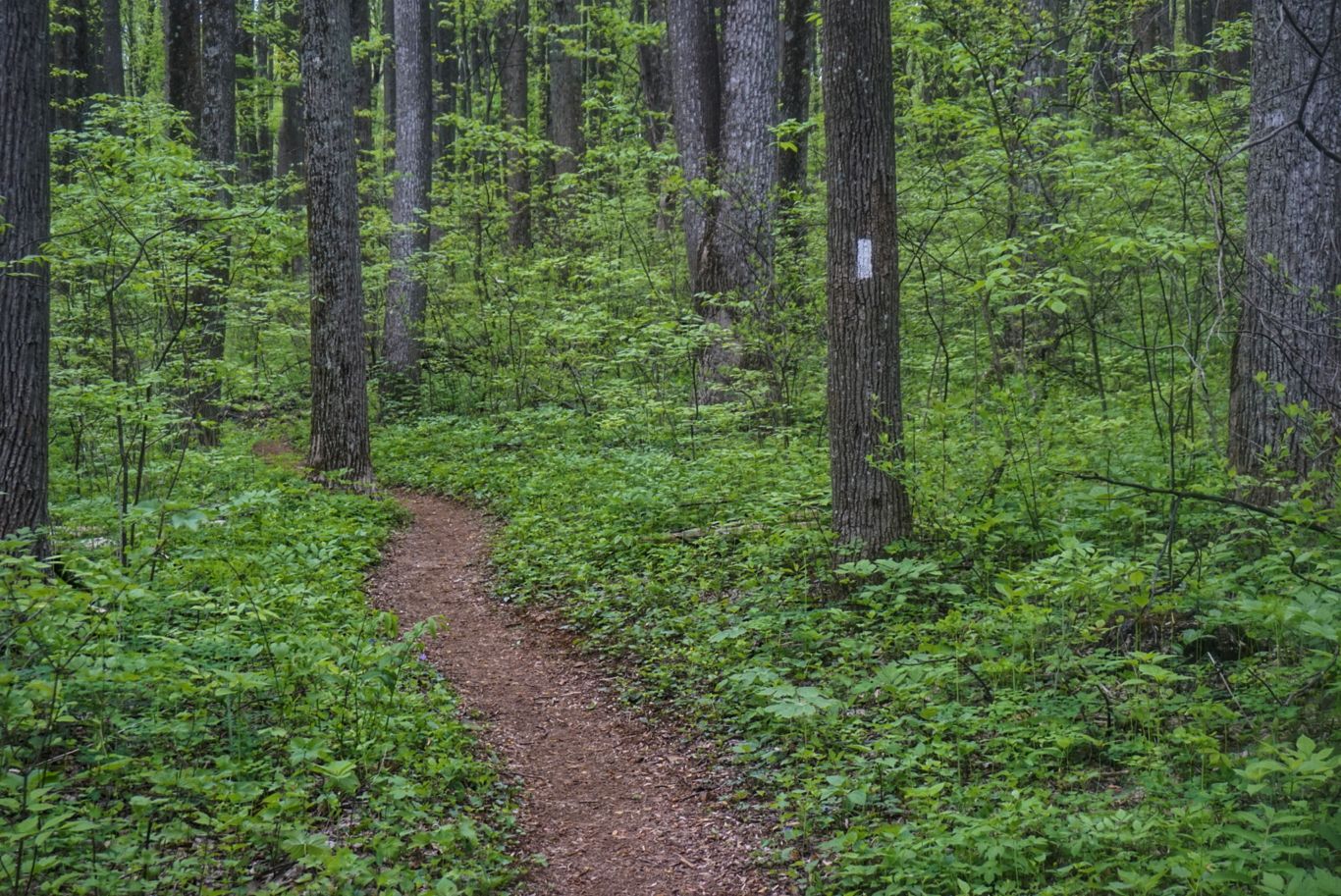
The brown ribbon.
Most of the trail was uneventful, but toward the end I entered what’s known as “The Rollercoaster”. This is a section of trail that has about a dozen successive climbs and descents in as many miles with no flat parts in between. The elevation gain for each is only a few hundred feet, but the climbs are steep at times. The elevation profile for this section looks like a saw blade, just sharp ups and downs for miles. My destination campsite for the night is about a third of the way through this section, so I got a taste for it just before finishing for the day. It’s not too bad. I’ll have a bunch more to do in the morning.
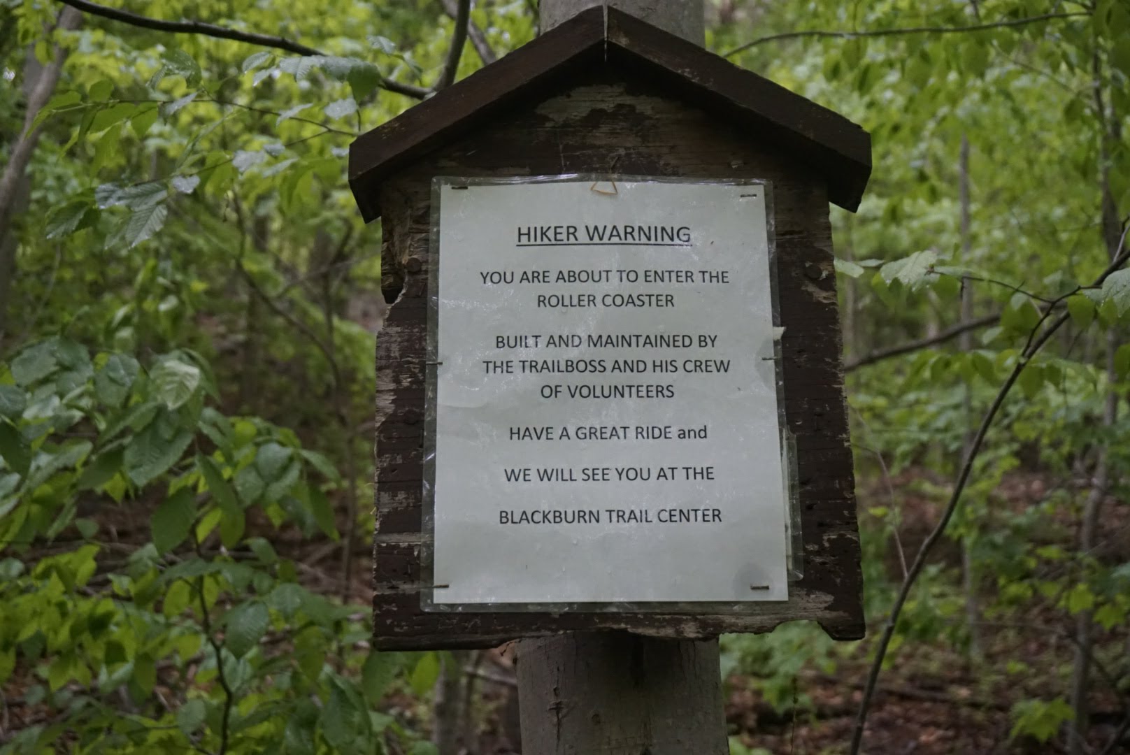
Weeee!
I didn’t realize until I arrived that I’m camping at mile marker 999.5 – just a hair before the 1,000 mile mark. Pretty incredible that I’ve come this far. Tomorrow I’ll pass that milestone and head in to Harper’s Ferry, which is about 24mi from here. I’ll stay overnight at the Quality Inn, pick up a resupply box, and rest up for the evening.
Day 49: Campsite at mm999.5 to Harper’s Ferry – 24.1mi
I woke up a little early this morning and was on the trail at 6:30am instead of my usual 7. I hope to get to the point where I can get on the trail at 6 now that it’s getting light around 5:30 as opposed to 7:30 when I first started. I’d prefer to start early and get finished a little early if possible.
Soon after I began, I hit the 1,000 mile mark. It’s a bit surreal to know that I’ve walked one thousand miles since March. What’s even more mind-blowing is that I still have about 1,200 miles to go!
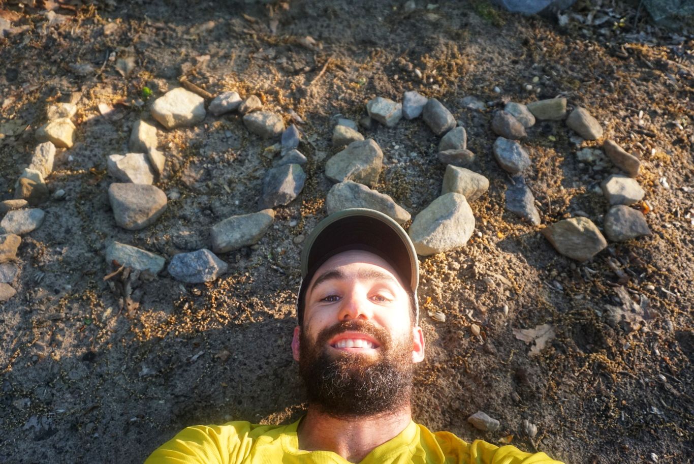
I could take a nap here!
The first part of the day was a bit tough. As I mentioned I was in the middle of the “rollercoaster” and so I had another 6 or 7 ups and downs to do before it was back to regular terrain. These climbs weren’t easy, so it took me nearly 5 hours to go 10 miles and knock the rest of them out. The rest of the day was a mixture of super nice and easy trail along with parts that were incredibly rocky. For some reason I was stumbling around more than usual, stubbing my toe about every hundred steps it seemed. Each time felt like I was kicking a curb and it would send me careening forward, but fortunately my trekking poles caught me every time. Damn those rocks! At some point during the day I also passed by the West Virginia/Virginia state line, which was a welcomed sight. The AT winds through Virginia for over 500 miles (the most of any of the 14 states it passes through) and I’ve been there for almost three weeks. I was ready for a change!
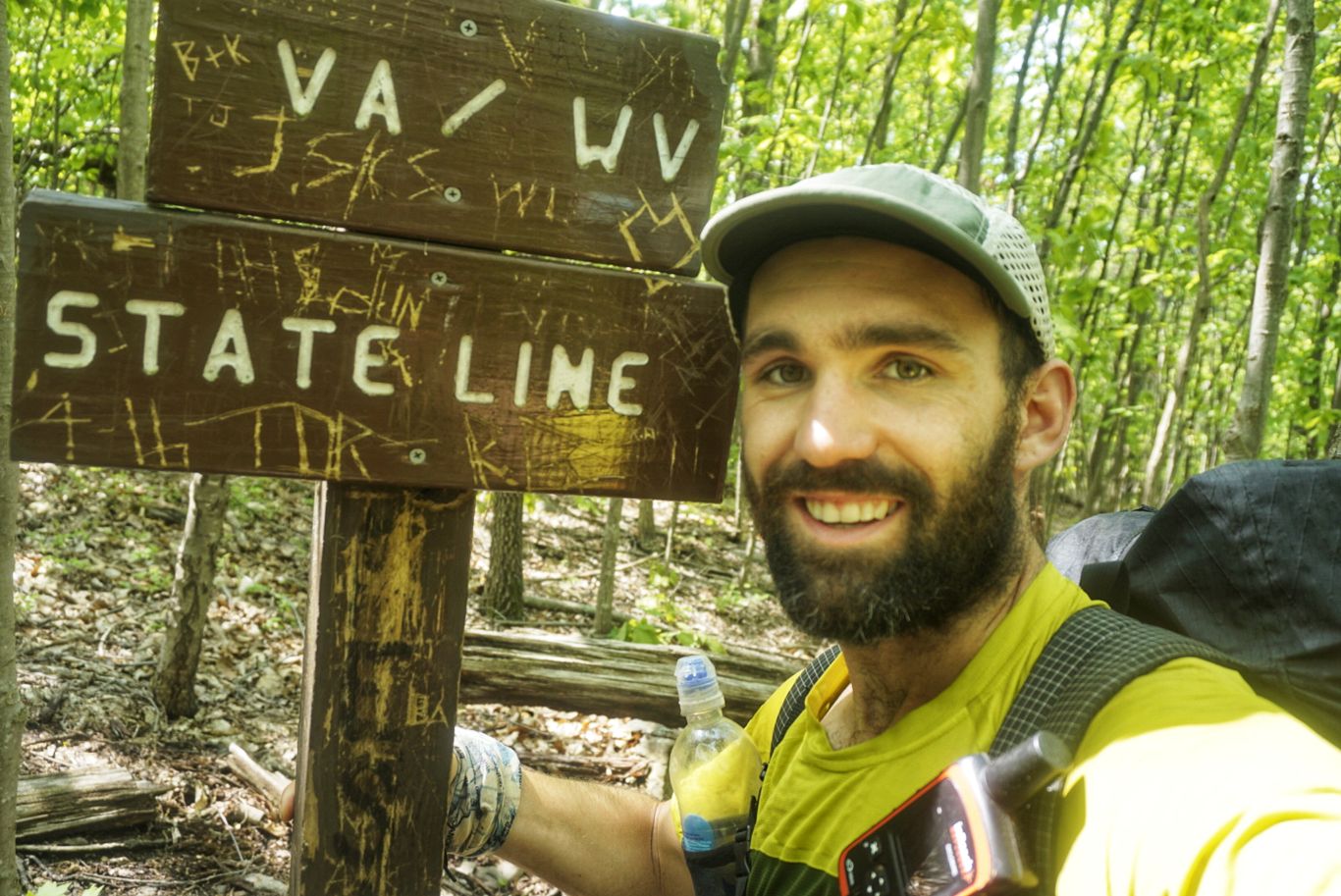
Sayonara, Virginia!
About 5mi from Harper’s Ferry I ran into a trail maintenance volunteer carrying a chainsaw. He’s one of the awesome people that take care of the trees that fall across the trail and block it (of which there are many). He helps to maintain that stretch and goes out every couple of weeks to clear the path for hikers, which is very much appreciated. We shot the breeze until we arrived at the parking lot where his car was, and we parted ways. A few miles later, I was walking across the bridge into Harper’s Ferry!
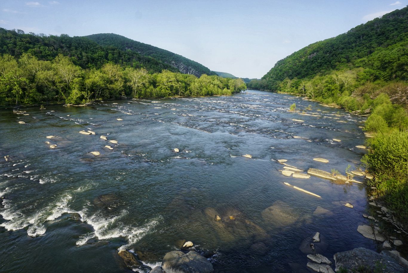
Crossing the mighty Shenandoa River.
Although Harper’s Ferry is only at mile 1,023, it is considered the “psychological halfway point” (the real halfway point is another 71 miles north). It is home to the Appalachian Trail Conservancy headquarters as well, and many hikers stop there to have their photo taken and put into the records.
I got to the Quality Inn at about 6pm and picked up my packages. I took them up to my room, showered, ate, and soaked my feet in the bathtub. The hotel has coin-operated laundry, which is nice, and also a computer to use in the lobby so I hope to get a few things done before retiring for the night.
That’s all for this week!

This website contains affiliate links, which means The Trek may receive a percentage of any product or service you purchase using the links in the articles or advertisements. The buyer pays the same price as they would otherwise, and your purchase helps to support The Trek's ongoing goal to serve you quality backpacking advice and information. Thanks for your support!
To learn more, please visit the About This Site page.