
Weekly Trail Update Thirteen: Days 86 – 92
Welcome back for another trail update!
Day 86: Full Goose Shelter to Campsite at mm1934- 20.1mi
I was up and on the trail at quarter to 6 this morning, knowing I’d need all the time I could get for what laid ahead. To start the day off, there was a rugged and steep (albeit relatively short) climb that immediately blocked me from getting any kind of rhythm going. It was followed by a similar descent, at the bottom of which I already needed a break. This wasn’t starting off so well.
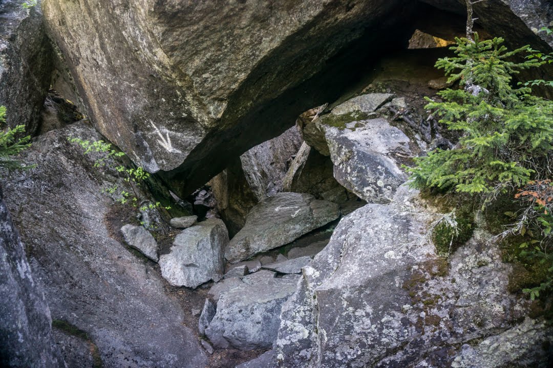
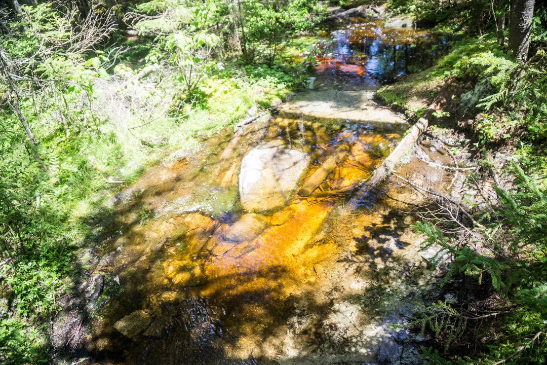
After a mile and a half, I was at the west end of Mahoosuc Notch, a notorious rock scramble known as the hardest and most fun mile on the trail. I stowed my trekking poles as I wouldn’t be needing them, and got to work hopping from one rock slab to another, shimmying between crevasses, and crawling under boulders. It was, actually, pretty fun!
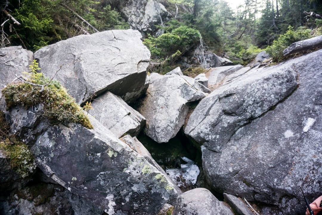
Mahoosuc Notch fun!
At one point I took a wrong turn and ended up scaling a big rock that I didn’t need to. On the way down I couldn’t maneuver myself in the same way I had on the way up and ended up having to take my pack off and lower it through an opening between rocks and then follow after. However, when I let go of the pack it dropped just a few inches and I heard a clang as my cook pot (which I store in one of the pack’s side pockets) hit the rock. I then saw the lid of the pot go rolling down the rocks and into a deep crevasse, never to be seen again. Damn.
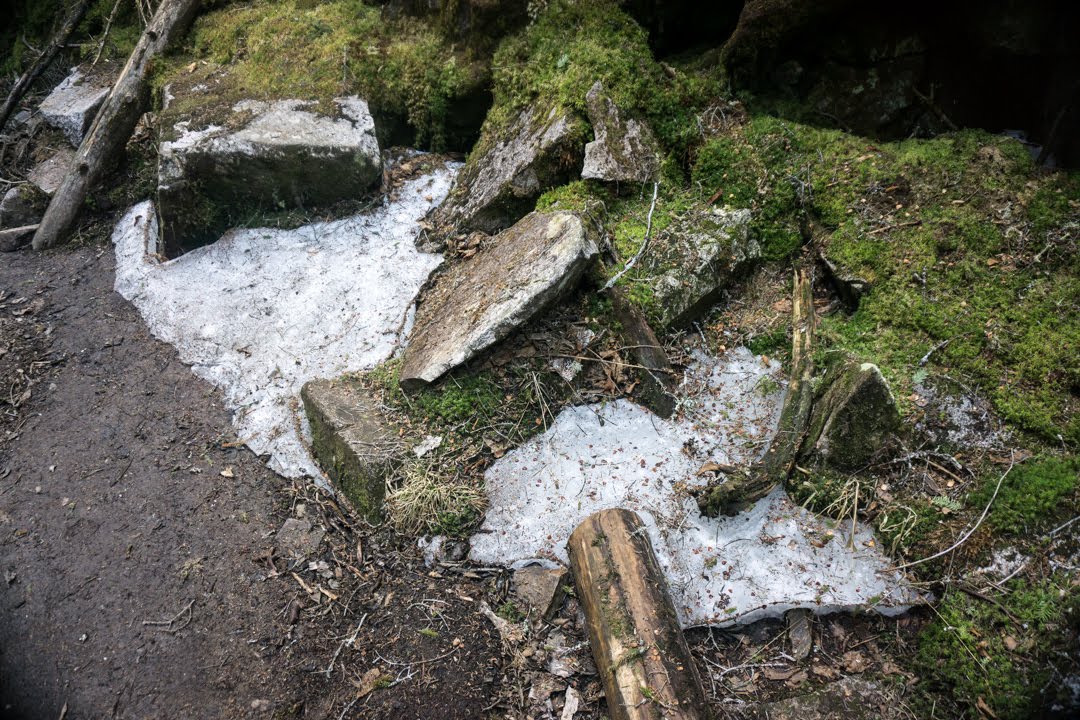
Another crazy part of the notch was that there’s still a good amount of snow between the rocks and on the ground. Wonder when that will finally melt! I continued my scramble until the mile was up, and I took another break to get my poles out and rehydrate.
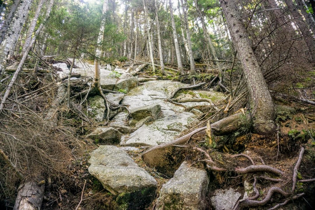
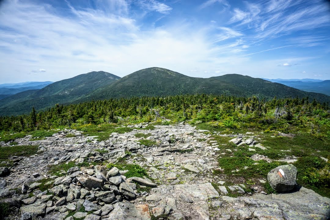
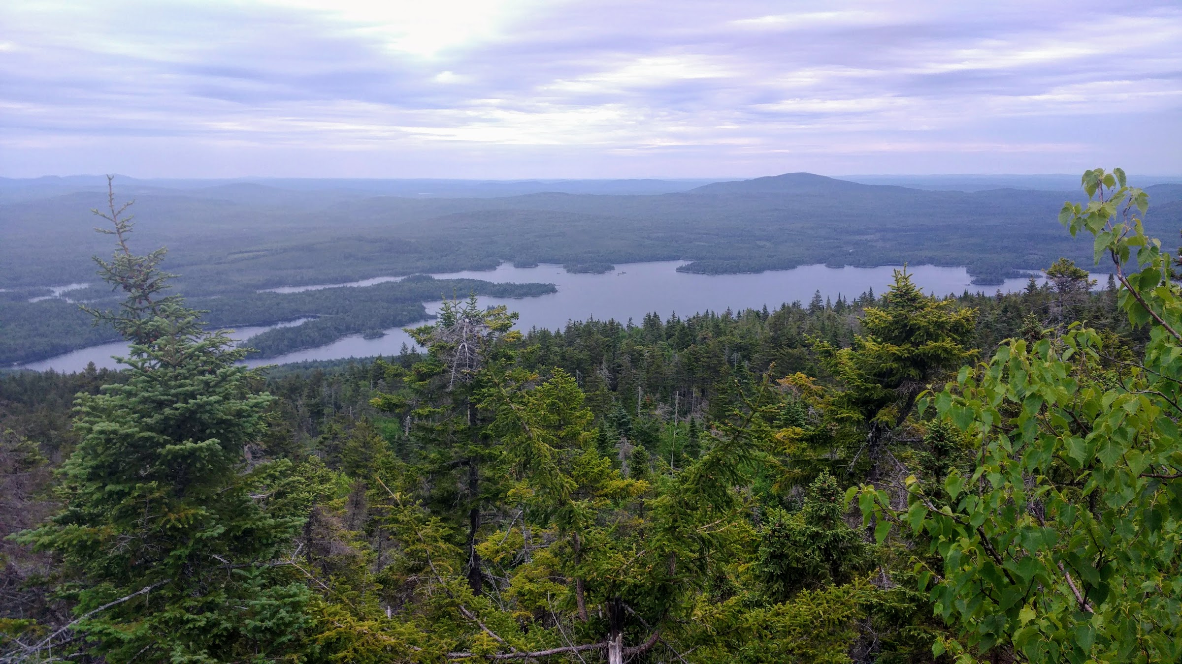
Immediately following the notch is the climb up Mahoosuc Arm, which one of the steepest ascents on the trail (seeing a pattern with anything that has Mahoosuc in the name?) as it rises over 1,500ft in one mile. It was no joke!
The long way up Mahoosuc Arm.
I took my time and tried to conserve energy by taking smaller steps. By avoiding larger steps up onto ledges and rocks, I’m able to keep from having to constantly do hard and explosive movements and instead just chip away at the hill. Once at the top the views were incredible, and I took another short break to take it all in. By that point I’d been hiking for just about 4 hours and had gone just 4.5mi – probably my slowest average ever, but understandable given the terrain.
The rest of the day consisted of several more big climbs over rooty and rocky terrain plus several conversations with day hikers (it was Sunday and also Father’s day with great weather, so lots of folks were out). I also saw my first pair of Southbound (SOBO) hikers, which was surreal. They are just a couple hundred miles into their journey and it’s almost like I’m the grizzled veteran. I admire their spunk and excitement for the trail, and maybe they are jealous of my beard. Who knows.
I ended up pitching my tent on a nice flat spot next to a brook. My energy waned toward the end of the day, as it does after so much climbing, but I was happy to get in 20mi over this terrain. This section is tough! Tomorrow I’ll have a short day as I am staying at “The Cabin”, a home/hostel run by a couple of old school hikers. I only need to hike about 10mi and call them for a pick up, which will be nice because it’s supposed to rain in the afternoon.
Day 87: Campsite at mm1934 to Andover, ME – 10.2mi
I woke up at my usual time and was on the trail at 6. It had started to rain very lightly as I was packing up, but after 10 minutes it was pouring. My poncho kept everything above my knees dry, but my feet were soaked and very sore. Each day, I take an ibuprofen right after I wake up so that it will kick in by the time I start hiking so as to relieve the soreness on my bunions (which are the only things that hurt, really). Most of the time this works great and then I take one ibuprofen every four hours or so until I’m done hiking for the day. This usually ends up being 800mg per day which I know is quite a lot and I’m not proud of having to take it. I’d much rather not take any at all, but I simply couldn’t do the mileage without it. I should probably have these bunions checked out when I finish, as they can seriously affect my future hiking and running plans if something doesn’t improve. Anyway, sometimes the first ibuprofen doesn’t have its regular effect, and I’m sore and hurting for the first hour until I decide to take the second one early. I can’t figure out why this happens, but it occurs about once a week. Today was one of those days, and so I spent the first hour and a half hobbling along the rooty trail waiting for the pain to subside. It eventually did, and I was able to resume my regular pace which, on this terrain, is quite slow.
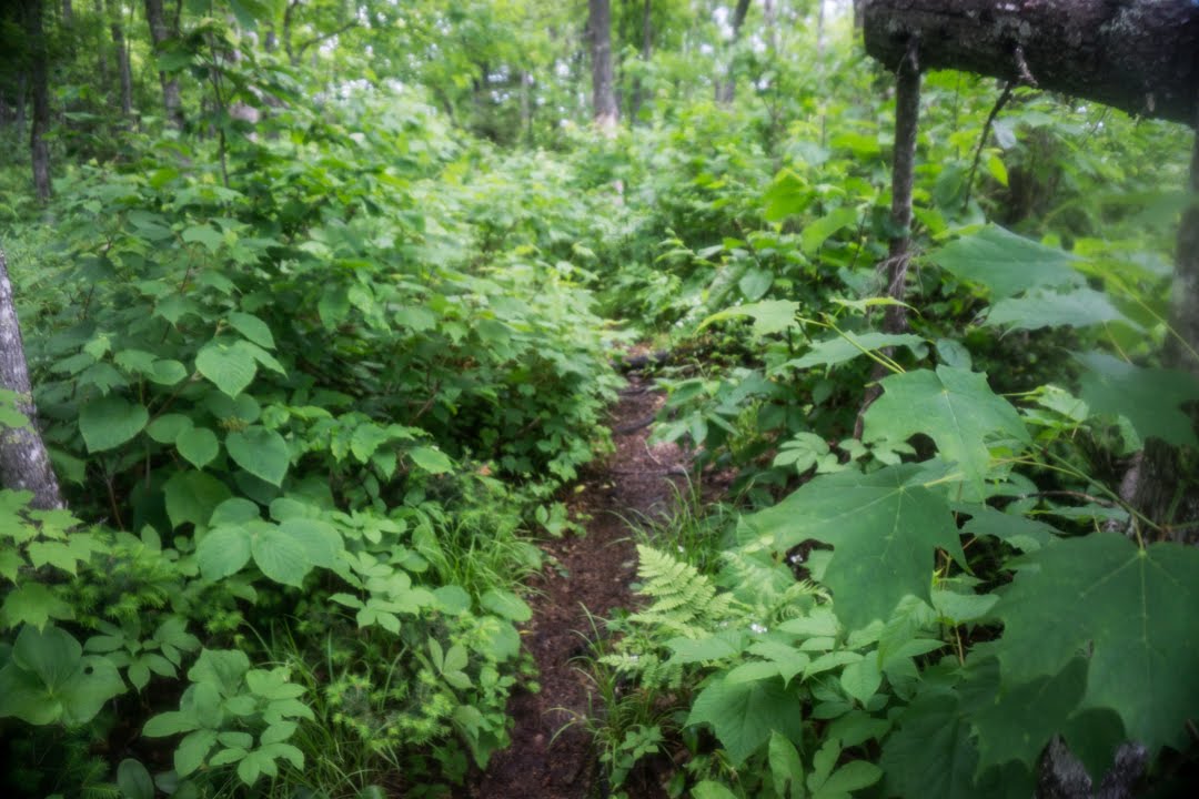
Bushwhacking my way to Andover.
Despite only needing to hike 10mi today, it included two steep and slick ascents that took the wind out of my sails. I keep thinking and hoping the terrain will get easier, but I think this is going to be the norm for the remainder of the trail. The two SOBOs that I met yesterday had made it there in two weeks, though, so I’m confident that I can finish in time.
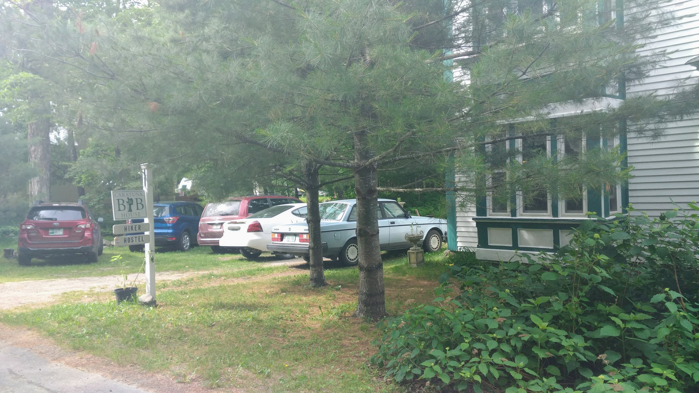
I haven’t had any cell service for a couple of days, but I managed to get a single bar on top of Moody Mountain. From there, I called The Cabin and explained that although I had a reservation for tomorrow, I’d like to come by today instead. Bear, one of the owners, said “no problem!” and he met me at the road crossing a half hour later to bring me back to his place.
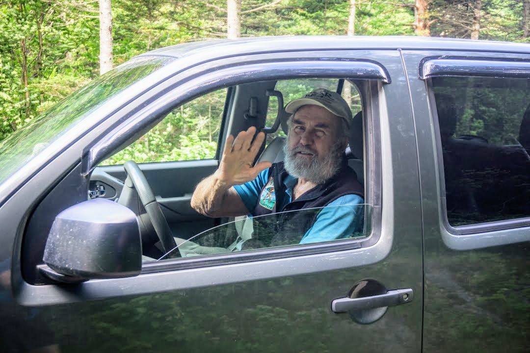
“Bear” in the flesh!
Believe it or not, I’m the first NOBO hiker they’ve hosted this season. This place is sort of off the beaten path and known more by word-of-mouth as opposed to advertising, so only those “in the know” understand how great it is. The bunkhouse is in the finished basement of the owners’ cabin and didn’t appear to be set up yet for the season. Despite that, Bear was incredibly generous. He offered me leftovers from breakfast which included blueberry pancakes, home fries, toast, eggs, and corned beef hash. It was all delicious, and I filled up before heading downstairs to do laundry, dry things out, and charge my electronics.
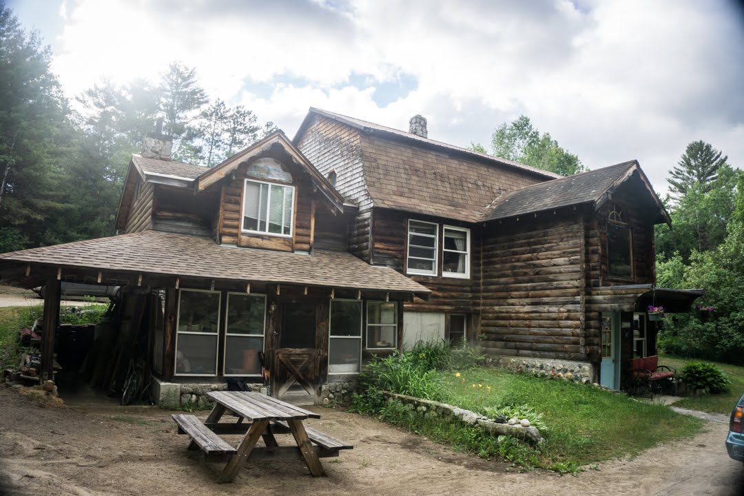
The Cabin.
For the rest of the afternoon I worked on my blog, went to the store with Bear’s son to grab dinner, and was happy to be out of the rain. It poured on and off all day, which would have been miserable out on the trail. Tomorrow it’s supposed to be nice again and should be that way for the next couple of days at least, so I hope to get in some good miles. I need to average 22mi/day from here on out in order to get to Katahdin when I need to, and I think I can manage it. There are lots of climbs, but if I start early each day and hike till dark it shouldn’t be an issue. I’ll get it done one way or another – Katahdin or bust!
Day 88: Andover, ME to Campsite at mm1968.4 – 24.3mi
My day began by sleeping in until just after 530am and then gathering my stuff before heading upstairs for breakfast. Although Bear had a stroke a couple of years ago and isn’t very mobile anymore, he’s still a pretty good cook! We had omelets with bacon, toast, and waffles (ok, so only I had toast and waffles). We chatted about life and the trail for a bit before it was time to hit the road. I paid up ($35 for the bunk, breakfast, and ride to the trail), grabbed my bag, and we headed out.
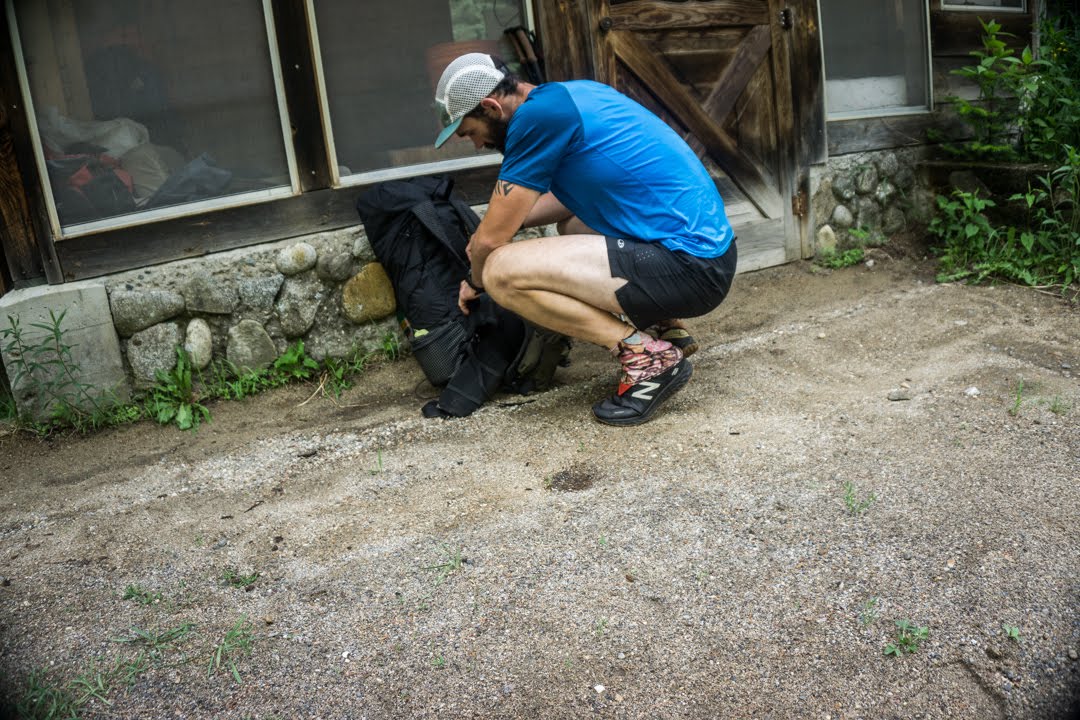
Packing up.
I was hiking just after 8, a bit later than normal for me, and started with a pretty sizeable climb up Old Blue Mountain. That brought me up to the ridgeline where I hung out most of the day, going up and down and crossing lots of bogs.
Even though the weather had cleared up and it was a nice day, there was so much water on the trail I couldn’t believe it. Climbing up Old Blue, it was running directly down the path and pooling wherever it could. On top of the ridge, it collected in the middle of the trail anytime there was space. I spent a significant amount of time trying to avoid soaking my feet, but it only took a couple of missteps before they were nice and damp. Ugh.
Waterlogged trail.
I summited Bemis Mountain a couple of miles later, and it was uneventful. It had a decently long descent that was one of the more walkable parts of the terrain today (of which there were very few).
Right near the road crossing at the bottom was a cooler with drinks and snacks that someone had left and, lo and behold, there was actually some left! As I was sucking down a ginger ale, the trail angels themselves showed up to restock the cooler. It was a nice older couple that had with them some apples, granola bars, and beer. We chatted for a few minutes before they took off and I hung around for a few more minutes to enjoy the goodies.
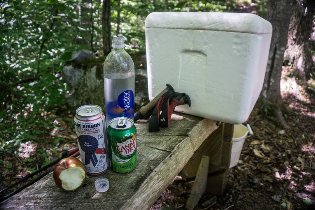
Trail magic!
Immediately after crossing the road, I faced Bemis Stream, the first crossing I’ve needed to ford. It was maybe 100ft across and not super deep, but there was no good option for rock hopping across. Even the guidebook says that it usually needs to be forded, so for the first time yet I took off my shoes and socks and went for it. The water came up to my knees at a couple of points and had a good amount of force in it, causing me to slip and almost fall in completely a couple of times. Thankfully I made it across without too much trouble and reassembled my footwear. From what I understand, this is the first of several streams I’ll need to ford in Maine.
The rest of the day consisted of more climbing, more bogs and water, and certainly more roots. I’m trying to get to the town of Caratunk in 4 days, which requires an average of 24mi/day, so although I really wanted to stop earlier I ended up hiking until after 830pm to get the miles in. This terrain and these climbs really wear me out!
Tomorrow is going to be a hard day as well with a lot of climbing in store. I’ll summit Saddleback Mountain (the ski resort I broke my wrist on almost a decade ago) as well as a couple of other smaller summits. We’ll see how it goes.
Day 89: Campsite at mm1968.4 to Campsite at mm1992.8- 24.4mi
The mosquitoes last night were so bad that I had to zip myself up in my tent to eat dinner otherwise I’d be eaten myself. Even when I closed myself in, I killed at least 15 that had gotten inside.
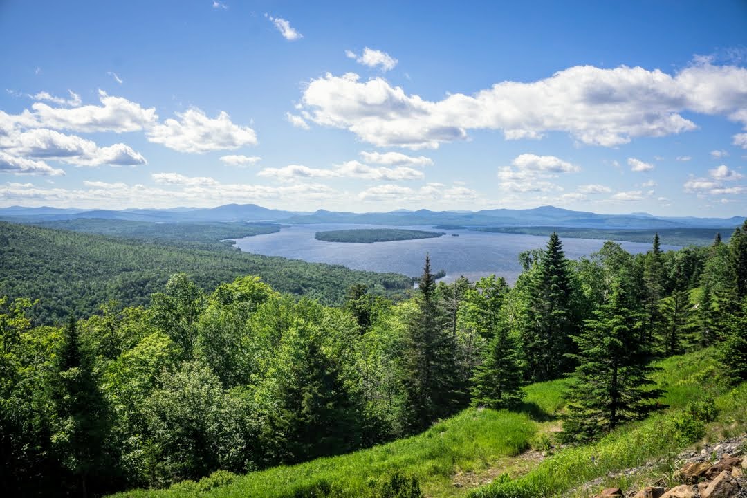
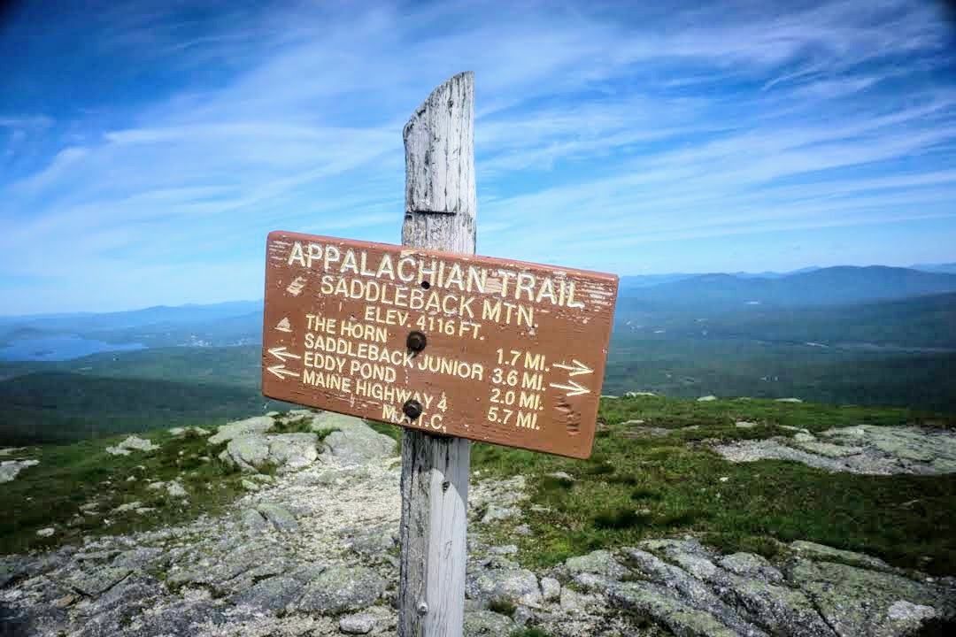
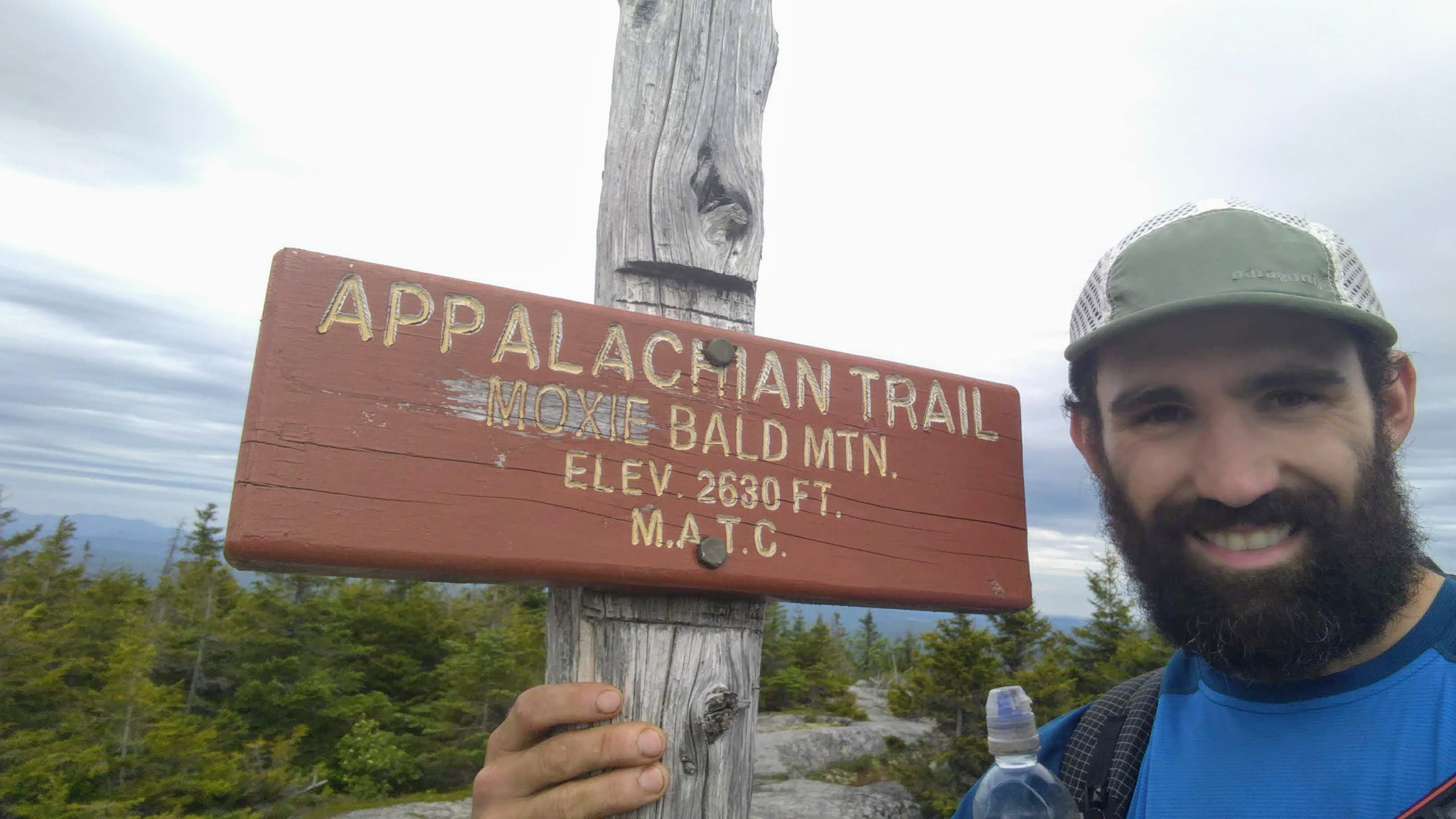
Anyway, I slept well and was on the trail at 6 per usual. I had a couple miles of mild terrain but it wasn’t long before the big climbs started in. The first was to the top of Saddleback Mountain, which was long and arduous. Saddleback is also home to a ski resort in the winter, and is also where I broke my wrist snowboarding almost a decade ago. I haven’t been back since, so it was kind of cool to see it from a different perspective.
From there I summited “the horn”, the other peak opposite Saddleback which creates the “saddle” that it’s named after. Following that I went up and over Saddleback Junior, Lone Mountain, Mt. Spaulding and Sugarloaf (also a ski resort). All in all, it was a hell of a lot of climbing! I saw a few more SOBOs on the trail today as well, and they’re all in such great spirits.
Looking back at some of the day’s summits.
For some reason today, I was super cranky. It might have something to do with almost being done with the trail, but more likely it’s the terrain. This section of southern Maine has been a huge pain in the ass. The snarled roots, constant puddles, and scattered rocks make it nearly impossible to walk on some parts. Then there’s the blown down trees blocking the path (had to climb over or crawl under at least 20 today alone) and all the other obstacles. This part is incredibly rugged so it takes me forever to get anywhere and my feet are absolutely wrecked at the end of the day. The views are wonderful, but the climbs are never ending. I know that relief is not on its way anytime soon, so I just push on and try to get the miles in before dark.
Tonight I found a flat spot just after the 24mi mark the day and I arrived at 8pm. I used to be able to do 30mi by 7pm in some places, but here it takes me 14 hours to do 24, and I feel more beat up than ever!
Tomorrow will be more of the same.
Day 90: Campsite at mm1992.8 to Little Bigelow Lean-to – 25.3mi
Yada Yada I was hiking by 6am. I started with a descent that was intensely steep and rocky, making it frustrating from the start. At the bottom was the Carrabasset River, which I was afraid I’d have to ford. Luckily, there was a nice new plank in place atop the rocks which allowed for easy passage. Then, the fun began.
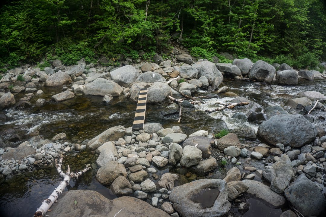
No ford necessary!
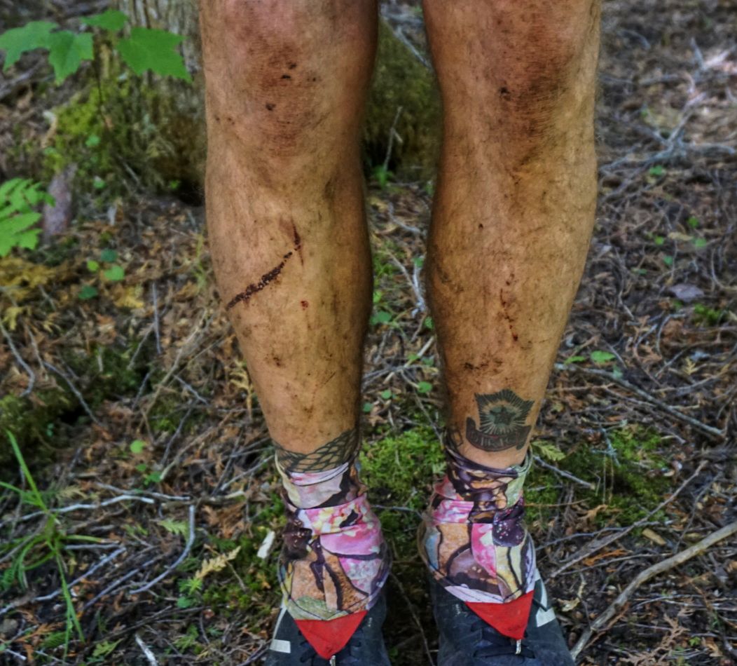
The mountains I climbed today included Crocker (both North and South) as well as the entire Bigelow Range (5 peaks). It had to have been the most climbing I’ve done in a single day, and there was nothing easy about it. The roots ate my feet up, the rocks slowed me down, and the milage forced me to hike until after 9pm (although today is the solstice so it was light until just about that time!). Boy, it was a real ballbuster. I also took a couple of nasty falls today, including one slip coming down a rock slab and another faceplant when my toe got caught on a root. My legs and knees look like they’ve been to war!
As usual there were some incredible views of the lakes and mountains in the area, which are absolutely stunning. Summiting any one of these peaks as a day hike would be a challenge with a good reward for sights, but doing them all at once left little time to hang out at the peaks.
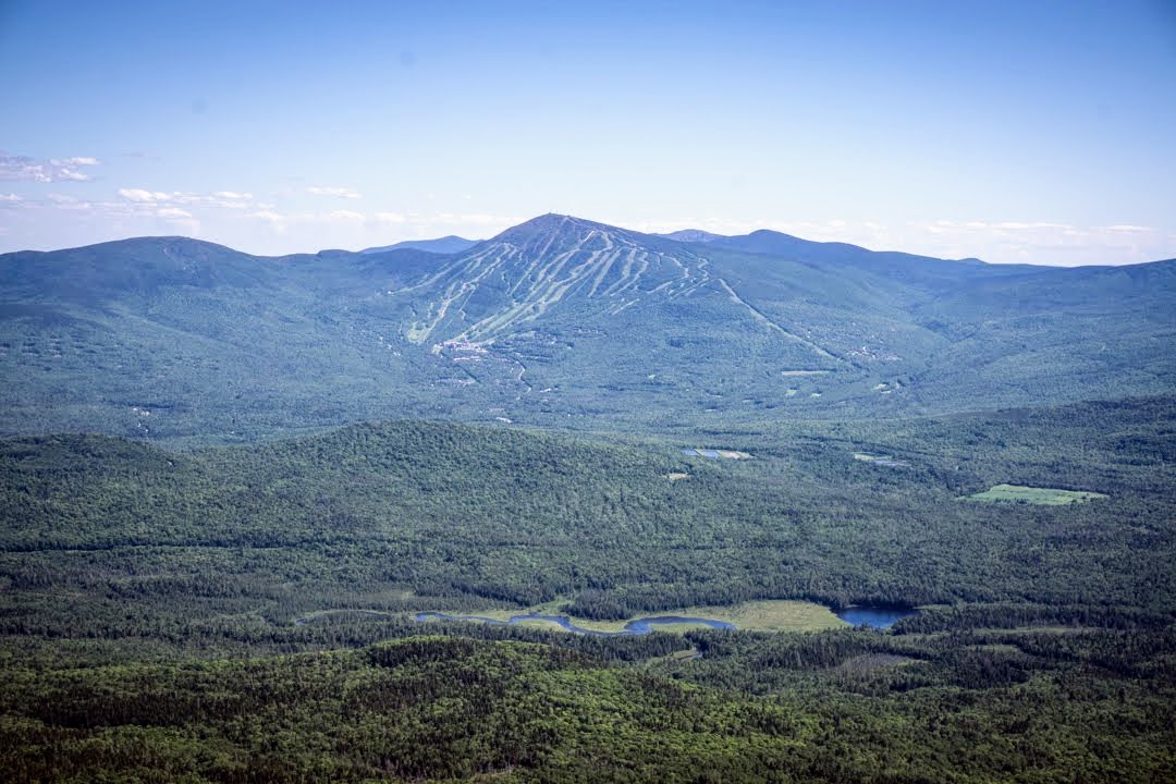
Overlooking Sugarloaf Mountain.
There isn’t much else to say about the day other than it took me over 15 hours to do 25 miles, something I haven’t experienced. I’m pretty fed up with this ridiculously rugged terrain and just wish it would ease up a bit. Looking ahead, there might be hope. The terrain looks pretty flat for the next bit, but of course that probably means it will be rocky and rooty as hell. My plan is to make it 21mi to the Caratunk House hostel so that I can shower, charge my electronics, and buy some more food before making the push to Monson.
Day 91: Little Bigelow Lean-to to Kennebec River – 21.7mi
I didn’t get to sleep until pretty late last night since I didn’t get to camp until after 9. As such getting up at 5, especially after such a tough day, wasn’t easy. Nevertheless I was hiking by 615.
Today was a bit odd in terms of the terrain. Almost immediately, it flattened out into a nice rolling leaf-covered path with barely any obstacles. I haven’t seen anything like it for hundreds of miles – it was awesome! The conditions waffled between that and something more technical with rocks and roots, but overall was pretty amenable. Certainly appreciated after all the hassle I’ve been through. There were a couple of incredibly small climbs but it was pretty much flat all day. The trail went along a couple of ponds and waterfalls and it was nice to take in the tranquility.
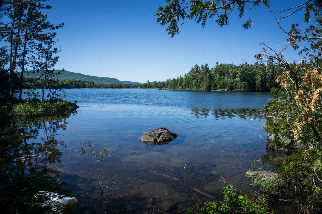
One of the many stunning ponds along the trail.
At one point I stopped for a break and checked the map to see how far I was from the hostel. The hostel description mentioned that it’s close to the Kennebec River crossing, but as I looked closer I realized that it’s on the OTHER side of the river from where I’d be approaching. Although normally not an issue, the Kennebec River crossing is a different story. The river is about 400ft wide and fast moving, making it extremely dangerous to ford (one person has died this year already attempting to do so). The ATC offers a “ferry” service free of charge for hikers, but it’s only available between 9 and 11am. I had planned to use this service tomorrow, thinking I’d be at the hostel, but by the time I figured out my mistake the service had already stopped for the day. There’s an option to book transport after hours for $50, though.
I hiked on and enjoyed the views, thinking that maybe I’d run into another hiker near the river who would split the after hours cost with me. When I made it to the river a couple of hours later, I found that there were 4 others there in the same predicament. Two of them I know and have hiked with, including Trout (the guy I met at Rock N Sole Hostel in Pennsylvania who started on the same day as me). They had been waiting for a couple of hours already and were unable to get ahold of the guy who runs the ferry. There’s no cell service, so Trout is using his InReach (same one I have) to relay information to his mother in Texas who has been trying to call on our behalf, but no luck yet.
If we don’t get this guy then we’ll have to wait it out until tomorrow morning, which is a huge waste of time. Although I wish I’d noticed the hostel location earlier, I couldn’t have done any more miles yesterday to get me here by 11am, so there wasn’t much I could do anyway.
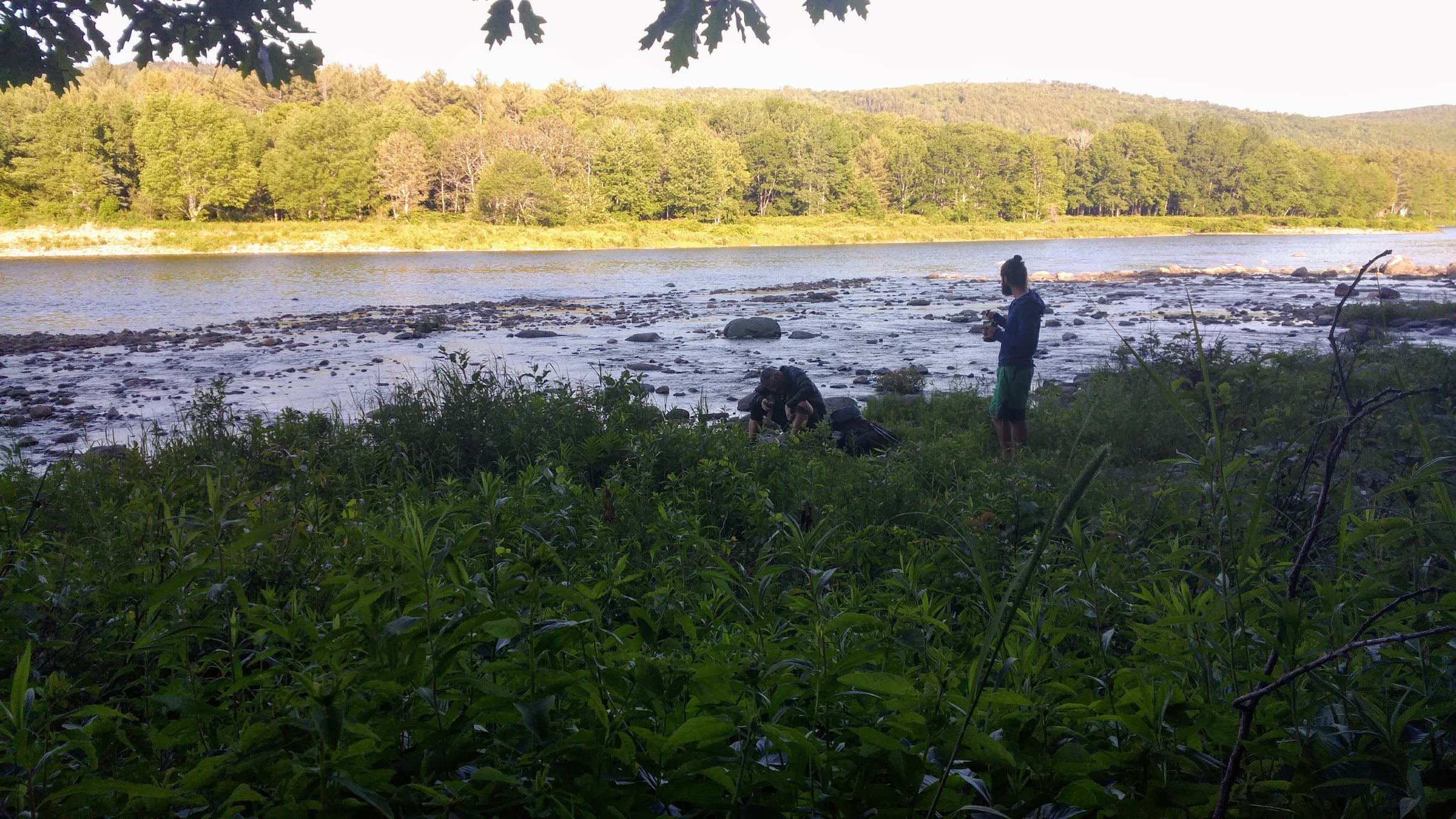
Stuck on the wrong side of the Kennebec.
In the end, Trout’s mom got ahold of the ferry guy and he refused to take us, so we all had to pitch our tents and wait it out until tomorrow. There’s also rain on the way, so that sucks. At least I’ll get a lot of sleep tonight!
In other news, some of my gear is beginning to fail on me. My Katadyn water filter has a flow rate of a trickle meaning it takes me 15 minutes or more to filter my water each time. It used to be much, much faster. I’ve also had a phone go bad, a valve on my inflatable pillow fall out, and now my camera is acting up. I guess there’s only so much abuse these things can take, but I’m so close to the finish I hope the rest holds out!
Day 92: Kennebec River to Campsite at mm2064.2 – 25mi
What a day! As I mentioned yesterday, several of us got stuck on the wrong side of the Kennebec River with no way to cross, and the guy who runs the ferry from 9-11am (and who also does after-hours trips for $50) refused to take us. So, without anything to do and no miles to hike, we all set up camp early and I was asleep before dark. I decided to sleep in a bit this morning as well, knowing that we wouldn’t get a ride until 9am, so I was out until 730am. That’s not only the latest I’ve slept in while on the trail, but it was also the most sleep I’ve had in one night – just shy of 11 hours! For once I felt great when I woke up and had no problem getting my act together.
As I was packing up, one of the other hikers said that there was a woman there with a stand-up paddleboard who was offering rides across. Nice! Trout and Blackbird, the two guys I know, were already across. I rushed to finish packing and ran down to the water to jump on. It was just before 8am by then, so crossing a full hour earlier was awesome. I sat cross-legged on the back of the board with my pack in my lap while Kim, the paddler, was on her knees on the front paddling away. It took a little practice to stay balanced, and the board took on a little water that soaked my shorts and shoes, but I was just glad to be getting across. While we made our way to the other side, Kim said that she lives within sight of the pickup point and often checks to see if any hikers need a lift. She also said that the guy who does the ferry was over at her house last night and mentioned something about getting phone calls, but she didn’t realize that he was ignoring us and refusing to come by. What a jackass. Anyway, we made it across in just a few minutes and I thanked her profusely before heading off down the trail. What a great trail angel!
Not far down the trail you come to downtown Caratunk, which is one single road. Even though I didn’t get to stay at the Caratunk House hostel, I still wanted to stop by to pick up some food for the next couple of days so I headed in that direction. It was only about a tenth of a mile from the trailhead, and when I arrived I saw Trout, Blackbird, and a bunch of SOBOS.
Note: from here on I had to use my cell phone for pictures since my camera crapped out. Apologies for the poor quality!
Caratunk House – one of the best hostels on the AT!
I went inside and instantly fell in love with with the place. The hostel is in a big old house with lots of rooms and trinkets everywhere. Bob, the owner, is an old school thru-hiker himself and has done a great job with the place. The resupply options are the best I’ve seen at any hostel, and the prices were reasonable as well – he’s not out to gouge hikers, even though he could since there’s no other option. I picked up a bunch of stuff and brought it to the counter to pay. As I waited for the total I saw the breakfast room down the hall and asked one of the other staff, a very nice older lady, what they served that morning. She answered that they had French toast, eggs, bacon, and homefries. My ears perked up and I inquired about leftovers, as I am wont to do, and she said there was about a serving left. Bob said I could have it for $5 and I said “yes!” before he finished his sentence. After paying I went to the dining room and inhaled everything, washing it down with a nice cup of coffee. You really can’t beat it. I thanked them over and over then went to fill my water bottles and get ready to hit the trail.
Although I had a late start (930am) I figured I’d try to get in about 25mi. That way, I’ll have a half day into Monson tomorrow which I definitely would appreciate. I started hiking and caught up with Trout in about half an hour. We hiked together for a while, but eventually separated on one of the climbs and I didn’t see him again for the rest of the day. There were two sizable summits to go over today, Pleasant Pond Mountain and Moxie Bald. Both required over 1,000ft of climbing but were also both quite easy. The terrain was totally manageable and not overly steep, which was a great change of pace.
Moxie on Moxie Bald!
Between the climbs was an awesome flat section that I cruised through with no trouble. There were short sections of rocky and rooty terrain, as usual, but about 70% of the trail today was good or great.
I kept a decent pace all day, only stopping for a couple of short breaks, and was able to get the mileage done by 8pm. I was pretty pumped. I set up on a nice flat spot right off the trail and tried to get some good tree coverage as it’s supposed to rain overnight. It sprinkled on and off throughout the day but picked up later in the evening. It’s supposed to drop off again tomorrow morning and then resume in the afternoon, but hopefully I’ll be warm and dry by then. I only have to hike 12 miles to get to Shaw’s Hiker Hostel tomorrow, my last stop of the trip, so I’m excited for that.
That’s all for this week!

This website contains affiliate links, which means The Trek may receive a percentage of any product or service you purchase using the links in the articles or advertisements. The buyer pays the same price as they would otherwise, and your purchase helps to support The Trek's ongoing goal to serve you quality backpacking advice and information. Thanks for your support!
To learn more, please visit the About This Site page.