
Weekly Trail Update Eleven: Days 70 77
Welcome back for another trail update!
Day 70: Campsite at mm1550.7 to Cheshire, MA 28.2mi
Despite the big rigs whooshing by throughout the night on the nearby highway, I slept well. It didnt rain overnight, which I was very thankful for, but it started pretty soon after I got on the trail.
The rain was more of a light drizzle not enough for me to get soaked but enough to saturate the trees and plants along the sides of the trail which I am constantly rubbing against, which in turn transfer their moisture to me. Before long my shoes and shirt were soaked, so I put on my poncho even though the humidity would make me sweat through it anyway. For whatever reason, my feet hurt significantly more when wet. I think it has something to do with the water softening my callouses which make me feel every step that much more.
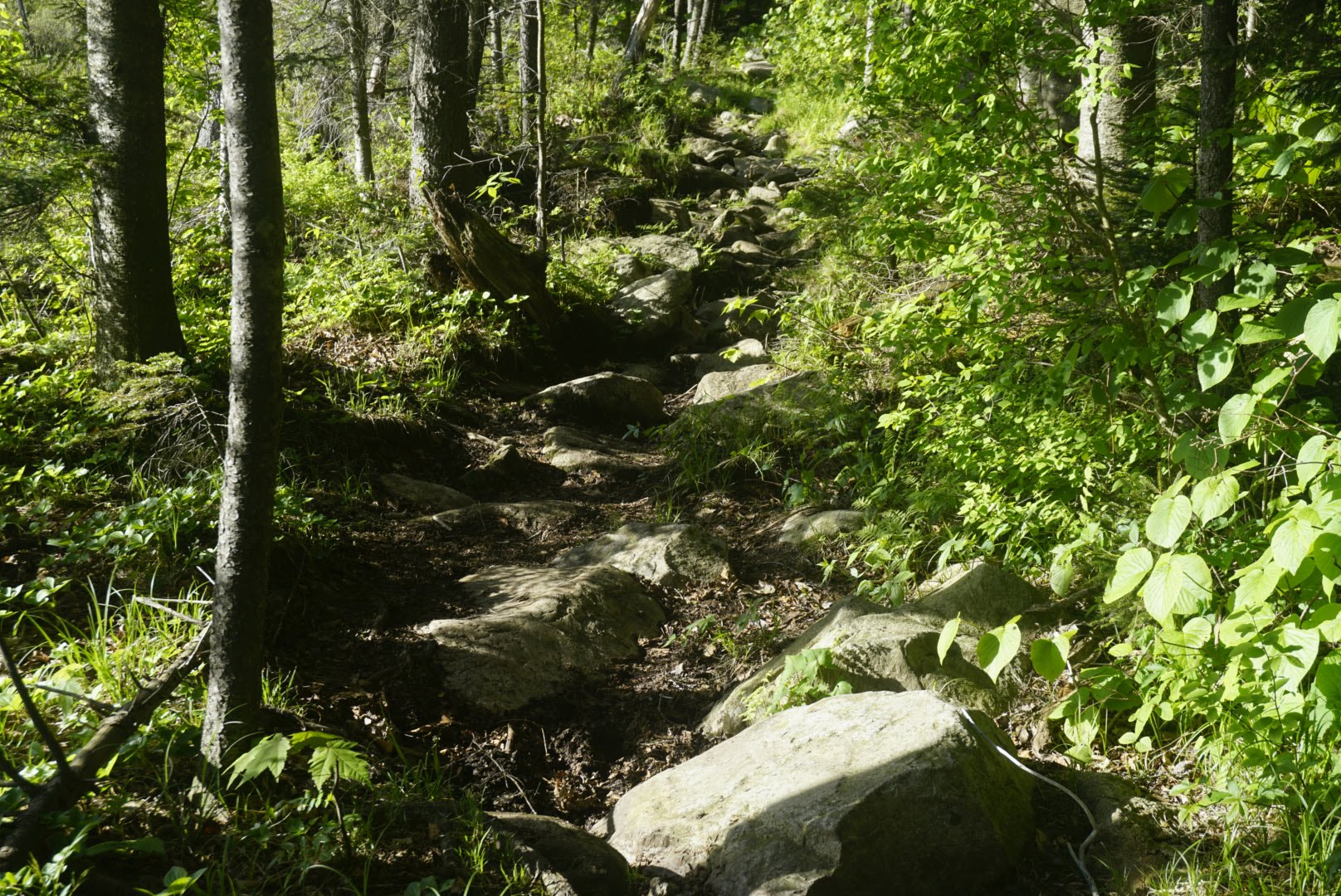
After completing the first sizable climb, the trail got narrow, a bit rocky, and then relatively flat. I was having trouble getting into a rhythm and taking more breaks than usual, but I kept going little by little. The first 15mi really dragged on, and I was moving slower than usual due to the slippery rocks and my lack of motivation.
At about noon, the rain stopped completely and the sun started to shine just a little. I stopped to filter some water at a stream and around the corner came Logs, the guy Ive been hiking with on and off for the last week or so. He had gone into Kent, Connecticut to resupply when I stayed on the trail, then he pulled some crazy miles (38 yesterday) to catch right back up. We hiked together into Dalton, MA which was only 4.5mi away.
This part of New England reminds me a lot of the trail in the south, where youre going either close to or directly through a town almost every day. We havent gotten much of that in the last thousand miles, so its been nice. While walking through town, we passed by the house of a well-known trail angel named Tom Levardi. He lets hikers camp on his lawn and although we were not planning to do so, we stopped and chatted for a while. He gave us each a soda and some great information about the trail in this area and what weve got coming up. He says that once we get to Vermont, the partys over in terms of passing through this many trail towns. Hes a really nice and generous guy I would have stayed there if plans allowed!
Logs and I walked through town and stopped at the Cumberland Farms gas station, which had lots of good lunch options like pizza and hot dogs. I grabbed two dogs, a slice of pizza, some candy, and a giant soda. It was delicious.
Logs is staying in Dalton for the night, so he headed off to his hotel and I made my way back to the trail I still had another 9mi to get to my destination of Cheshire.
The rest of the day was uneventful. There was a climb or two but nothing severe. The only thing bothering me was my feet, and I had to take a couple breaks along the way.
I reached the town at about 7pm and made my way to the St Mary of the Assumption church, which is just a couple of blocks off the AT. There, they let hikers camp on the lawn and use the bathroom which is a nice gesture. Apparently they used to let hikers sleep inside the church until last summer, but some kind of coding or zoning rule now prohibits them from doing so. I dont mind camping at all except for the fact that it may rain again tonight.
Tomorrow Ill be passing by a gas station that has a Dunkin Donuts inside, so Ill hit that up on my way back to the trail. Ill then face Greylocks Mountain, the highest climb since southern Virginia. Gulp. Im hoping I dont have to do it in the rain!
Day 71: Cheshire, MA to Campsite at mm1606 27mi
What an interesting day! I slept well outside the church in Cheshire and got up at my regular time. Instead of making oatmeal as usual, I packed everything up and walked about half a mile to the gas station with the Dunkin Donuts. There, I got a double sausage and egg sandwich on a bagel plus two chocolate donuts and a big cup of coffee. I sat there and enjoyed every bite. It tasted like the best meal Ive ever had thats how out of touch I am!
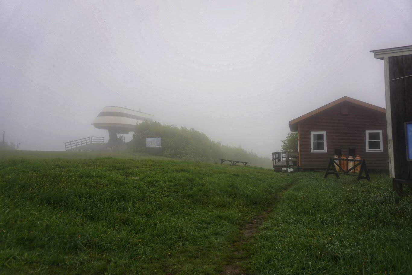
I got back on the trail at quarter to 7 and began the big climb up Mt Greylock. It is indeed the highest peak since Virginia and proved to be a tough summit. The trail was kind of like a staircase in that it would be steep for a while and then flatten out, repeating this pattern all the way to the top. The ascent was drawn out over several miles, so it wasnt too crushing but it took me over three hours to get to the top (the highest point in Massachusetts!). Up there it was so foggy that no views were to be had. They have a nice little lodge and a couple of memorials on the top. I filled my water bottles in the bathroom of the lodge and continued on.
The descent was also much like Virginia as there was no relief from the grade. It was full of rocks who had not found their forever home (i.e. loose) and it made for a slow journey. This whole section chewed up 14 miles and a good portion of the day.
After Mt Greylock, the trail passes through the town of North Adams, MA. There isnt much to do in town, but theres a big grocery store half a mile off trail and, even better, a Papa Johns pizza place right next door that supposedly gives hikers 50% off their order. I wanted to check those places out, but per usual was dreading the extra walking. As luck would have it, just before leaving the woods and walking through town, someone had put up a poster saying that they had bikes for hikers to use to check out the town. How cool! Ive been dreaming about going for a bike ride since I started and this would be an awesome way to get to/from the stores. I walked a block or so to the persons house, and sure enough there were four bikes on a rack right next to the road. I stowed my trekking poles, climbed aboard, and headed out.
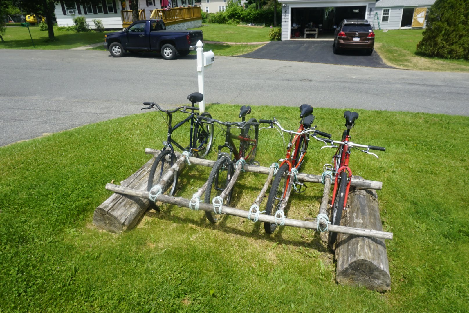
The ride to the store was easy and quick. However, when I arrived I was horrified to discover that the Papa Johns had permanently closed. NOOO! I was quite distraught, as I had been thinking about pizza all day. I hung my head and went into the grocery store, where I picked up a few Clif bars and a big sub for lunch, along with a slice of cake from the bakery. I sat out side, ate, talked to Veronica, and enjoyed the break. By the time I returned the bike nearly two hours had passed its easy to lose track of time when you go into town, thats for sure.
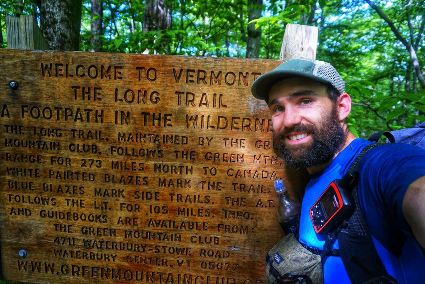
I got back on the trail and faced another big climb, although not as significant as the last. After reaching the summit, a sign welcomed me to Vermont and indicated that I was now on the Long Trail. The LT, as its known, runs for 279mi from that point to the border with Canada and is the countrys oldest long distance trail. The AT follows the LT for 105mi before splitting off toward New Hampshire. It was pretty exciting to be in a new state (again) and, practically, on a new trail.
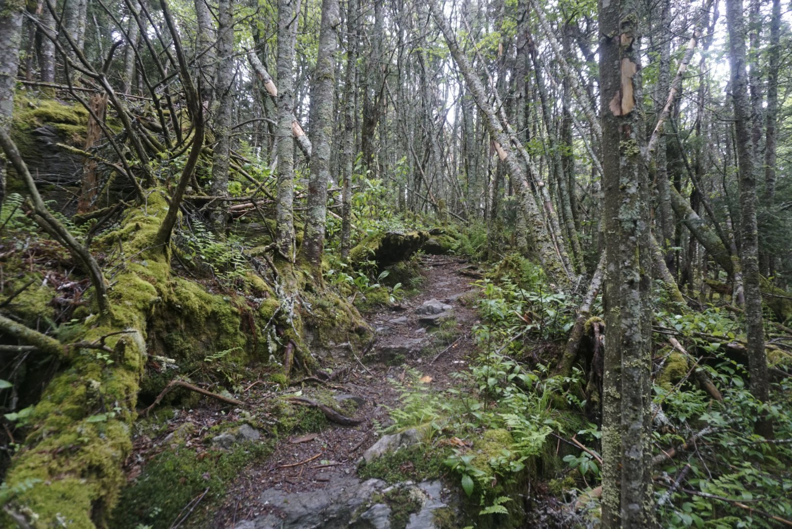
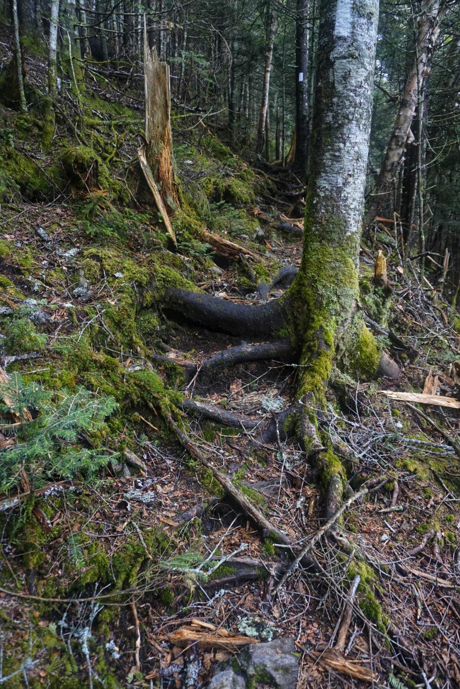
By this point it was almost 4pm and Id gone about 18mi. I was hoping to make it another 10mi to a shelter but with the late start and delays it didnt look like that was going to happen, at least without night hiking. My feet were feeling pretty battered from the terrain, too. Since getting into New England, roots have become the major obstacle. Their slender profile and spiderweb-like configuration make them impossible to miss with each step, and by the end of the day it feels like youve been walking on Lego blocks with bare feet. So, I went as far as I could before it got dark and set up camp just off the trail at 830pm, falling about a mile and a half short of the shelter.
My next town stop is Manchester Center in two days, which is 46mi away. Im hoping to get close to 30mi tomorrow to make for a short day into town, but with the upcoming climbs Im not sure thatll happen. Well see!
Day 72: Campsite at mm1606 to Story Spring Shelter 25mi
Last night I slept like a rock and didnt want to get up. As usual, though, I did eventually manage to get my stuff together and start hiking at 6.
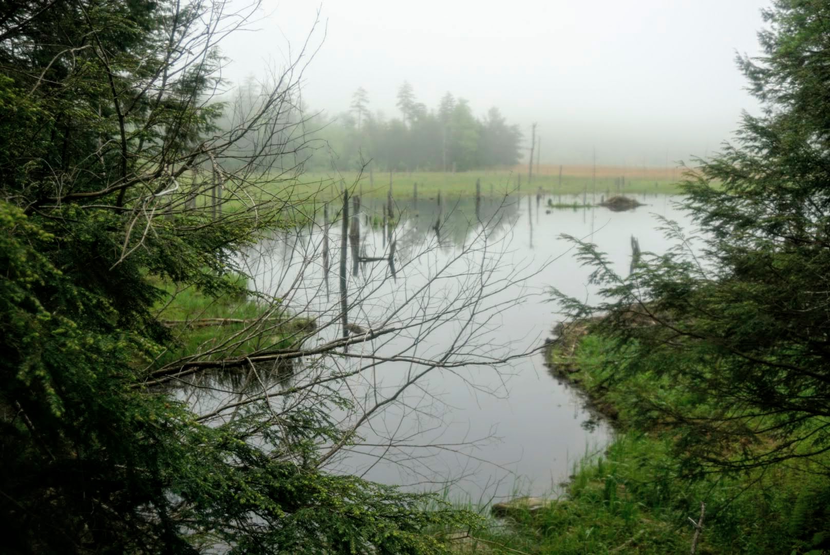
My main climb for the day was Glastenbury Mountain, which was drawn out for nearly 16mi. Along the way were many shorter hills and descents, but nothing compared to the big summiting push. There werent many views or interesting things to see along the way, just a few bogs and beaver dams.
The trail, as Ive mentioned, has become riddled with roots, rocks, and mud (they dont call this place Vermud for nothing!). These obstacles slow my pace considerably, especially toward the end of the day as my feet get worn out. I made decent time during the first part of the day, and so I stopped at Godard Shelter to have lunch. I talked to a couple other hikers there and one mentioned that it was going to rain tonight. I checked the weather and sure enough its going to get wet. Itll start tonight and carry on through tomorrow and possibly the next day as well. Ugh. At that point I had to make a decision about where to stay tonight. I had planned to do another 13mi which would put me within 17mi of Manchester Center for an easier day tomorrow, but with rain on the way I wanted to be in a shelter to keep from getting everything soaked. There was a shelter 9mi away and 20mi away, and I obviously wasnt going to make the latter so I went for the closer one. That means Ill have to do 21mi tomorrow, likely in the rain, but at least Ill be dry overnight.
For some reason, those 9mi to the shelter after lunch felt super hard. The weather was a nice 65 degrees all day so it wasnt the heat, but for whatever reason I couldnt get back into the groove. It seemed like the trail got harder as well, because every step was avoiding a rock or root. My feet were eviscerated and I had to take several breaks throughout the remainder of the day. I couldnt wait to be done.
I finally made it to the shelter at about 630pm and there was just one other person. Soon after, Logs showed as well. I plan to get to sleep early tonight and rest up for tomorrow. Theres a huge climb coming up (isnt there always?) and Im sure the trail will be a mess after this storm.
Day 73: Story Spring Shelter to Manchester Center, VT 21.5mi
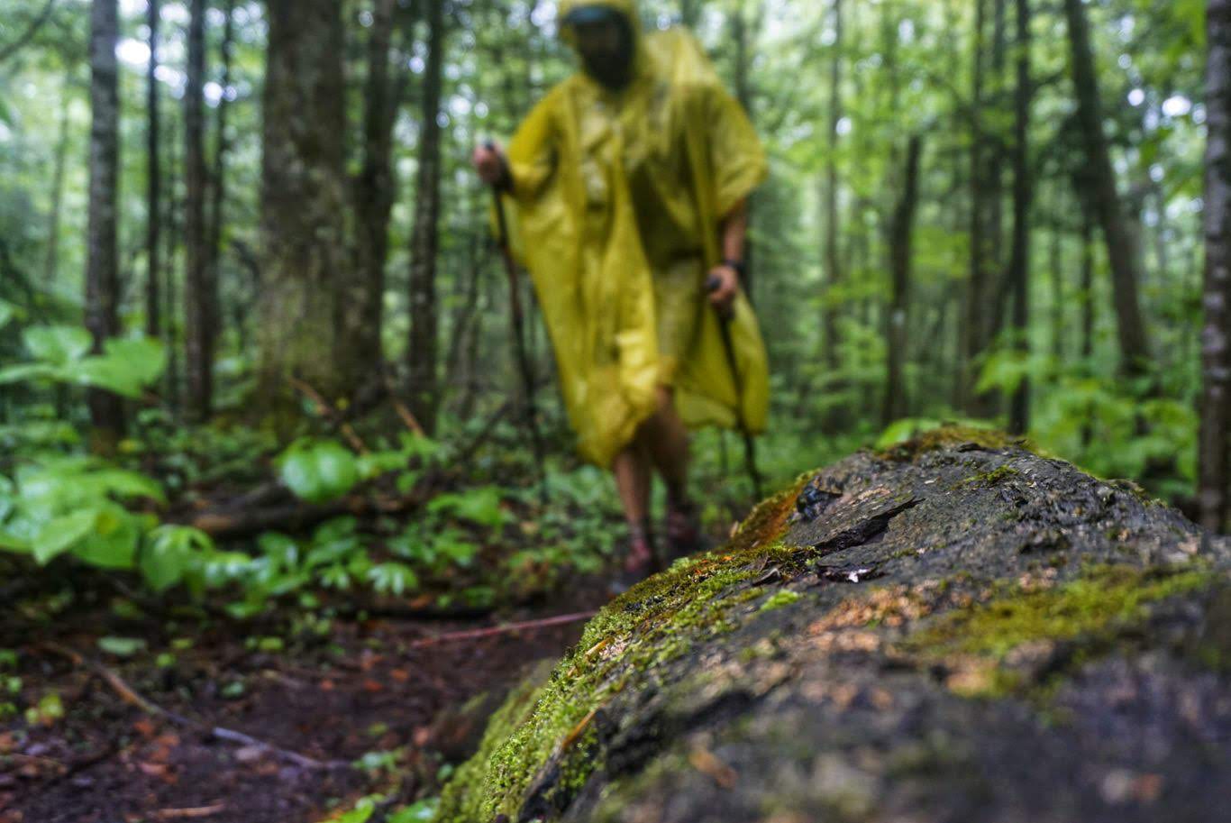
As predicted, it rained hard overnight and was still going strong in the morning. Not only that, but the temperature dropped to the low 40s something we havent experienced since the beginning of the trail. Both Logs and I were up at 5, but we sat watching the rain for a long time, not wanting to get out of our warm sleeping bags and into the rain. Logs eventually took the plunge, and I followed suit soon after. I was on the trail just before 6, but I wasnt happy about it.
The temperature drop really thew me for a loop and I wasnt prepared for it. Mixed with the rain, it was hard to keep my hands warm so I resorted to my old tactic of putting one hand at a time in my pocket to warm it up while the other cradled my trekking poles. The day started with a 2,000ft climb up Stratton Mountain, which was actually easier than I expected. The trail was nicely groomed and not nearly as technical as yesterday, which was a great change. The downside, of course, was that the rain had turned it into a sloppy mess, and I spent most of the day dodging mud puddles. At one point I slipped and fell flat on my face, unable to break my fall since my hands were preoccupied.
The descent down Stratton was also easy. The rain had died down a little by this point, but it was still pretty cold. I kept my head down and hiked hard, just trying to get the mileage done as quickly as possible. Because I cut my day short yesterday, I had a few more miles to do today and I couldnt wait to be done. Although I was relatively dry and warm under my poncho, my shoes and feet were understandably soaked.
I took only a couple of breaks throughout the day and thanked the heavens for easier trail. I was able to get the miles done by 2:45pm and immediately went to hitch a ride into Manchester Center. I got passed over by a few cars until someone from the trail who was out for a short day hike took pity on me and gave me a lift. He dropped me off at the Mountain Goat outfitters, where I bought some new socks, tips for my poles (which were worn to nubs), and picked up a resupply box I had sent there. I then walked down to the Price Chopper grocery store for a few items, to McDonalds for a double quarter-pounder, and then called Jeff from the Green Mountain House Hostel to come pick me up.

When I got to the hostel, Logs was already there along with one other hiker. The hostel is actually a house, and a nice one at that! Its for sure one of the best places Ive stayed so far, and is a great deal at just $35/nt including shuttles to/from the trail and breakfast. I spent the evening updating the blog and doing laundry. It was great!
Day 74: Manchester Center, VT to Minerva Hinchey Shelter 29.7mi
The hostel last night was awesome! I really enjoyed the place and the owner was a great guy and very accommodating. The hiker who I shared a room with, Squid, snored like a freight train though so I ended up moving to a different room. Even with earplugs in he woke me up!
In the morning I ate a couple bowls of cereal and four hardboiled eggs before we all piled into the car to head back to the trail. Jeff, the owner, was nice enough to take us at 6am so that we could get an early start as we like to do.
The first climb of the day was up Bromley Mountain, which is a ski resort. We literally hiked up a slope and walked right next to the chairlift. They have a ski patrol hut at the top that hikers can stay in, and there were a few inside.
There were several other climbs during the day, but nothing very notable. As expected, the trail was a mess thanks to the rain and my feet were wet all day. The terrain, although steep at times, wasnt too bad most of the time. All of the mountains have switchbacks which makes the ascent somewhat walkable, so that helps. There were areas that were quite rocky and slick, and one time in particular I tried to hop from one dry spot to another, slipped, and ended up falling sideways into a mud puddle. Such is life on the AT. Luckily, though, it barely rained all day and the temperature was a little warmer than the 40-degree nonsense we had yesterday.
I took my time getting the mileage in but arrived at the shelter just after 7pm. Logs was here already and we have the place to ourselves a rarity. Tomorrow we have the big climb up Mt. Killington to face, which looks like itll be a real bear.
Day 75: Minerva Hinchey Shelter to Stony Brook Shelter 30.4mi
Logs was up and out of the shelter at 430am but I slept in until my normal time and was on the trail by 6. Another hiker, Impact, ended up coming in at around 9pm and joined us for the night. Id met him a couple days earlier in Manchester Center.
I really earned my miles today on the trail! The day started off with a couple of quick and steep climbs which had no switchbacks and were quite tough. Although it wasnt raining, the rocks and roots were still slick and I was sliding all over the place. I ended up on my ass at least three times when my feet flew out from under me after stepping on one of these ice-rocks.
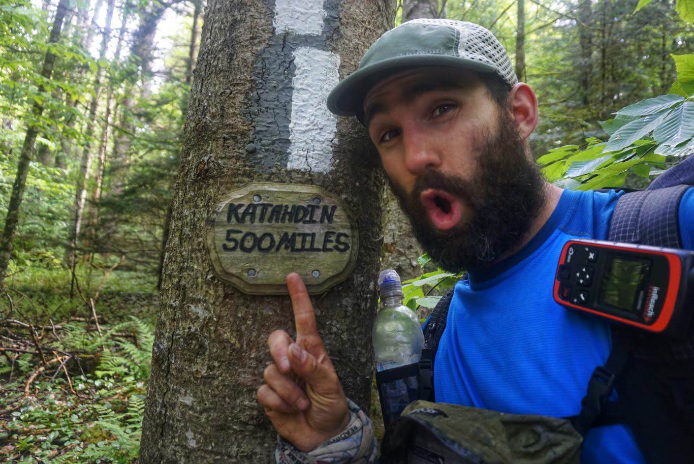
After the first climbs the trail crosses a road and theres a sign indicating that Katahdin is just 500mi away. That means Im more than 75% done with the trail at this point, which is pretty incredible.
The next big climb was to the top of Mt. Killington, a ski resort and one of the tallest mountains on the east coast. The trail going up actually wasnt too bad at first as it started gradually and then ramped up. Before I knew it I was scrambling over rocks and around large root spawns while circumventing the summit. It took me a while, but I made it to the top.
After the descent, there were just a couple more climbs to do for the day and they were much like the first steep and hard. These climbs were worse than Killington!
I finally strolled into the shelter at 815pm. It was a long and difficult day, as always, but Im glad to have those climbs behind me. Weve now departed the Long Trail and are back on the AT, so no more sharing!
Tomorrow Im planning to do similar mileage, and the elevation looks a bit more favorable.
Day 76: Stony Brook Shelter to Happy Hill Shelter- 31.1mi
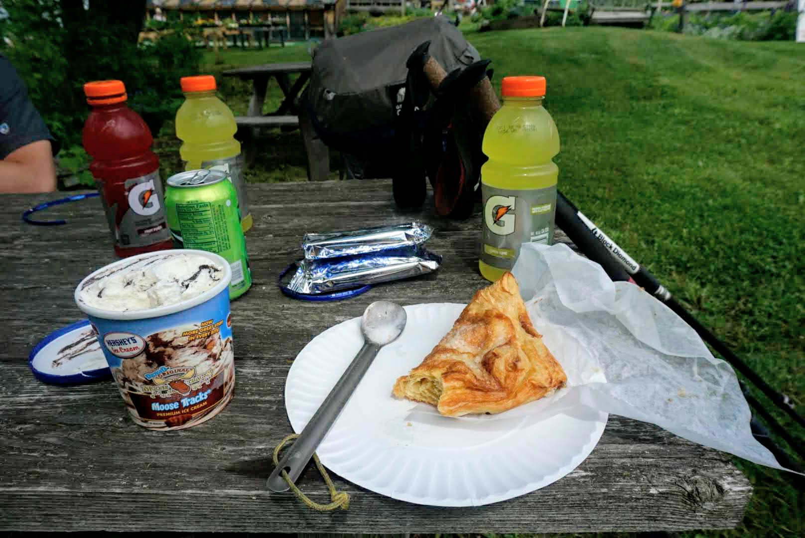
Both Logs and I were on the trail just before 6 and made good time. Wed heard of a farm stand about 14mi away that sells ice cream, soda, and baked goods that we planned to stop by, so that was our motivation for the morning.
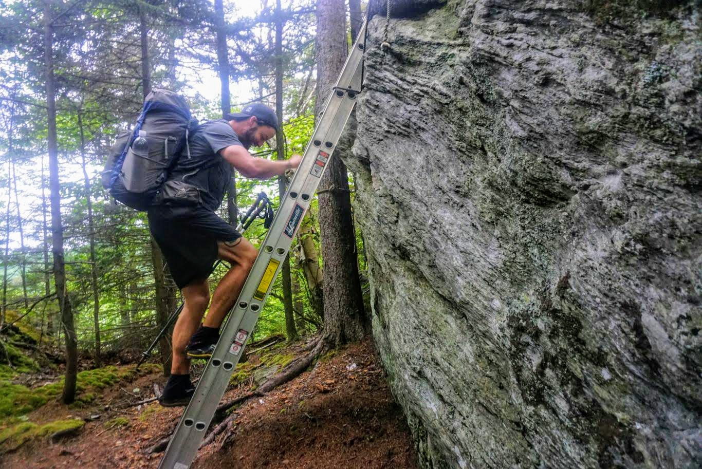
The trail between our shelter and the farm stand was mostly good and soft with very few rocks or roots. There were several short and steep climbs, but nothing like wed see later in the day. At one pojnt, though, we had to get down from a giant Boulder using a utility ladder that had been tied to a nearby tree. Interesting.
We made it to the farm stand just after 11am. We each bought a pint of ice cream, an apple turnover, and some other snacks. We sat at their out door picnic table and stuffed our faces until it was time to head back to the trail.
The rest of the day involved lots of climbing. We went up and over three thousand-foot hills and descended in the same fashion. Once again, switchbacks were nowhere to be found so the trail was almost straight up quite tough.
We eventually made it down to the little town of West Hartford and walked through town. We got talking to a guy who lives nearby that hiked the trail in 2016. He was very nice and gave us some good information as well as a couple of beers, which we happily accepted.
The last 4 miles to the shelter were mostly uphill, which is always tough at the end of the day. We finally arrived just after 7pm, which is pretty good considering the mileage and our extended stop.
Tomorrow well pass through Hanover, which is a nice little trail town and home to Dartmouth College.
Day 77: Happy Hill Shelter to Campsite at mm1768 25mi
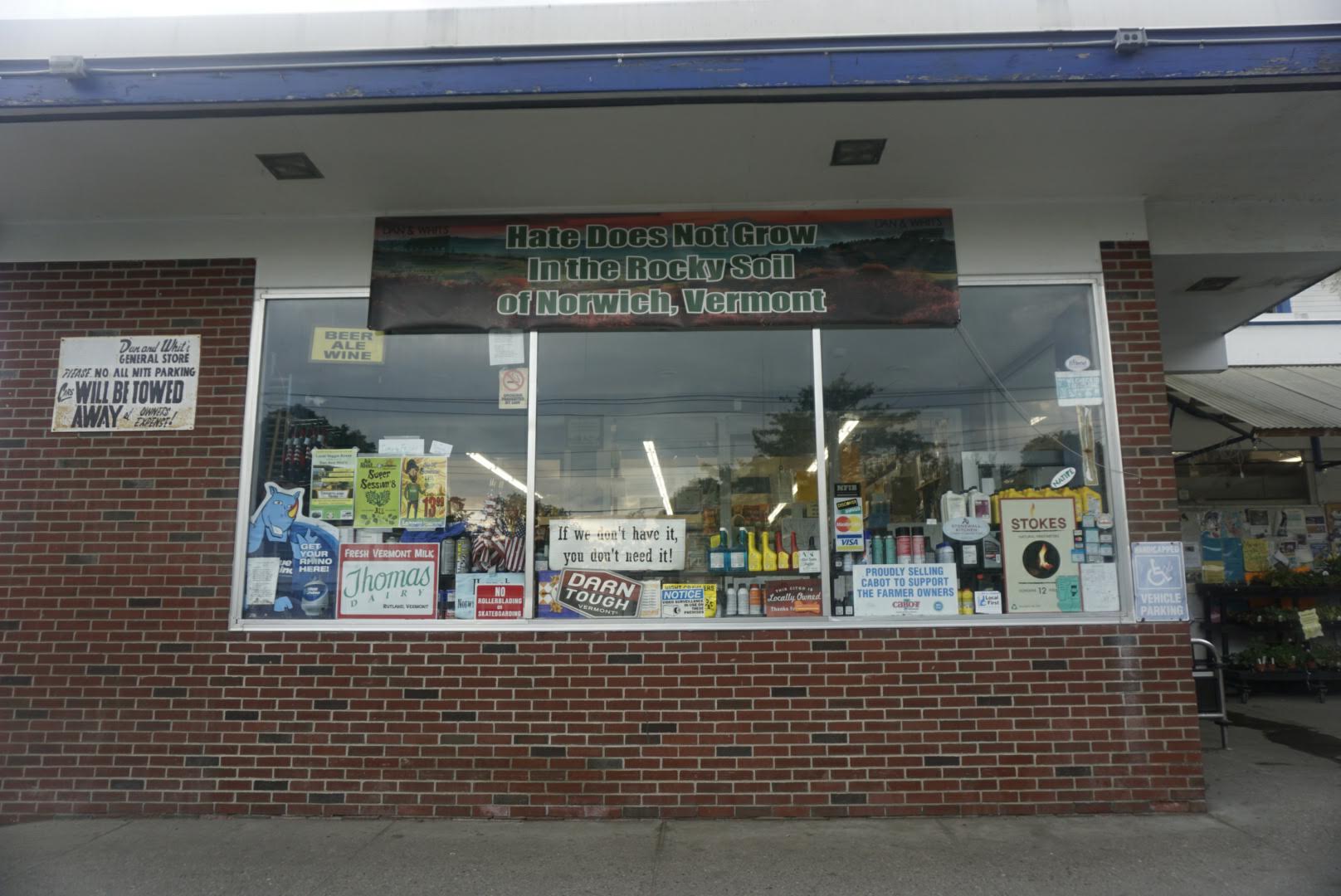
Logs and I were on the trail just before 6 and had an easy first few miles. Before we knew it, wed popped out onto the road and within a mile we were in the little town of Norwich. There, they have a general store called Dan & Whits where they sell, well, everything. We both needed just a couple of things to get us through the next few days to our next resupply and they had exactly what we were looking for. They even gave us day-old sandwiches for free, which apparently is something they do for hikers.
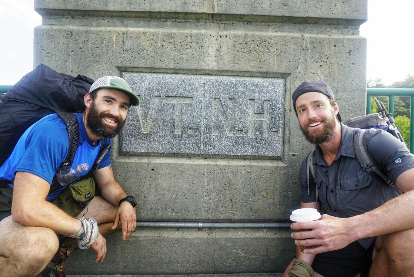
After finishing there, we made our way to Hanover which was about a mile away via the road. While crossing a bridge, we also crossed into New Hampshire the penultimate state of the trail!
In Hanover, we both needed to pick up a package at the post office and we arrived right after they opened at 830. I had bought a new pair of shoes from Amazon and had them shipped there, which was a mistake. Apparently Amazon only ships UPS and so the post office said they didnt have it. I was able to pull up the tracking information and show that it was indeed delivered and signed for by someone named Dave. After a little more digging they found the box, but now they said I had to pay postage for it (even though I already had with Amazon). So, $10 and half an hour later, I had my shoes. Im trying a different approach with this pair instead of going with Altras I tried to find a pair of trailrunners that come in a wide size, so as to give some relief to these damn bunions that are always getting pinched. The only acceptable pair I could find was some by New Balance, and so far they seem to be decent. I got the widest possible (4E) and they fit pretty well without crunching my feet. No way to know how theyll work in the long run, but I was just happy to find something that fit better.
After the post office, we went to the Recreation Center just down the road, where they let hikers take a shower and do laundry which we both needed badly. It cost $3/shower and $2/load of laundry, which was great. We hung out there for a while, charged our electronics, and waited for our clothes to finish. After departing the rec center we headed next door to their co-op grocery store to buy some sandwiches for lunch.
We finally made it back on the trail just before noon. With full bellies and clean clothes, we began to hit the climbs. There were just two bigger ones on this stretch, but they took a lot out of me. I was tired and was finding it difficult to get in a rhythm. By the end of the day, even though it was shorter than normal, we were both toast. We found a decent stealth camping spot and called it a day.
The next two days are going to be brutal. Between here and Lincoln, NH, is 50 milesand 15,000 feet of elevation gain. I have a hotel reservation there in two days, but no matter how you slice it well be hitting several multi-thousand foot climbs per day so itll be incredibly tough. Itd be best if we could do 32mi tomorrow to set up an easier day into Lincoln on Sunday, but with this amount of elevation Im not sure I can handle it. Well see how it goes.
Thats all for this week!

This website contains affiliate links, which means The Trek may receive a percentage of any product or service you purchase using the links in the articles or advertisements. The buyer pays the same price as they would otherwise, and your purchase helps to support The Trek's ongoing goal to serve you quality backpacking advice and information. Thanks for your support!
To learn more, please visit the About This Site page.