
Weekly Trail Update #1: March 25 – April 1, 2018
Welcome to my first update from the trail! Here I’ll give a day-by-day account of my hike and everything that goes along with it. Please excuse the absence of flowery prose and the multiple misspellings, as I have limited opportunity to edit these entries as I go.
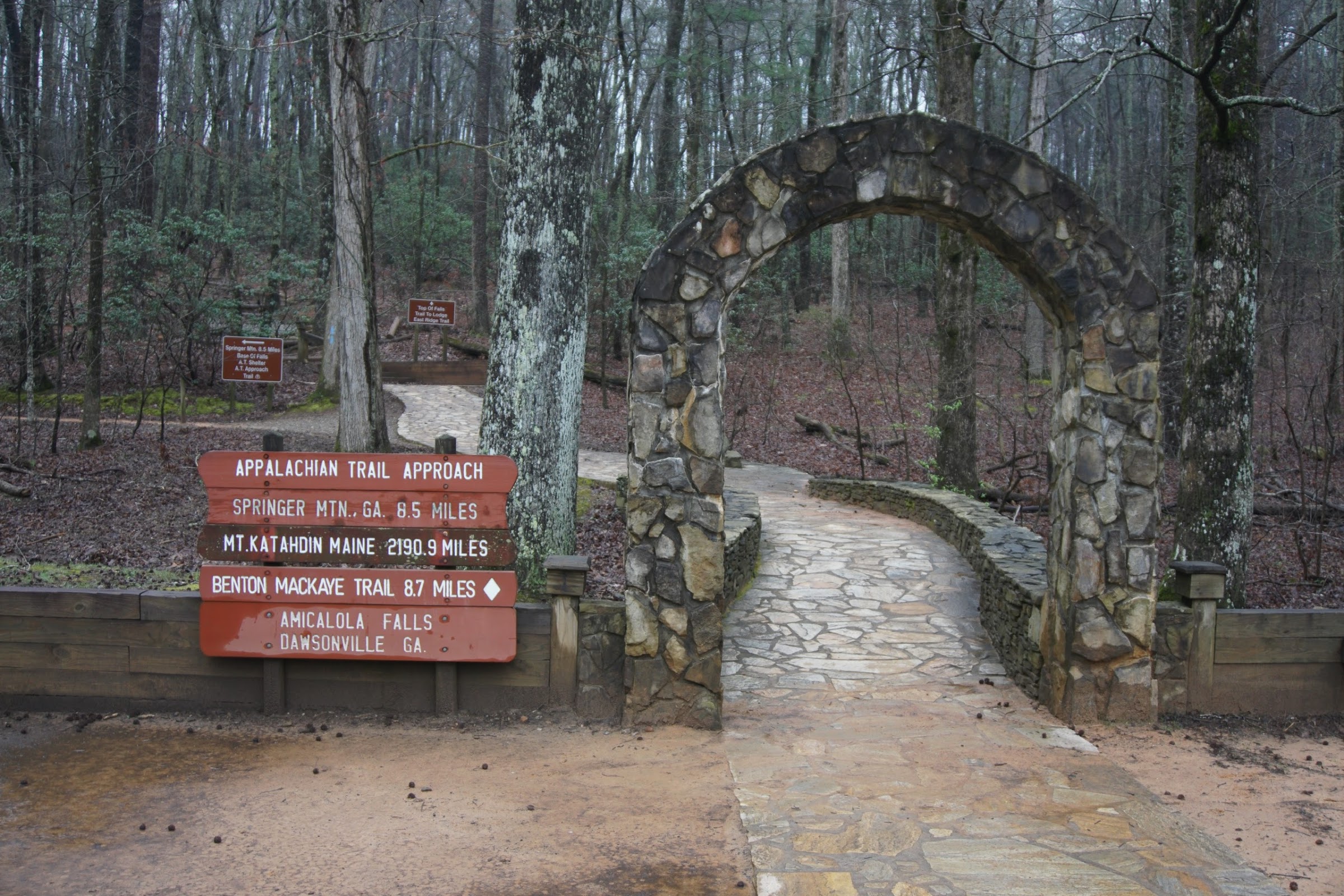
Beginning of the Approach Trail, which I had not intended on taking.
Day 1: Half of the Approach Trail to Gooch Gap – 21 mi
It was like Christmas morning! I woke up around 6:30am at the Hyatt Place near Sandy Springs, a few miles north of Atlanta proper. I did some busy work preparing my stuff, then went down to have breakfast. It was POURING rain outside, but I checked the forecast and it wasn’t raining on Springer Mountain so I was hoping it would be alright.
My graceful chauffeur, Sarah, picked me up just before 9am and we started on our way to Springer. We stopped at Walmart so I could pick up a few things like fuel, hand sanitizer, and some candy. We continued on toward the Amicalola Falls visitor center, assuming we could get to the Springer Mountain parking lot from there. Besides, I figured I’d check in and do the whole thru-hiker register thing. The place was absolutely swamped! I guess they were doing one of their “Thru-Hiker training” classes as well, so the room where you register was overstuffed. I decided not to bother with the registration and just snapped a picture of the arch before getting back in the car. I hadn’t planned to do the Approach Trail, as it’s an extra 8.8mi (from the Visitor’s Center) that isn’t actually part of the AT. However, when we asked for directions to the Springer Mountain parking lot, the employees said they were not allowed to give out directions anymore because they’re trying to discourage people from using the road that leads there and instead want hikers to do the approach trail. My thinking is that if you want to make the approach trail part of the AT then do so, but don’t refuse to provide directions to the actual start! We looked up some directions on Google Maps and tried to navigate on our own. Despite our best efforts, we ended up on a gnarly dirt road that eventually just stopped. It happened to cross the approach trail at about the 4.3mi mark, so instead of retracing our steps I just started there (a bit south of Nimblewill Gap).
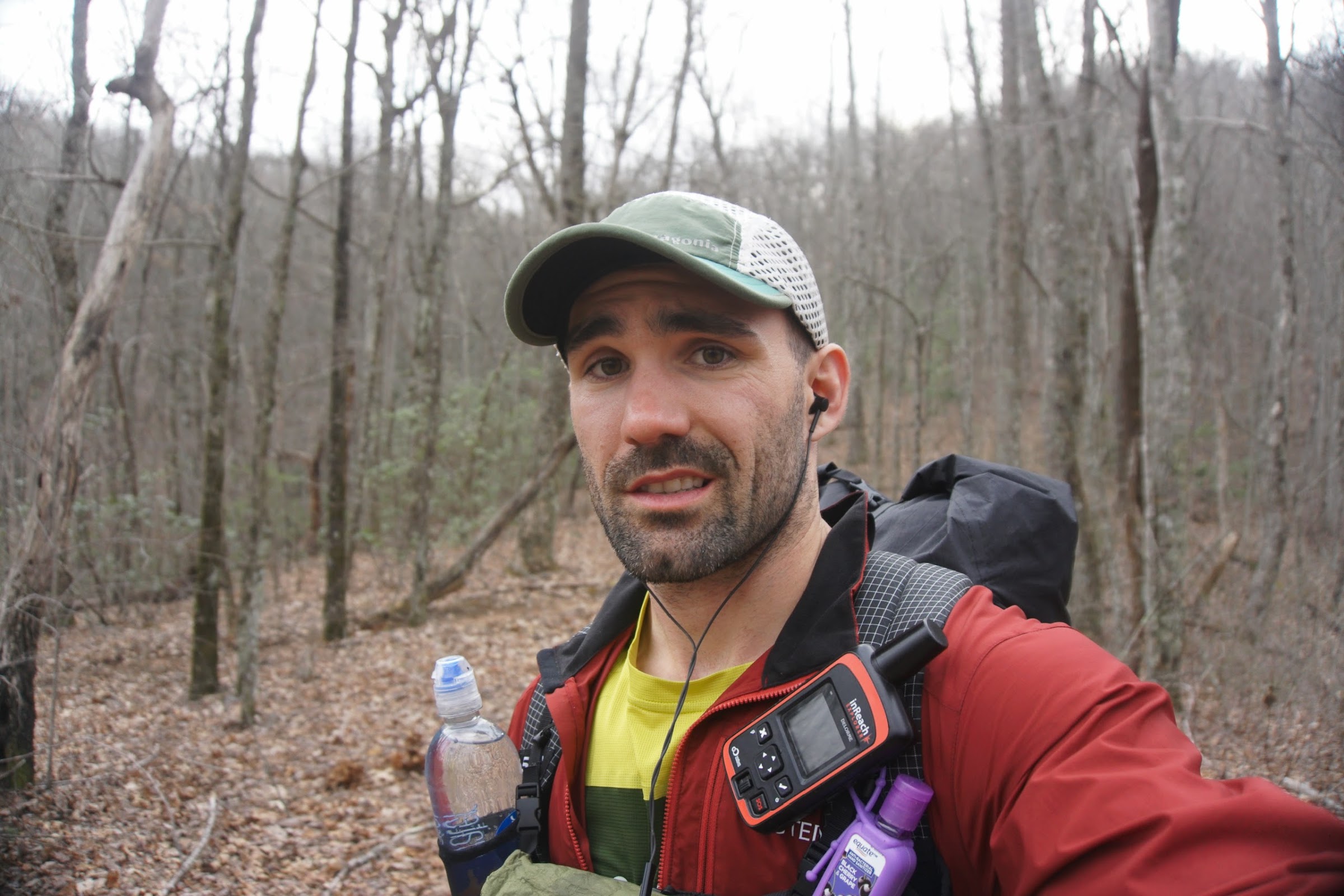
The approach was easy and I got to the summit of Springer in a little over an hour. There was a ridgerunner, Tom, who was giving information to folks starting. There was one other older guy up there starting a section hike. He showed me the logbook and took a photo for me-not that you could see anything because of the fog! It was pretty chilly up there but I was comfortable. I had my tights under my shorts and my thermal under my wind jacket. Kept me very comfortable all day.
It was surreal to be there, finally starting what I had planned and trained for for so long. I headed out toward the parking lot, where I had intended to start, and met Mountain Squid, a volunteer who was also giving information and some snacks (first trail magic!). I grabbed a star crunch and shot the breeze for a minute. He told me that over 40 thru hikers and about 30 section hikers had passed through today. Wow! Pretty unbelievable. Because I started late (about noon), most were way ahead of me.
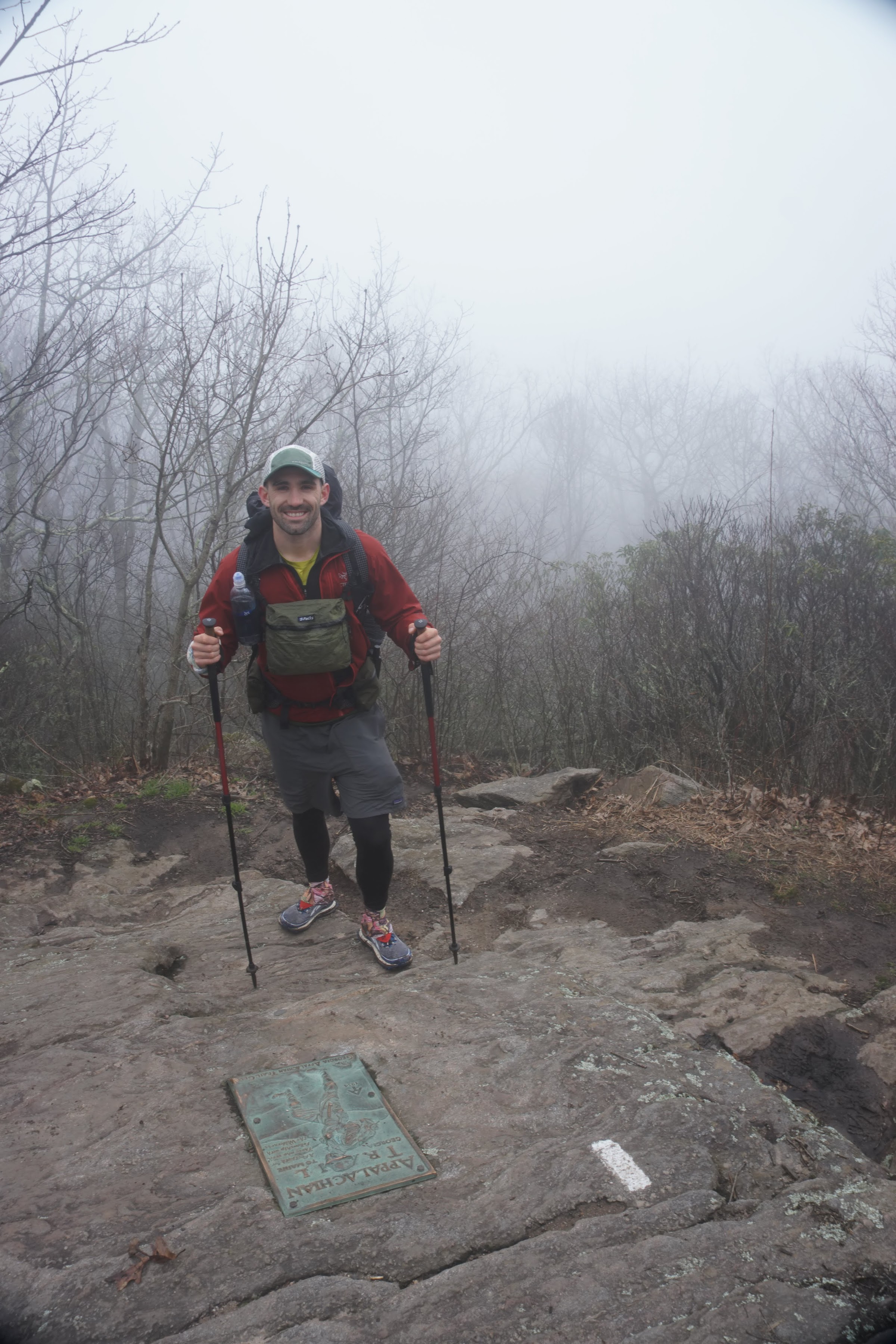
The REAL start – Springer Mountain.
I said thanks and headed off on the trail. It was pretty uneventful and not very scenic for the entire day. I saw maybe 25 people, mostly day hikers, and passed a few thru-hike hikers. My goal was to get to Gooch Mountain shelter, which I did at about 7pm. However, it was completely packed – not even a tent site to spare. So I pressed on, eventually finding a flat spot at Gooch Gap and settling down.
I did about 21 miles including my half approach trail, and I felt good. The trail is so well maintained and soft that it’s really nice to walk on compared to what I’m used to. There were only a couple of long-ish climbs, but nothing too bad. I made dinner, texted with friends (somehow I had service!) and it was lights-out by 9:30pm.
Day 2: Gooch Gap to Low Gap – 26.4mi
I had a hard time sleeping last night when the temperature dropped below zero. I slept in all of my clothes and put more things on as I could, including my wind pants which helped immensely. I still woke up many times and couldn’t get comfortable. I must have gotten at least a little bit of sleep because I woke up when my alarm went off, however since it was still dark I snoozed it and hung out in my bag for a bit longer. My headlamp died last night so I couldn’t have gotten packed up before dawn if I had wanted to.
I did eventually get up, made breakfast, and packed. I was on the trail just after 8 and I was freezing. My hands were numb from the exposure and it took a long time to get thawed out. I wore the same thing as I did the day before and was chilly, but comfortable. Eventually my hands thawed and I got into a good groove.
I got to Woody Gap and a girl of about 25 in a Chevy Impala popped her head out and excitedly asked if I was hiking to Maine. I said yes and she lit up, saying that she would like to do it someday. She asked if I needed anything, which I didn’t, and wished me luck. On the other side of the road was some trail magic – water and a bag of apples – which I gladly accepted
My next stop was Neels Gap, 12mi away. It took forever to get there and had some big climbs. There were lots of day hikers and kids on top of Blood Mountain. I got into Neels at about 2:15pm and bought new batteries for my headlamp, got my Capture Clip (device for holding my camera) tightened as the bolt had come loose and bought/scarfed down a pizza. I had heard about the pizzas there and foolishly thought they were fresh. Turns out you just buy a frozen Red Baron pizza and they microwave it for you and charge $8. A bit of a scam, but delicious nevertheless. Mountain Crossings (the store at the gap) has resupply options, but as expected the prices are quite high. Outside is the famous tree with shoes from hikers who called it quits. Supposedly, a significant number of people quit at that point, just 30mi in.
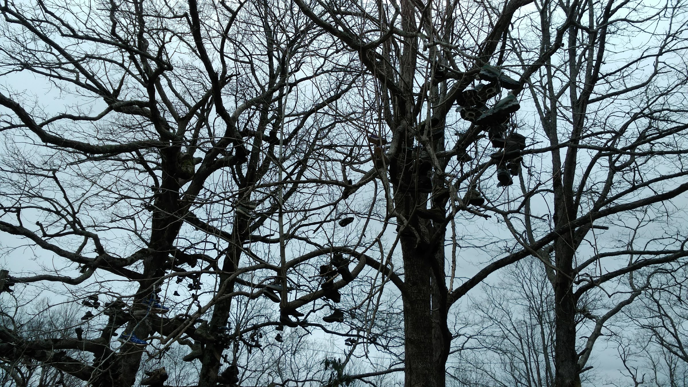
Hundreds of hiker souls (or should I say soles?)
My destination for the night was Low Gap, another 11mi away. I started at about 3pm and was slow going at first. I had just inhaled over 1500 calories and my body wanted a nap, but I pressed on. Uneventful for the rest of the evening, but took till 8pm to reach the shelter. Of course it was compley full, so I just got some water and found a flat spot just off the trail at the entrance to the shelter. It was still cold and windy.
Day 3: Low Gap to Dick’s Creek Gap – 26.4mi
Had another rough night. The wind was howling and it was all I could do to stay warm. It was such a pain trying to set the tent up when it was blowing everywhere. Anyway, I ended up wearing every piece of clothing I had plus pulled my quilt up over my head in order to create warmth. It worked surprisingly well and I actually slept better than the night before, but not much.
Today had some big climbs, including Blue Mountain, Rocky Mountain, Tray Mountain, and Kelley Knob. It was sleeting at the tops of all of these mountains, but it wasn’t enough to necessitate rain gear. Lots of ups and downs, and my place slowed significantly.
Coming into Unicoi Gap, a well-known pickup spot for people staying in Helen or Hiawassee, there was some trail magic of a container of various granola bars. Right behind me was another hiker, didn’t catch his name, who had been on trail for 6 days. He said that there was a huge rainstorm on Saturday, just before I started, and that he got off trail to wait it out. He said there was no rush to get to the Smokies since it’s still under a foot of snow. Lovely. I told him I was hoping to stay at the Top of Georgia hostel that night, and he gave me a sideways look and asked if I had a reservation. Damn, never got around to that. He said he called yesterday and got the last bunk for Wednesday, so don’t be surprised if it’s full. Damnit, I was looking forward to a warm night!
As the day progressed, we came out of the mountains and the temperature got much more manageable. I even stripped down to just my wind jacket and the shirt, losing the thermal hoodie. The miles were ticking off slowly, and my feet were gradually hurting more. The first two days I barely stopped all day, but by the afternoon today I was resting my feet every couple of miles. No blisters, but I’m hoping it doesn’t get as bad as the FKT which would be miserable.
At long last, I made it to Dick’s Creek Gap. I didn’t even bother checking the hostel, assuming it was booked, and instead moved on to a tent site mentioned in the guidebook about 3/4mi away. It said that it was a nice spot with room for about 4, so I was praying there was space. I found the place to be completely empty! It’s a great little spot right on the trail. I got in at about 7:30 (a 12h45m day) and was able to set up camp before dark, which was a nice change.
Day 4: Dick’s Creek Gap to Carter Gap – 24mi
Today was a grinder. The mileage was lower (24), but my feet were really feeling it. Not bad at first, but progressively worse as the day went on. Thankfully, I slept great in the warmer weather so my energy was high.
The trail for the day was basically a long uphill. There were lots of little downhills as well, but the general direction was upward. Started at the great tent site outside Dick’s Creek, and realized that I somehow lost a glove. Grrr. Because my set has both the liners and the goretex covers, there were 4 total to keep track of. I could have sworn I put them all in the same place, but it could have fallen out of my pocket. Thankfully I didn’t need them today and I’ll pick up a new set in Franklin.
At one point as the hills started, a middle aged woman was taking a break and clapped for me as I passed, saying she was the cheer squad. I made some comment about the steepness of the hills and she responded, “Welcome to North Carolina!”. Wow, I didn’t realize I had crossed over already – if there was a sign, I missed it.
A little unsure.
The rest of the day was quite uneventful. I started listening to an audiobook (The Woman Who Smashed Codes) about a female crypt-analyst that broke some of the most secure ciphers during both World Wars. It’s excellent! I leapfrogged a couple of different hikers throughout the day, and at one point a female hiker commented that looked like I was hurting. Ouch, I didn’t realize it was that obvious! But she was right.I have yet to see a decent view (except for Blood Mountain the other day). The last couple of days have been completely covered, so nothing exciting exciting. At one point, I came across two young women on the trail – well, I could only see one because the other had tried to go over a big log that was blocking the path and ended up slipping off and down the adjacent embankment. They were laughing about it, but she needed help getting out and back on to the trail, so I lent a hand and pulled her up.
After several breaks, I finally rolled into Carter Gap at 7:30pm. A very long day for the distance covered! At the gap, there is a shelter and tons of tent sites all around. I didn’t bother checking the shelter and just plopped down in a nice and private flat spot. I was able to set up, eat dinner, and hang my bear bag before it got dark – win! I was lights out by 9pm.
Day 5: Carter Gap to Winding Stair Gap – 16mi
My goal for the day was to get to Winding Stair gap so I could catch the shuttle into Franklin, NC, where I had a reservation at the Hampton Inn and a resupply box waiting for me. I knew there were shuttles offered by a local organization for $3 between the Gap and town, but they only came at 9:30am, 12:30, and 3:30pm. I had originally planned to get on the 12:30pm shuttle, but after the last couple of days I didn’t there was any way in hell I could do 16mi by then, no matter what time I started.
Despite that, I wanted to get an early start so I woke up at my regular time (~5:50am) and stayed under the warm quilt until 6. I decided to skip breakfast because I didn’t feel like cooking and knew I would be in town later on, so that cut my breakdown time in half and I was on the trail by 6:30.
This section ended up being the easiest so far by a large margin. Mostly downhill on clear, soft, and wide paths. A few ups and downs, and a couple of rooty sections, but nothing compared to what I had been experiencing. I was flying through the switchbacks and making great time. There was ample water along the way and I only needed to stop once, so it was very smooth going.
By that time, I thought there was a chance I might actually make it to Winding Stair Gap by 12:30 – and then I hit Albert Mountain and that climb took a bit of steam out of me. At the top of the mountain is a big firetower, offering great views of the valley below. The summit marks 100 miles of the trail, and just beyond the tower someone had written “100” out of sticks. Man, that flew by! I pushed on through the nice terrain.
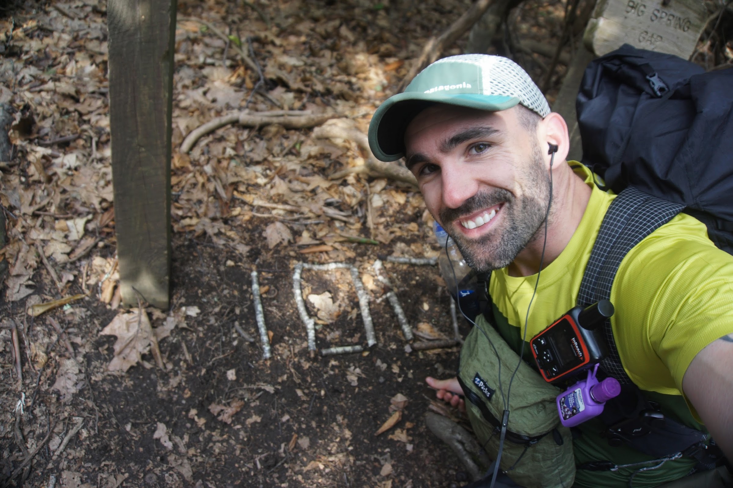
Hundo!
Just otuside of Rock Gap, I passed a couple in bright orange shirts. They turned out to be the Honeymoon Hikers, a set of trail angels off to give trail magic to passing thru-hikers. They gave me a bag of Easter candy and a nice, cold Coke that really hit the spot. They said they plan to hike the Camino de Santiago this year – a dream of mine as well!
Pressing on and not really worrying about the time, I did eventually make it to Winding Stair Gap – at 12:37. I had missed the shuttle by a mere 7 minutes. Damn! Just behind me were a couple of German hikers, and together we decided to hitch into town. Within a couple of minutes, we had a ride. Little did we know that the hostel owners in Franklin, which is a huge hiker town, prowl the common areas looking for hikers without a place to stay. They kindly offer a ride and a bed, if you need one. Because I had my reservation set up already, they asked for a “shuttle donation”, which was perfectly reasonable. The two Germans didn’t have a place to stay and I think one of them took the driver up on his offer (at the Gooder Grove Hostel).
They kindly dropped me off at the Hampton Inn, which is actually a ways outside of downtown, and it was a great relief. Check-in was a breeze, and within minutes I had hot, steamy water washing away 5 days of trail grime. I did some laundry in the tub, ate, and watched TV.
I rested up for the remainder of the evening and resupplied my pack for the next 5-day stint.
Day 6: Winding Stair Gap to Camp Site at mile 134.6 – 25.4mi
Had a fabulous night’s rest at the Hampton Inn in Franklin last night. I tried to call the Macon County’s Transportation Office, as they are the ones that run the hiker shuttle, but they were closed for Good Friday. So, it was either call the guy from the prior day and pay for an expensive shuttle, or try my luck hitchhiking. I decided on the latter.
First, though, I checked out and waked over to the Ingalls supermarket, just down the street, to pick up some spare batteries for my headlamp, a new dish scrubber, and hopefully a glove. They didn’t have any gloves, but I got the other two things.
And so, I ventured out on my very first attempt at hitchhiking. The road leading back to Winding Stair Gap is basically a 2-lane highway with a very narrowed shoulder and peo were flying by at 60mph. As soon as I went to cross over the street, I saw a Macon County bus drive by – the shuttle – and realized I just missed it. Not sure they would have stopped anyway.
I walked along the highway, sticking my thumb out to every passing cluster of cars and striking out each time. Eventually, there was an on ramp to the highway and a guy pulled over and offered a ride. His name was Nick and he had a minivan full of tools. He’s a cabinet maker / jack of all trades and was on his way to a job. I was super grateful for the ride and thanked him profusely. We shot the breeze for the 10 minute ride and he dropped me off right where I ended yesterday. The trail continued right across the road.
The trail today had some great view and was overall not too difficult. Lots of sloping climbs but no big ones. I started at 9:15am and was cruising along at a good pace most of the day. My feet felt refreshed and I was full of the delicious hotel breakfast (I had an omelet, waffle, and cereal).
I hit the “balds” today, which includes Siler Bald, Cheoah Bald, Wayah Bald, Rocky Bald, and Wesser Bald. None were particularly grueling, but together it made for a lot of elevation gain.
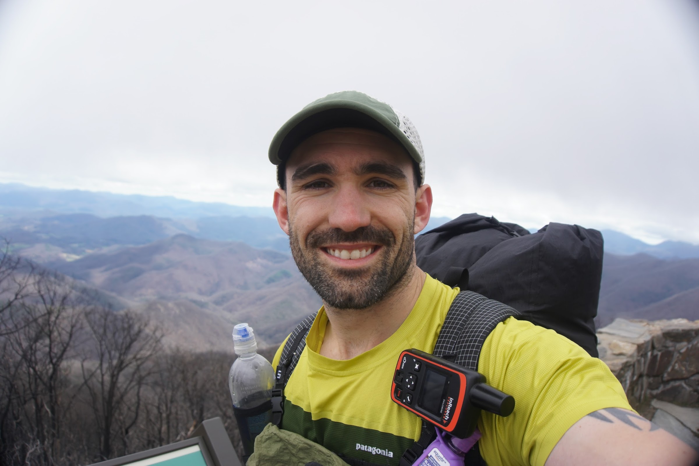
The balds.
I had planned to stop at Wesser Bald Shelter for the night, a 20mi day, but decided against it. For one, it was completely full – even the tentsites – when I reached it around 5pm. Two, I didn’t realize until yesterday that tomorrow I’m facing a HUGE climb after the Nantahala Outdoor Center that will seriously take several hours. As such, I thought it made sense to do a few extra miles today to make tomorrow easier. We’ll see how it goes.
So, I found a flat spot right off the trail about a mile before the Rufus Morgan shelter. Tomorrow I’ve got a couple miles to reach NOC and will start my big climb.
Day 7: Campsite to Cable Gap Shelter – 22.7mi
As mentioned, I did a few bonus miles yesterday to make up for what I thought might be a crazy hard day. I left camp at 7am and within about a mile I came across a good sized tent site with at least 15 set up. One guy, Too Easy, was just leaving as I was coming through so we got to talking. He said that place was a disaster – young guys drinking and howling most of the night – and he was trying to get as much distance as possible from them. Can’t blame him!
It was a frigid morning, and I was really missing that glove that I lost a few days ago. I figured I’d buy a new pair at the Nantahala Outdoor Center, which is a major stop, that was coming up in a couple miles.
We got to the NOC at about 8:15, and of course the store didn’t open until 9. I saw an employee heading in and pleaded that I just needed gloves and a bottle of water, and he said he’d get me what I need. He came back a few minutes later to say that they didn’t have gloves (which blew my mind), but he could get me the water. I paid $2.15 for a 20oz bottle (all they had, and I lost my larger 1L bottle) and was on my way. Just after leaving the store, I saw that someone had left a mitten on a nearby bench. Unfortunately it wasn’t the hand that I needed, but I took it anyway and was able to make it work. The trail provides!
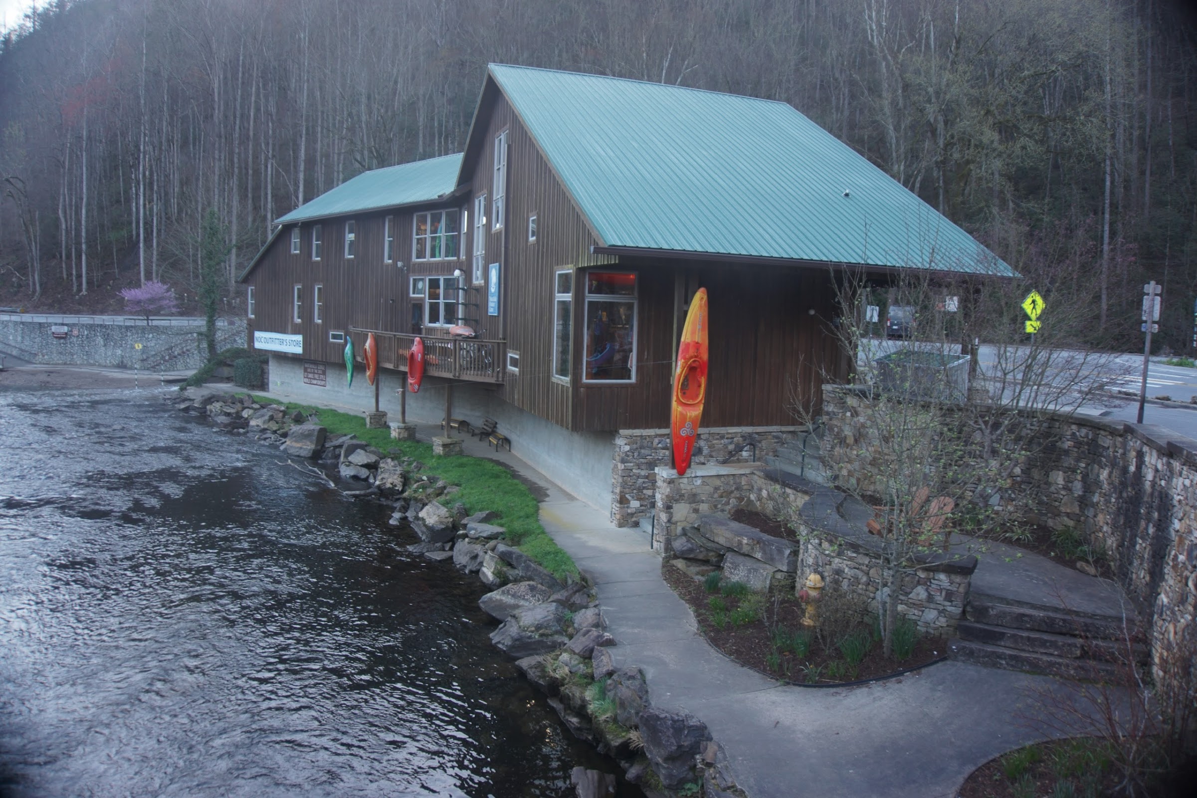
The NOC.
At about 815 I began the 6,000ft climb up Cheoah Bald, which was not as steep as I expected. It was certainly difficult and never-ending, but tolerable. It took me just under 3 hours to make it to the top, which was a bit over 7mi. Not bad!
I continued on, passing several gaps and shelters along the way. My biggest issue was water – this stretch was relatively dry and I only had the 20oz bottle from the NOC, which I polished off after the big climb. There were only a couple of sources along the way and for someone reason I kept missing them (not markedly, I passed it, etc). By the time I got to Stecoah Gap, about 14mi in, I was dry. The next source was 2.6 mi away, so after a short break there (ate a couple of apples someone left as trail magic), I was back at it.
It really warmed up in the afternoon and I was sweating pretty hard during the climb out of Stecoah, which wasn’t super long, but very steep. Somehow, I got in a groove and was able to push out the miles, but my mouth was quite dry by the time I finally refilled.
At that point, I had reached the point I was scheduled to, but it was still a bit early in the afternoon so I decided to press on and knock off a few more miles. A little while later, I passed a group of hikers and one said “FIT FOR MILES!” and gave me a fist bump. I recognized him as this guy named Chad, who follows me on Instagram and has been commenting on my photos. He’s an older guy who’s also trying to do the trail in 100 days, but his pace is a bit slower than mine at the moment. It was a bit surreal to see someone on trail that I knew from online!
After a few more miles I ended up at Cable Gap Shelter, which is full of course, but got a flat tent site which is fine. I got in at 7:15 and made dinner.
Tomorrow I’ll pass Fontana Dam and will enter the Smokies!

This website contains affiliate links, which means The Trek may receive a percentage of any product or service you purchase using the links in the articles or advertisements. The buyer pays the same price as they would otherwise, and your purchase helps to support The Trek's ongoing goal to serve you quality backpacking advice and information. Thanks for your support!
To learn more, please visit the About This Site page.