
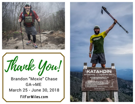
My Hike Ends with a Memorable Day on Katahdin
Welcome back for another trail update.
Day 93, 12.2 Miles: Campsite at Mile 2,064.2 to Monson
As expected, it rained throughout most of the evening but I managed to stay dry. It was just sprinkling in the morning so I managed to pack everything up without getting too wet (except for my tent, which was already soaked). Having just 12 miles to go in order to arrive at the hostel in Monson, I wasn’t too worried about the weather.
If there’s one thing about southern Maine that drives me nuts (other than the harsh trail), it’s the river crossings. For some reason they don’t believe in bridges, apparently, because I’ve had cross a handful either by fording or sketchy rock hops and I know there are a bunch more up ahead. Just in the 12 miles to Monson I had to do two. The first one had a rope running across the Piscataquis River that you could hold on to while crossing, but I was able to get over on some rocks. Kind of. My feet got a little wet but it wasn’t bad. A couple of miles later I had to cross the same river again, only this time my luck ran out on the rocks when one of my feet slipped and dunked into water up to my calf. I said screw it, and just started walking in the water. At that point I only had about 6 miles to go, so it wasn’t a huge deal – but I do really hate hiking with wet feet, as I’ve lamented before.
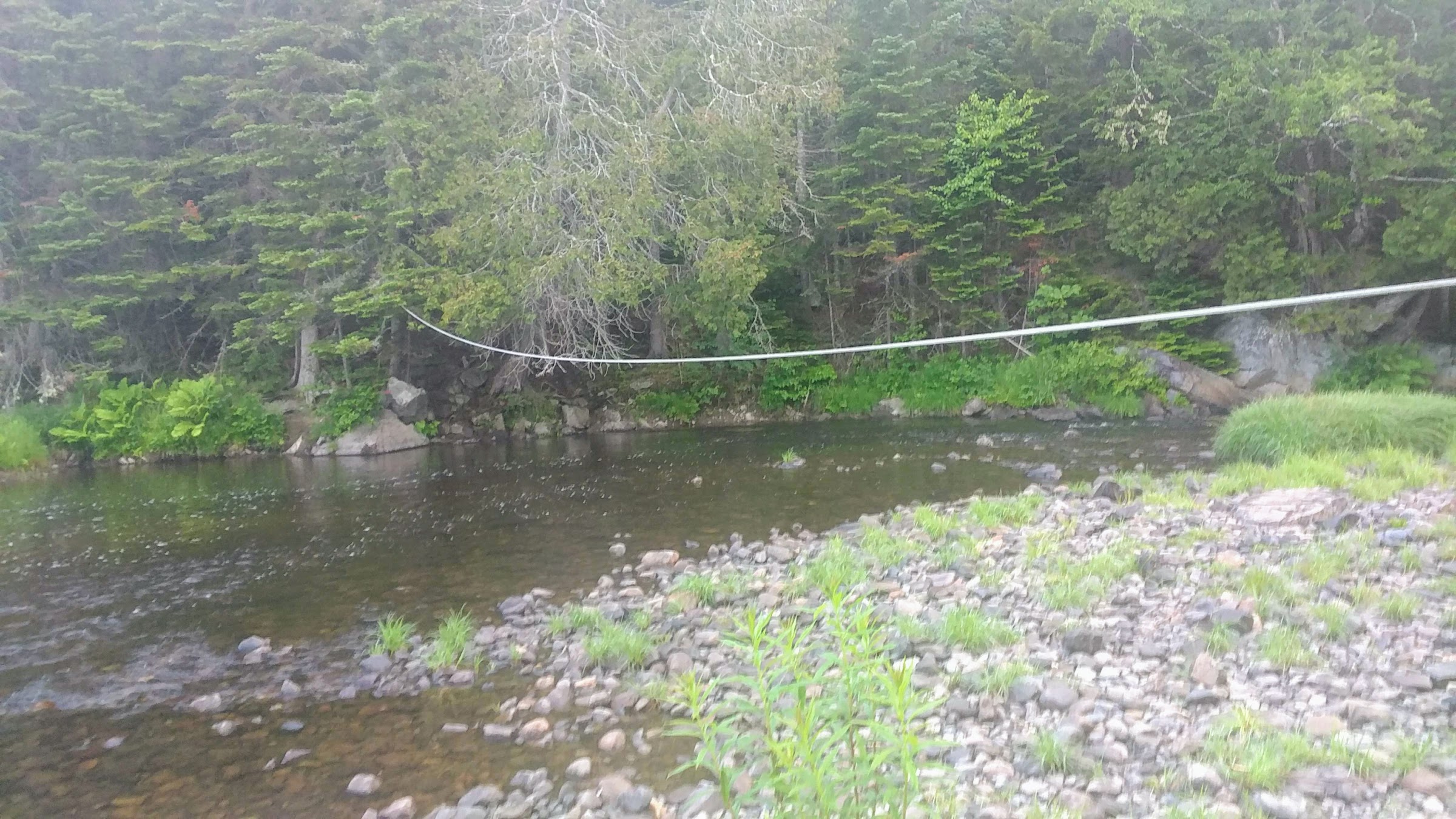
Crossing the Piscataquis like Cliffhanger.
The trail itself was similar to the last couple of days – rocky and rugged for about half, and nice and walkable for the rest. The mosquitoes were insane and fearless as they bit me right through my repellent. I arrived at the ME 15 road crossing just after 11 a.m. and, thankfully, had a single bar of cell service to call the hostel for a ride. Within ten minutes, I was on my way to Shaw’s.
Shaw’s Hiker Hostel is the last place for NOBOs and the first place for SOBOs to stay on the trail. They can sleep upward of 30 hikers and have an awesome gear shop and resupply. There isn’t much else in Monson, so this is the place to be. After arriving, I immediately got to doing my chores like laundry, resupply, and charging electronics. Then I walked to town with Trout and we ate lunch at the Lakeside Restaurant, which was “meh.”
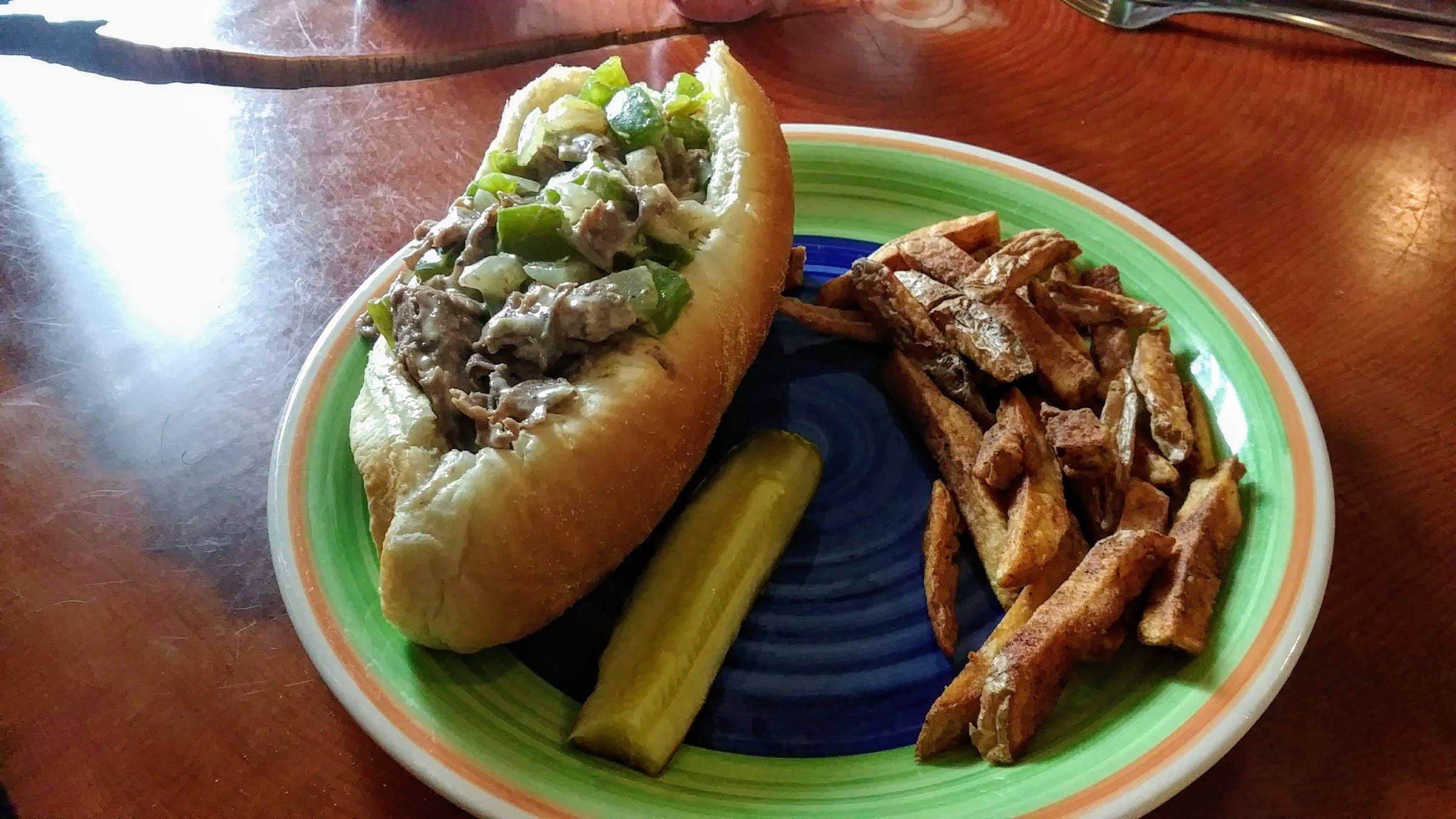
Mediocre sub with not nearly enough fries to satisfy my hunger.
Before heading back to the hostel we stopped at the general store for some junk food and snacks to hold us over until the next day. I went for one of my favorites: a whoopie pie.
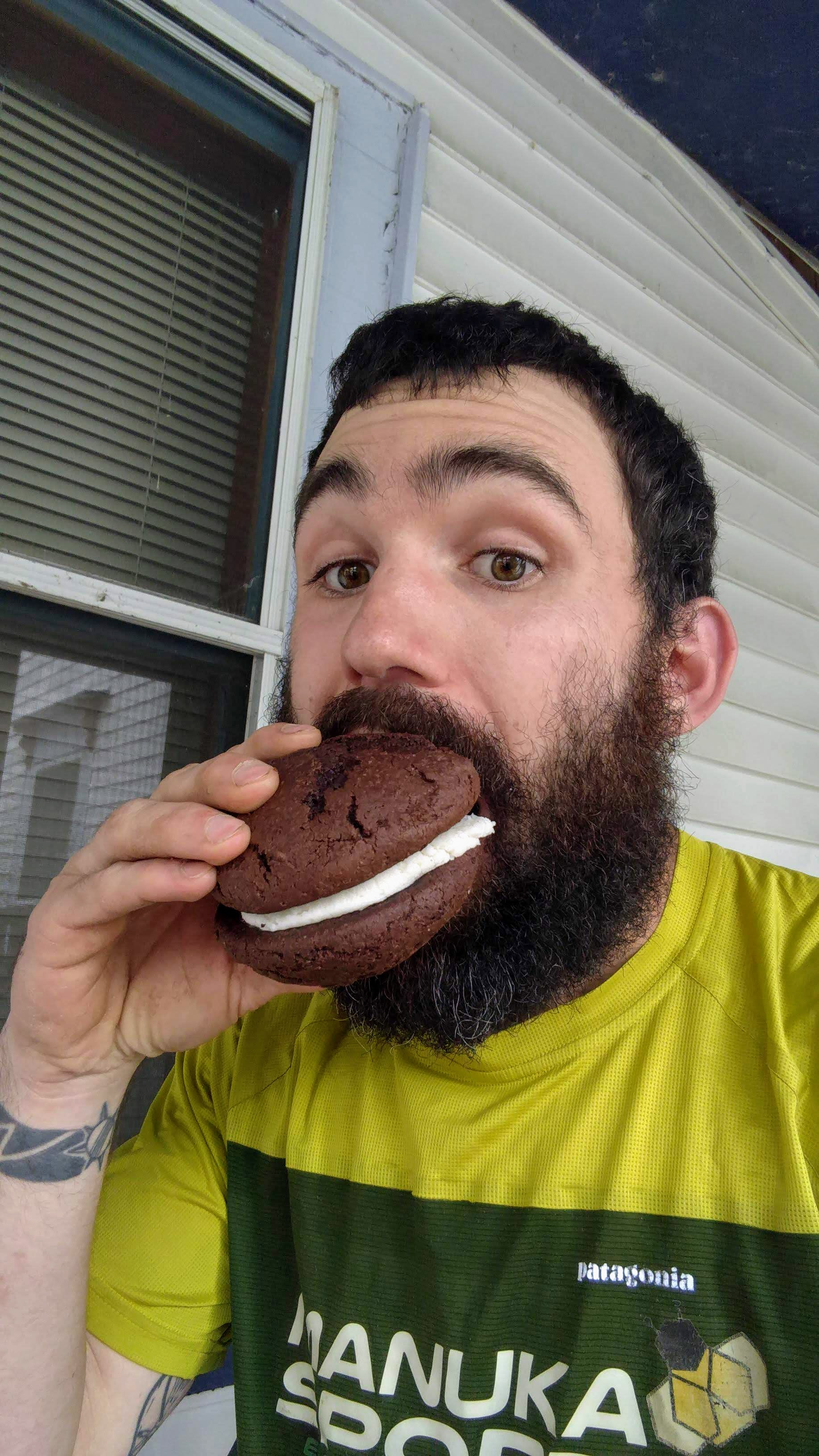
Nomnomnom.
For the rest of the day I hung out, dried my wet tent, and savored the internet that I won’t have again until I finish. I coordinated with my brother, who is flying in from California to hike Katahdin with me and one of our friends, so getting the logistics of that taken care of was key.
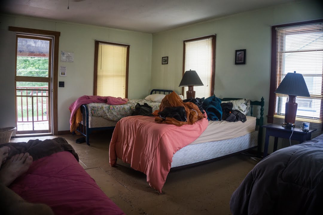
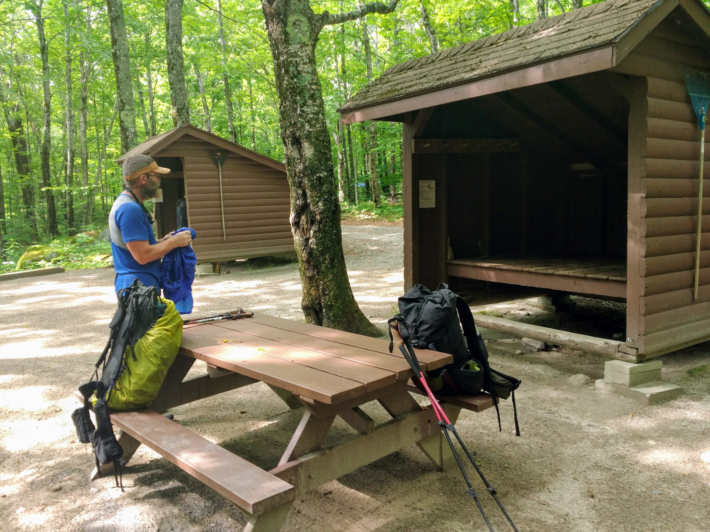
One of the bunkrooms at Shaw’s. This was the only photo I took of the place, for some reason.
I’m actually a day ahead of schedule, so I have five days to make it through the next 110 miles. As such, I’m going to take it easy and do mid-20s and enjoy the trail whenever and wherever I can for a change. Tomorrow I’ll hang out here for breakfast and then see how many miles I can get in before dark. It might still be raining so I’ll have to be prepared for that. Either way, I’m ready to hit the final leg of this trip.
Day 94, 20.6 miles: Monson to Campsite at Mile 2,097
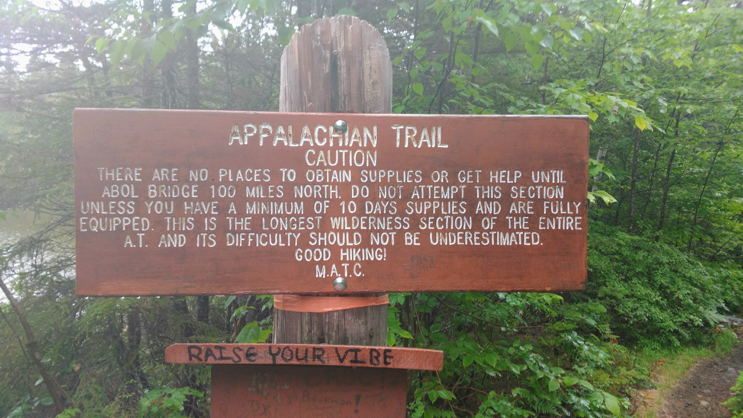
My stay at Shaw’s in Monson was awesome. This morning they served up eggs, bacon, home fries, and unlimited pancakes, which I totally crushed. I then packed up and jumped in his car for a ride back to the trail with a few other hikers. Poet, the owner, gave us good information and advice about the upcoming section on the way to the trailhead, and even recited one of his haikus about it. I can’t remember exactly how it went, but it alluded to “the last sip is the best” in that we were entering the final stage of the trail and it’s the best part. We gave our thanks and headed off into the 100-Mile Wilderness.
Home stretch!
The first few miles of the trail were relatively easy. Plenty of rocks and roots, but not terrible. Within ten miles there were three river crossings that had the potential to get me very wet. Thankfully, either the water flow was low or there were logs across the deep sections that prevented me from having to ford them. That’s getting very annoying.
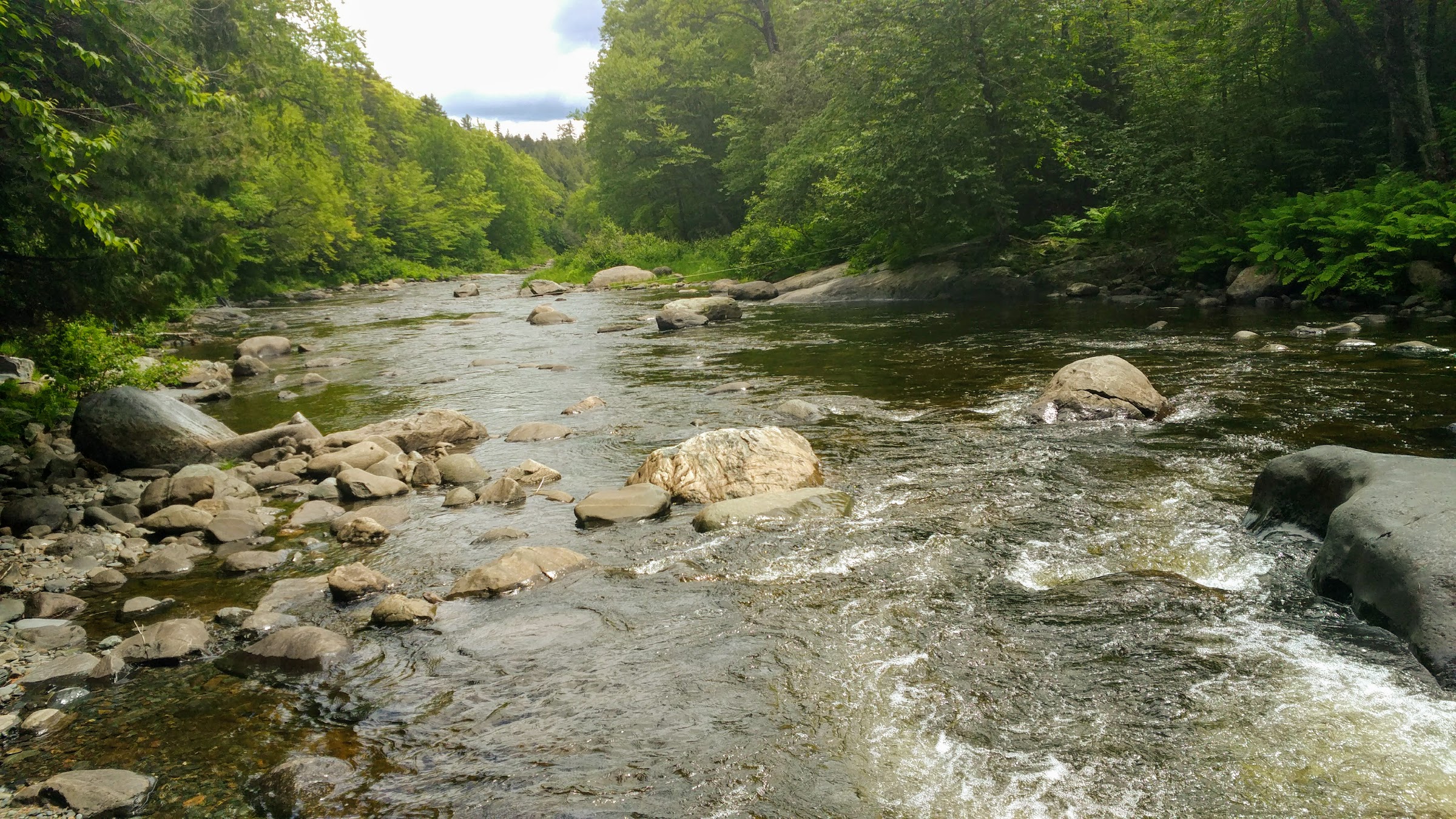
Yet another river crossing.
As the day went on, the terrain got harder and I just couldn’t get into a flow. At about 3 p.m. it started raining quite hard but let up after about two hours – just long enough to soak everything in its path (including my feet, grrr!). By 6 p.m., the rain had stopped completely and I was able to hike without my poncho again. However, the rain turned the trail into a wet and sloppy mess. I spent the rest of the day dodging puddles and slipping on rocks. It was tedious and frustrating.
I was hoping to get about 25 miles in today but I called it early. I don’t know where the time went, but all of a sudden it was 6:30 p.m. and I’d done less than 20 miles. I guess all the river crossings and rain really slowed me down. So instead of pushing it until 9 p.m. or later, I set up camp near a couple others at 7:45 and called it a day. Doing fewer miles doesn’t affect my plans for getting to Katahdin on time; it just means I’ll have a couple extra miles to do on that last day (which is easier, anyway).
Tomorrow I’ve got several mountains to summit with a good amount of climbing. I’m hoping to get a nice full day in and knock these things out. Hopefully the terrain and the weather cooperate.
Day 95, 25.7 Miles: Campsite at Mile 2,097 to Campsite at Mile 2,122.6
I woke up this morning at my normal time and was able to get on the trail by 5:45. I knew I had a long day ahead of me so I wanted an early start. As expected the terrain was just as tedious and rugged as it has been for most of the day with a break here and there. The weather was sunny and warm, which helped dry the rocks a bit and make things less slippery, although I still ended up on my ass a handful of times.
The trail trended downward slowly until it reached Pleasant River. My luck ended in terms of dry crossings so I had to take off the shoes and socks for this one. I knotted the laces together, stuffed my socks inside, and slung them around my neck to make the crossing. The water wasn’t too cold or too high, but the rocks were covered in moss and very slippery. Also, if I thought my feet hurt when walking in shoes, it was twice as bad when going across these things barefoot. I gritted my teeth and took it slowly, eventually reaching the other side where a kind soul had left a towel for us to dry off with.
I’ve been hiking with and around a small bubble of NOBOs who are all planning to summit on Saturday, including Trout, Jawbone, and Scooter. We’re all doing similar miles and slow playing it to Baxter since there’s time – although you wouldn’t think so given how slow we’ve been going over this terrain.
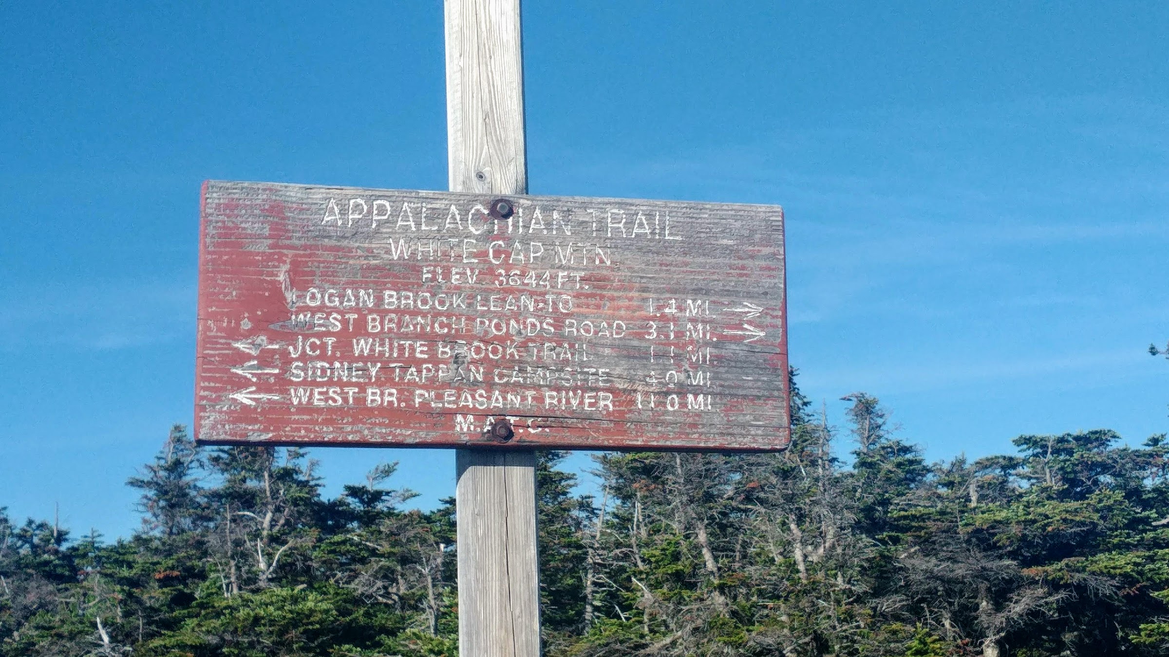
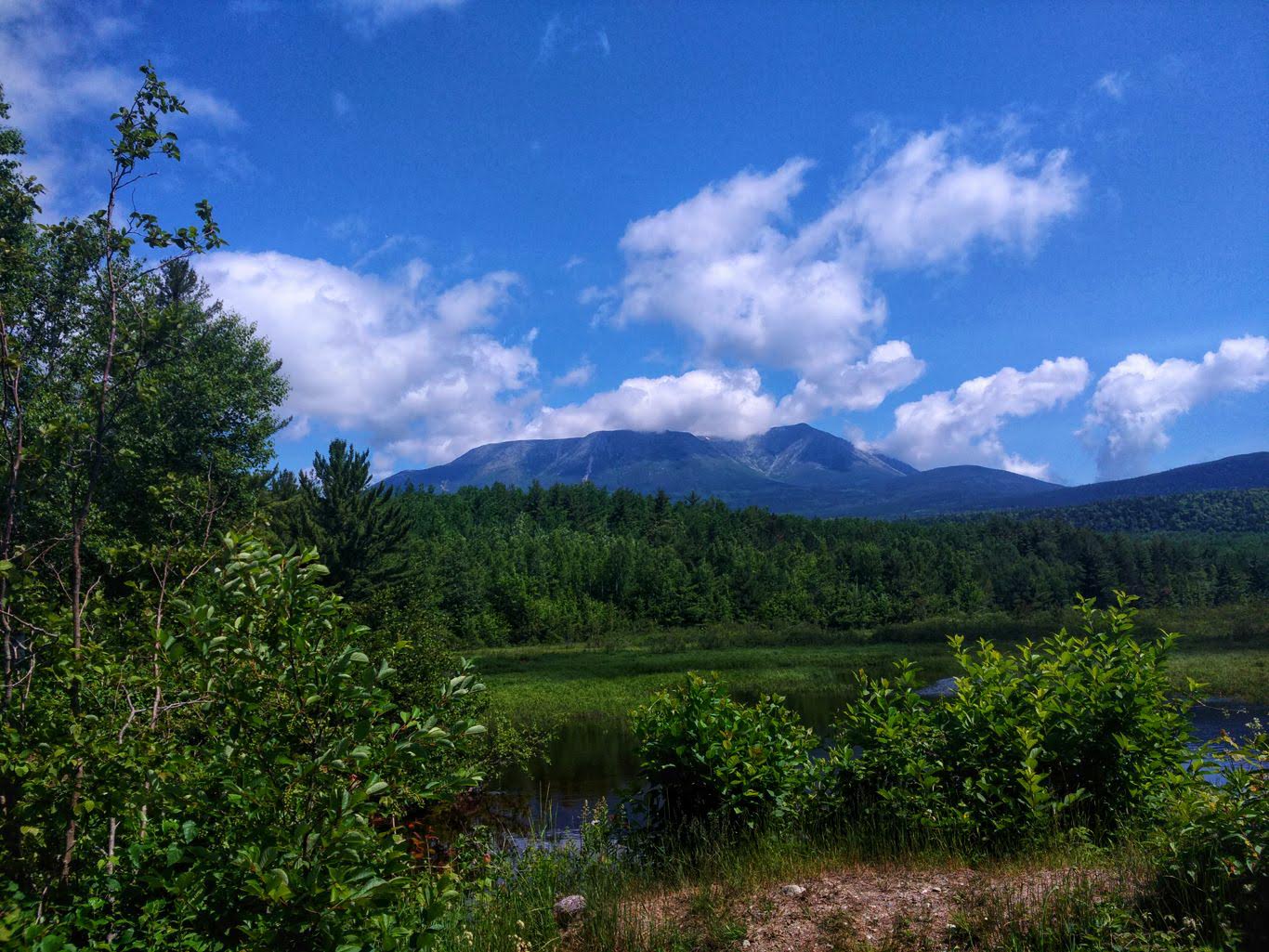
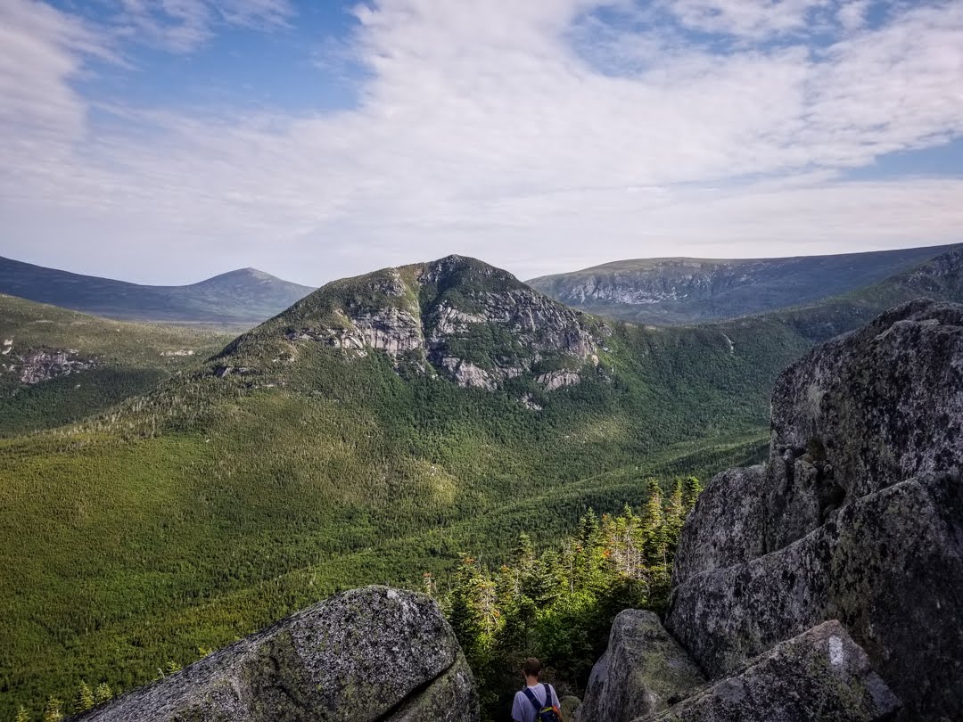
In the afternoon we came to the base of our big climbs for the day – a series of mountains that included Gulf Hagas, West Peak, Hay, and White Cap. These are, quite literally, the last mountains we’ll climb until Katahdin so I was anxious to get them over with. The trail up began as a rather tough path, but slowly it let up and became walkable. It was very refreshing. The climbs were sizable, but manageable and protracted so it really wasn’t too bad. The peaks were nothing special with the exception of White Cap, which had a wonderful 360-degree view, including our first glimpse of Katahdin. It was awesome.
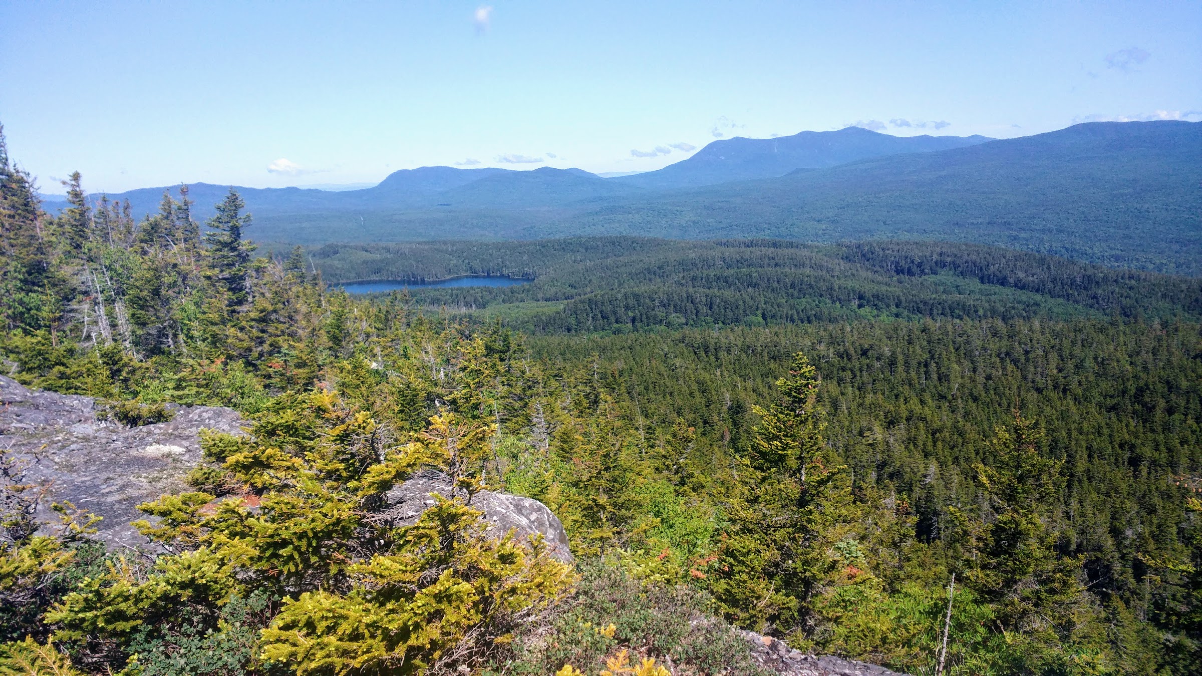
View from White Cap.
Top of the last big climb.
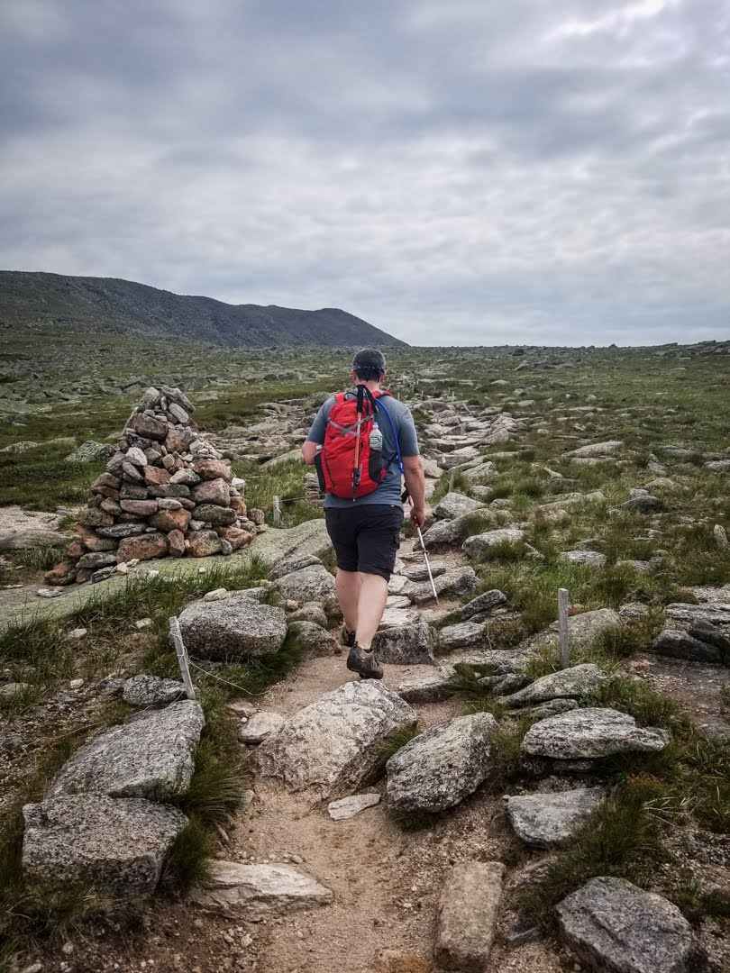
Coming down White Cap was rocky for a bit and then turned into a nice path. I passed the first shelter and planned to camp between that and the next one after passing a water source, but the spring was dry and I was forced to push on another mile and a half since I was completely out. I was getting absolutely eaten alive by mosquitoes, so I put my head net on and that helped a little. I eventually found a reasonable flat spot just off the side of the trail to set up camp for the night. I was very surprised to have gotten in 28 miles today given the terrain, but I was able to pick up the pace later on the day, which helped immensely. Hopefully this nice terrain is the new norm from here on out. Sixty-three miles to the base of Katahdin.
Day 96, 24.3 Miles: Campsite at Mile 1,122.6 to Nahmakanta Stream Lean-to
I slept very well last night and had no desire to get up when my alarm went off. I took my time getting ready and hit the trail just after 6.
The terrain today was some of the best I’ve had on the entire trail. Rocky and rooty here and there, but the majority was nice, wide, and soft. There was one insignificant climb to the top of Little Boardman Mountain, which was super easy. Otherwise there was one small hill to go over and the rest was flat. It was a great relief.
What’s more, there were no river crossings to do. Of course, I went over probably 20 streams and brooks, but all were easy with no fear of wet feet. I also passed by a number of quiet, serene, and beautiful ponds that I could have easily spent all day at. The weather was fantastic and there wasn’t a cloud in the sky.
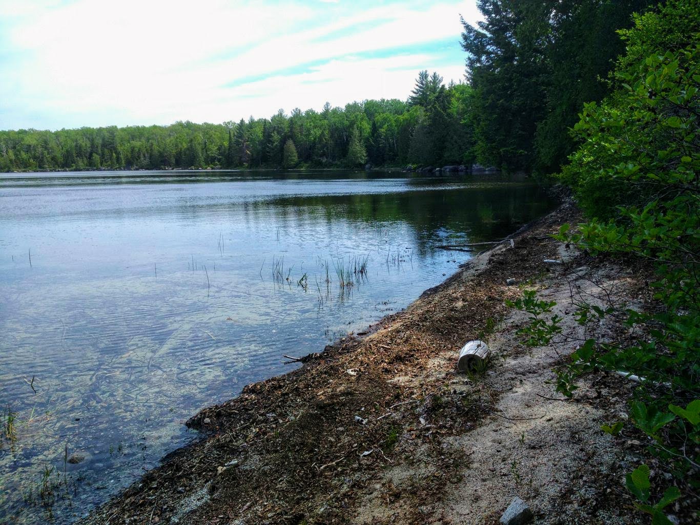
One of many ponds I passed with tiny beaches.
The only annoying part of the day, really, was the bugs. I literally had a swarm around me the entire day and couldn’t stop without being covered in mosquitoes. I wore my head net almost all day and reapplied my bug spray several times, but they just kept coming. It doesn’t get much more deep woods than this, so the bugs are to be expected, I suppose.
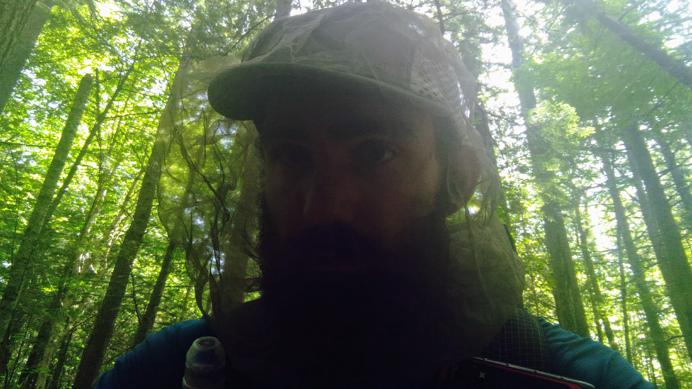
The bug net only does so much. I’m over it.
Tomorrow, though, is what I’m really dreading. It appears that instead of the sunny and warm weather we’ve been having for all of two days, we’re about to be hammered with a huge rainstorm. It’s expected to start around 4 a.m. and not stop until late in the evening while dumping up to three inches of water. It’s going to be absolutely miserable. I guess I’m dreading it so much because I’m close to the end and have had enough of temperamental weather. I just wish it could have strung together a five-day stint of nice days instead of pouring every three like it has been. As I’ve said before, I really hate hiking all day with wet feet but that’s exactly what I’ll be doing all. Damn. Day. Ugh.
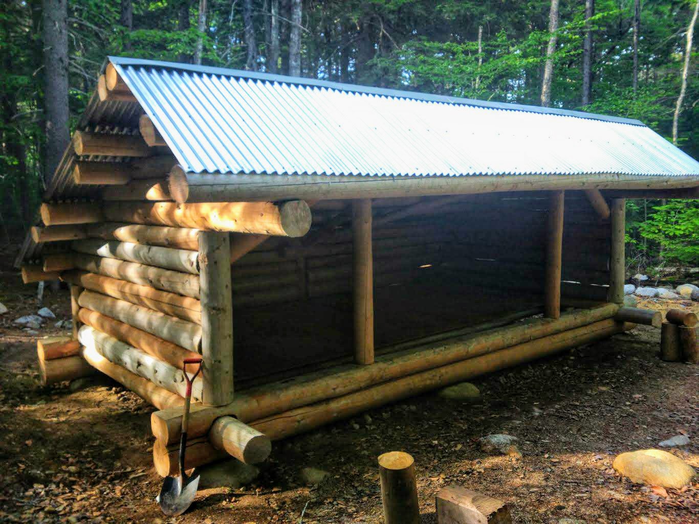
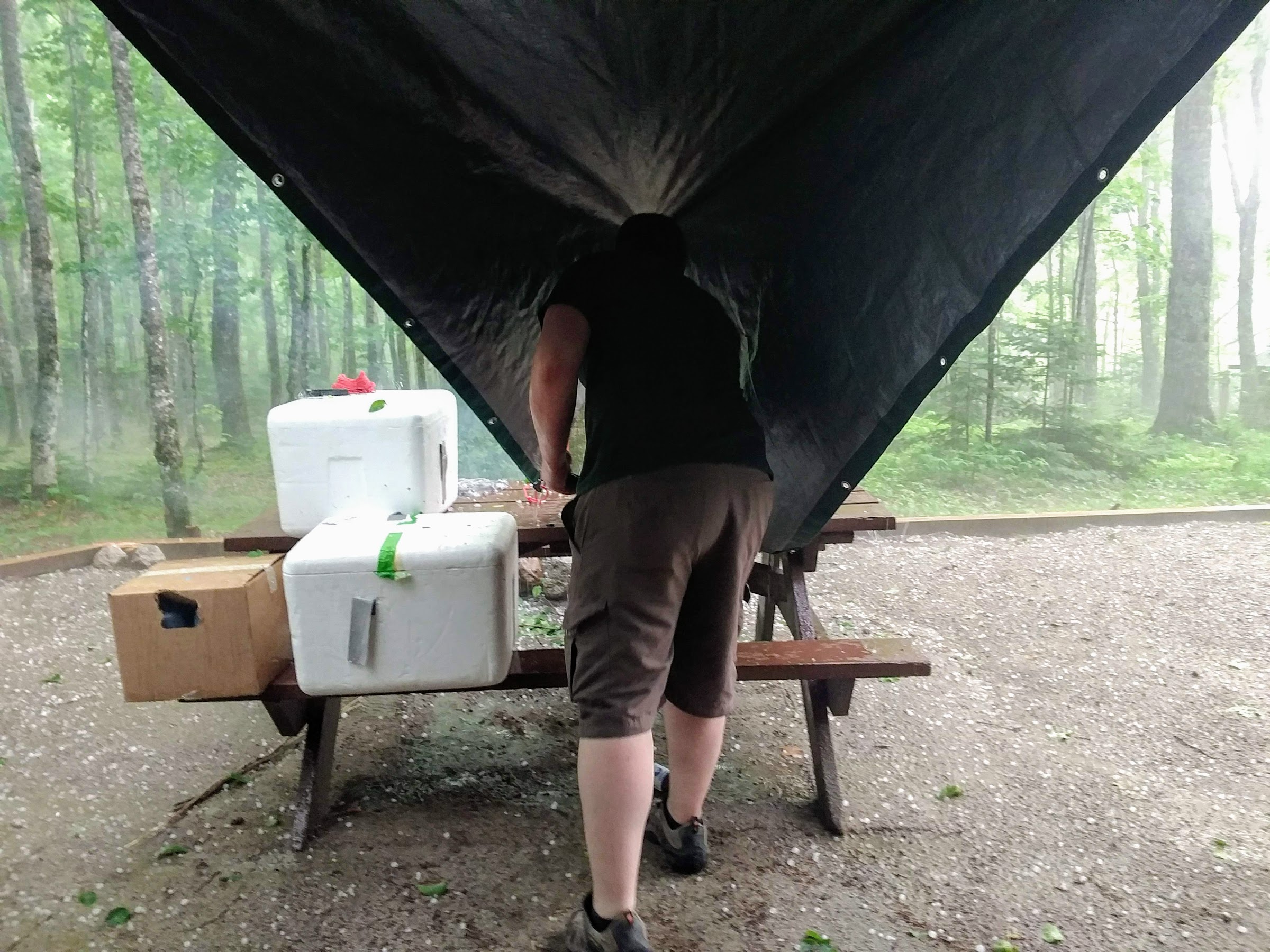
Newest shelter on the AT – just finished last month.
The only saving grace is that the weather is supposed to clear up and be perfect on both Friday and Saturday, meaning that when we’re going up Katahdin it should be clear. I’ll take a day of rain tomorrow in exchange for that, I suppose, but I don’t have to like it. I’m not sure how far I’ll make it tomorrow. I chose the shelter I’m at tonight so that I’d have a dry place to sleep, but tomorrow is a bit of a toss up. My goal is to get 25 miles in and stay at the last shelter of the 100-Mile Wilderness, which would give me another dry place to sleep as well as set me up for a short day to Katahdin on Friday. The only other shelter left is just 14 miles from here and would make for a much longer day on Friday, so I’m not keen on that. We’ll see how it goes and what I can get done with the weather.
Day 97, 25.4 Miles: Nahmakanta Stream Lean-to to Hurd Brook Lean-to
As expected, I woke at about 3:30 a.m. to the sound of rain pinging off the roof of the lean-to. Right on time. I went back to sleep for a while but kept waking up and dreading the conditions I was going to face all day. Eventually, though, I did pack up (after spilling my oatmeal on the shelter floor and having to clean it up) and both Trout and I stepped out into the precipitation at about 6:15.
At first it wasn’t so bad – the trees took the brunt of the water and we just got the aftereffects. However, that soon changed and before we knew it we were getting pummeled with drops. It didn’t take long for my shoes to fill and my poncho to wet out, but I knew that would happen fast. Trout and I hiked together for a couple of hours, just shooting the shit to pass the time in the miserable weather. We eventually separated when going up a series of climbs, and I didn’t see him for the rest of the day.
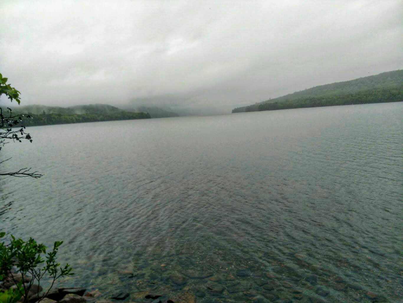
Rainy day on the ponds.
The trail itself was all over the place quality-wise. Sometimes it was full of snarled and slippery roots, other times it was clear and soft. Mostly the former, of course. I passed by more quaint ponds and skipped viewpoints that were completely obfuscated by the fog. Surprisingly, I made decent time and stopped at the Rainbow Stream Lean-to for a break and some food. There, I met a couple more NOBOs who I hadn’t seen before who are also planning to summit Katahdin on Saturday – sounds like it will be a busy day on the mountain.
I was back on the trail by 1:45 with 11.5 miles left to reach my destination. I was totally soaked through, but warm and not hungry, so it was just dealing with the water that made things tough. Per usual, the rain had turned the trail into a soupy disaster that was frustrating to navigate. By then I was just walking through puddles with little regard – can’t get any more wet so why bother trying tiptoe around?
I kept my mind off the situation as best I could by listening to audiobooks to shift my focus. It helped immensely. As the afternoon went on, the rain never eased up. It was always between a hard drizzle and an outright downpour, but it never ceased completely. My hands were as pruned as could be and I’m sure my feet looked even worse.
I finally arrived at the shelter at around 6:45 p.m. Of course, it was totally full of SOBOs as this is the first shelter for them on the trail (and the last in the 100-Mile Wilderness for NOBOs). Two of them had set up their tents inside the shelter, which is heavily frowned upon, and others were milling around. They were full of energy and still very excited about their hike, seeing as they were only on their second day. I chatted with them for a few minutes before going to set up my tent and eat dinner. Crazy to think that this is the last night I’ll be spending in it. It’s still raining but is supposed to stop by the morning. Unfortunately, my stuff will still be wet, so I’ll be walking in wet shoes yet again.
Tomorrow I have just 13.5 miles to hike to get to the Katahdin Stream campground, where I’ll meet Colby and Luke. I plan to sleep in a little bit and then stop by the Abol Bridge Restaurant, where they have an all-you-can-eat breakfast for $10. Then I’ll take my time hiking and enjoy the afternoon.
Day 98, 13.5 Miles: Hurd Brook Lean-to to Abol Campground
The rain continued throughout most of the night, but by the time I woke up it had stopped. Everything was still wet, of course, but at least I wouldn’t have to walk all day in it again. I packed up a little late and was hiking by 6:45.
The trail to Abol Bridge was only 3.5 miles long and was just like the rest – rocky and rooty. No breaks! I took my time and ended up at the restaurant at about 8:15 after having officially left the 100-Mile Wilderness. There, I met up with Trout and several other hikers who were all taking advantage of the AYCE breakfast. I did the same, and although the offerings weren’t very impressive (overcooked pancakes, weird egg medallions, and sausage), it did the trick. Trout and I hung out for a while before the guy running the operation made it clear that he wanted us gone (they stop serving at 9 a.m. and we had overstayed. Oops).
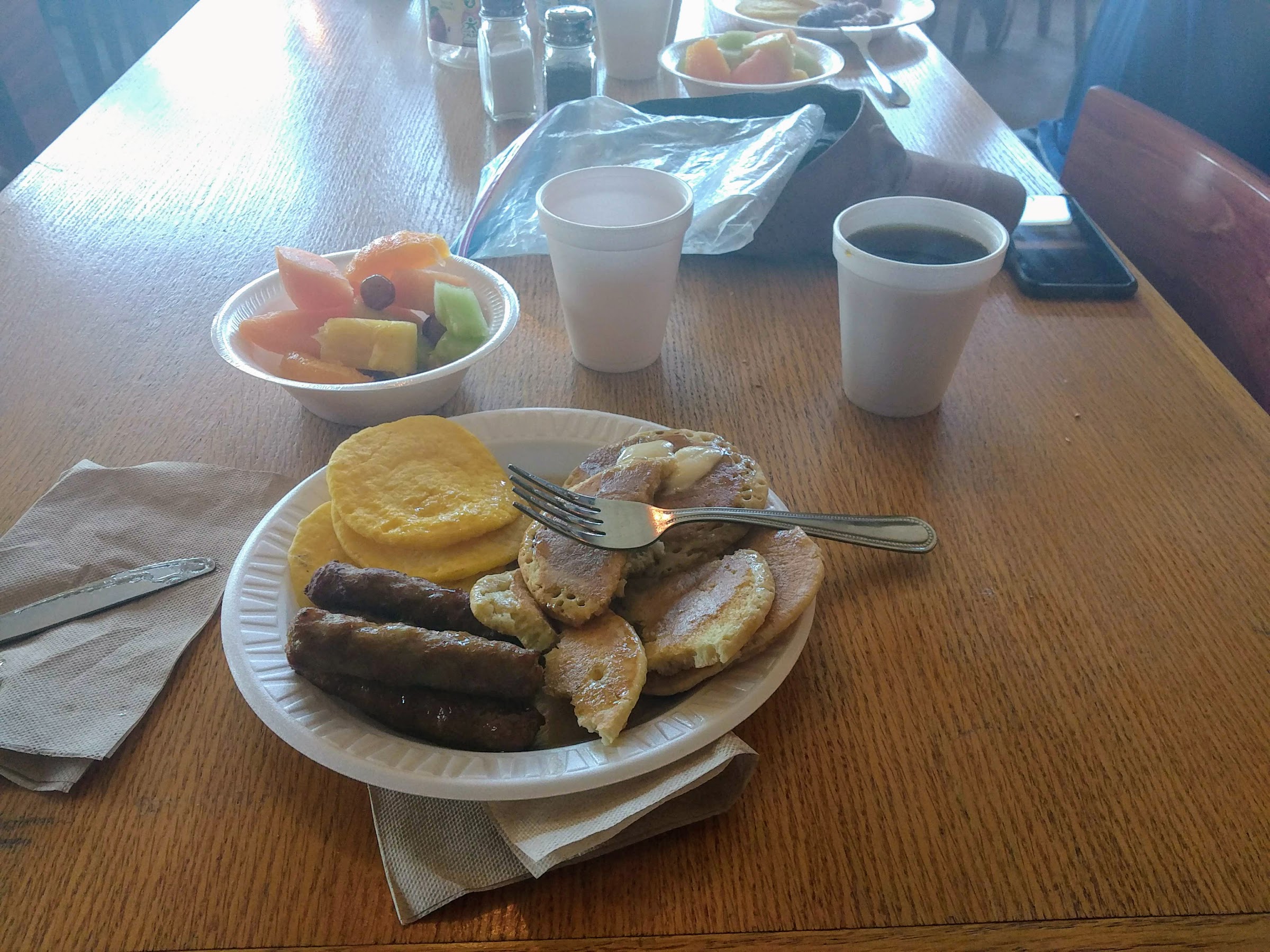
Getting my $10 worth.
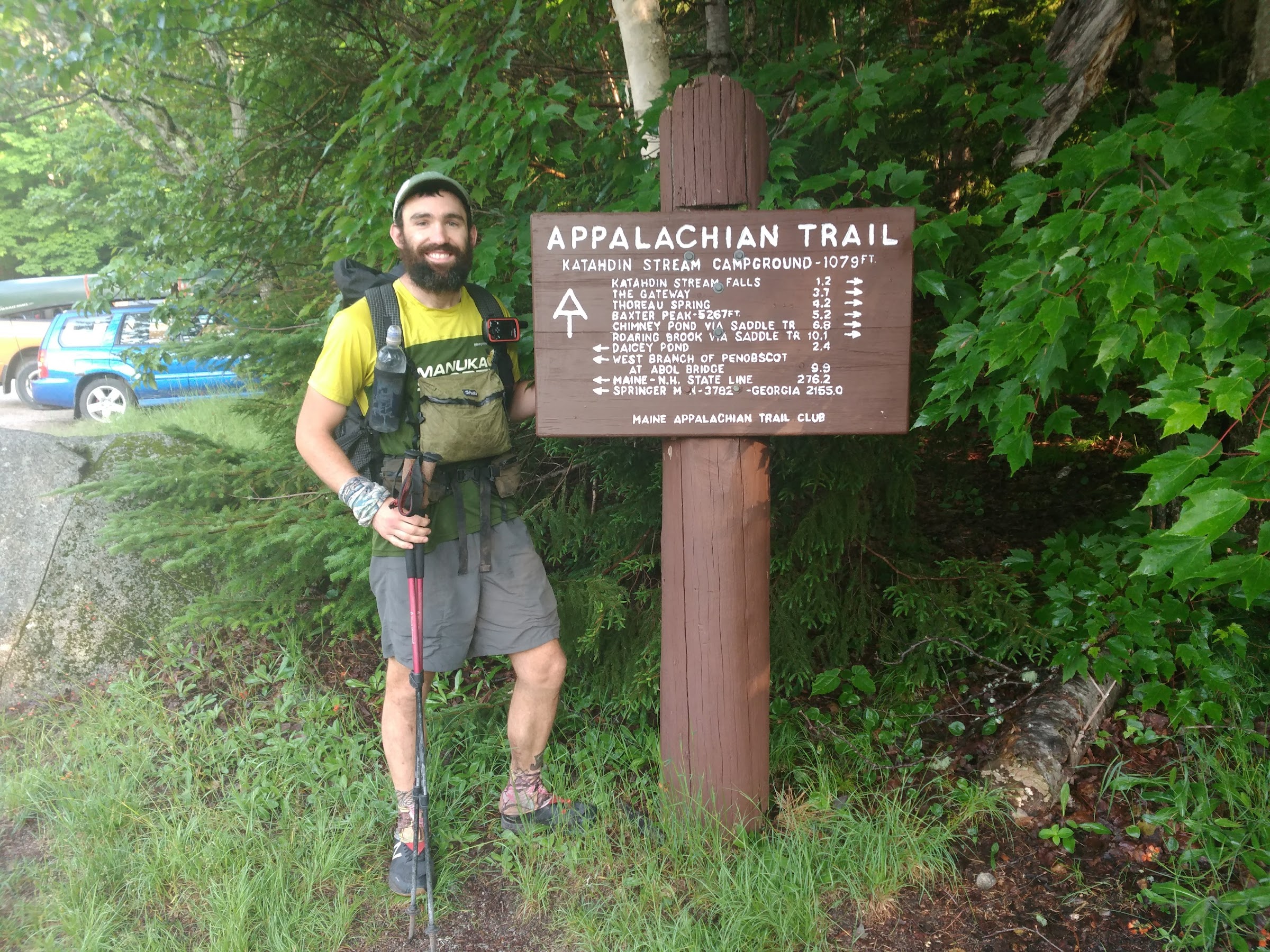
We started the last bit of the hike from there to Katahdin Stream Campground, which was about ten miles. Some of this section was flat and very easy, while most of it was the same as before. Again, I took my time and wasn’t in much of a rush.
Finally here!
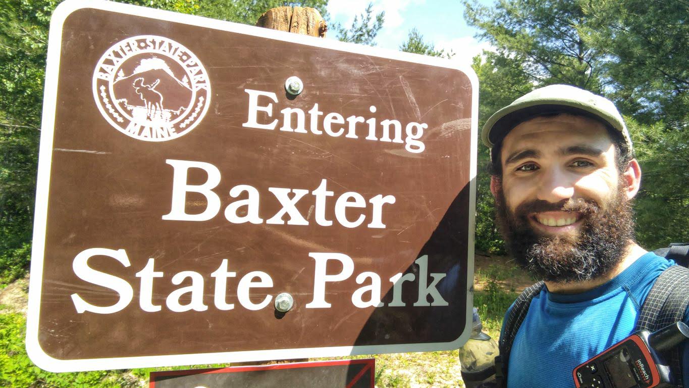
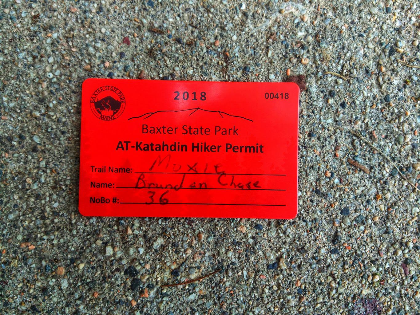
I was at the campground by 2:30 p.m., where I checked in at the ranger station (as all thru-hikers are required to do) and found out that I’m the 36th NOBO to head up Katahdin this year.
I scanned through the log book and noticed that my buddy Logs, whom I hiked the majority of New England with but lost in the Whites, summited four days ago. What a beast! I recognized a couple of other names, but most I didn’t know. What I do know is that there are about 15 of us all heading up tomorrow, so it may be a bit crowded at the top.
After registering, I waited for Trout to show up and then the rangers were nice enough to give us a lift to Abol campground a couple of miles away. Colby and Luke booked a site for us there and Trout is tagging along. We got to the site and set up a clothesline to hang dry all of our wet stuff from yesterday.
Trout getting set up.
The forecast for tomorrow looks good. There’s a chance of thunderstorms in the afternoon, but hopefully we’ll get an early start and will be down below the treeline before any of that happens. Colby wants to do the Knife Edge on the way down, which would be cool if the weather holds.
Day 99, 11 Miles: Abol Campground to Baxter Peak to Roaring Brook Campground
What a day!
Colby and Luke arrived to Abol at around 5 p.m. and we spent the evening drinking beer, roasting hot dogs on the fire, and shooting the shit like old times. Trout and I slept in the lean-to and Luke and Colby set up a tent and stayed in that (even though you’re not supposed to set up tents there). At one point we had a short hailstorm rip through and it was dropping pieces of ice that were the size of a quarter – I’ve never seen anything like it. We settled into bed at about 9:30 p.m. and then were up at 5 packing things up.
We loaded into Luke’s truck and drove over to Katahdin Stream Campground to start hiking the Hunt Trail at about 6:30 a.m.
One last climb.
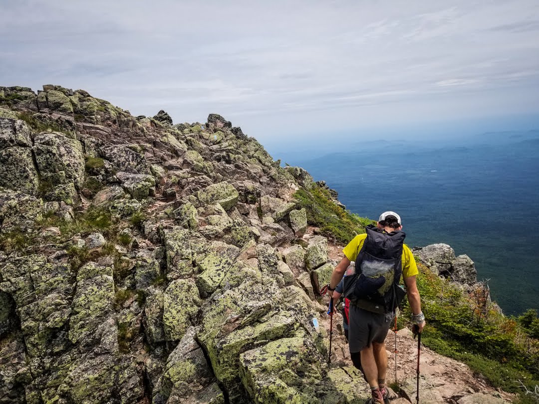
As expected, there were lots of other hikers on the trail, all heading for the peak. The first mile and a half of the trail was nice and easy, which was a great warm-up. Before long, the big scrambles started in and it was really slow going. Luke and Colby thought that they might slow down Trout and me, but that wasn’t the case at all – we could barely keep up. As we ascended, I saw three other thru-hikers making their way down having already reached the peak. We congratulated them and were then even more motivated to get to the top.
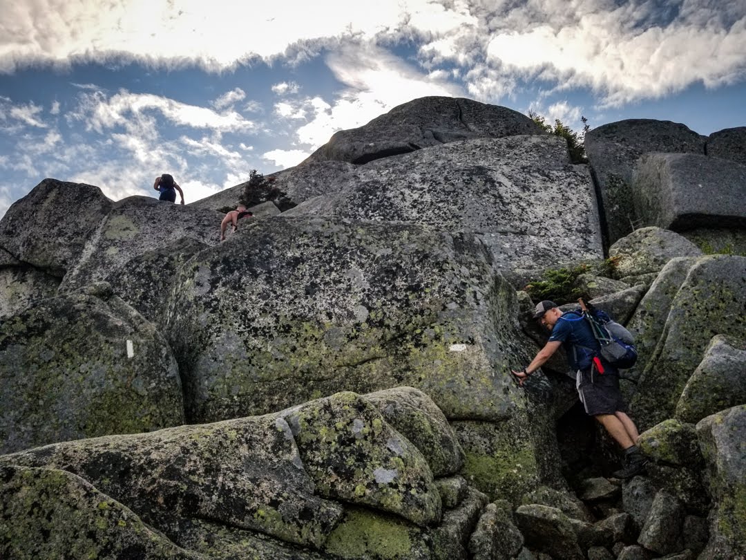
Slow progress over the boulders.
The trail was quite precarious in some spots, requiring careful foot placement and use of all four appendages. It was certainly the most difficult climb of the trail and not something I would want to do as part of a longer day. We took lots of breaks and soaked in the incredible views that we had along the way, which were plentiful. The weather was a little hazy and slightly overcast, but visibility was still quite good. The temperature was in the high 60s and was perfect for hiking. We couldn’t have asked for anything better.
Increasingly better views the higher we climbed.
With about a mile and a half to go, we reached the alpine zone and it was an easier walk from there. The big climbs were over and we could see the summit in the distance.
Luke leading the way above treeline.
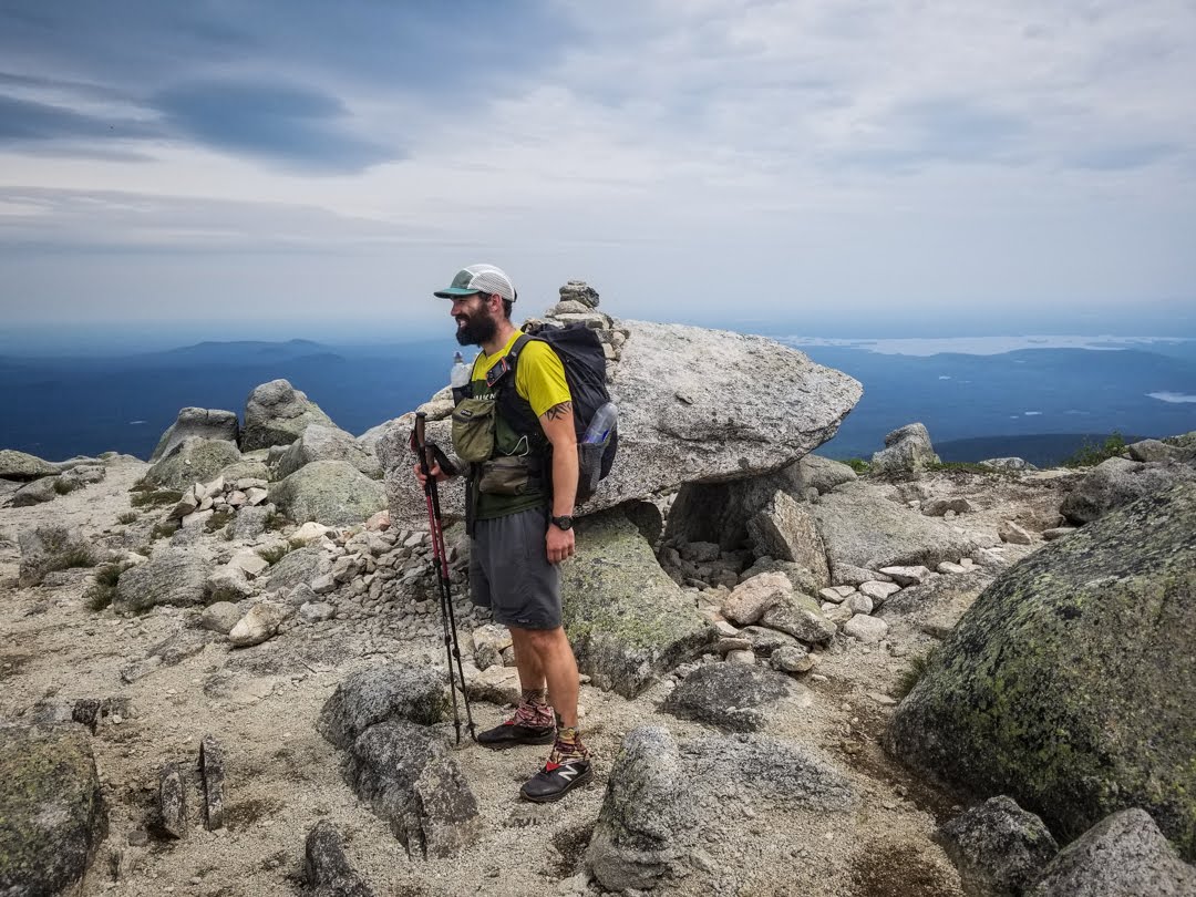
As we got closer, we could see that there were at least 30 people milling around and taking photos. Before long, I could clearly see the summit sign and I felt a wave of relief and accomplishment wash over me. Colby got ahead of me and was going to film my final approach, but right as I got within 20 feet of the sign I was interrupted by a couple of girls who were looking for another thru-hiker. I think they were trying to surprise him at the top but had made it there too late, as I said I had seen him about an hour ago going down the trail. That kind of snapped me out of the moment, but I continued toward the sign and, when, I arrived, wrapped my arms around it. I had made it to the end. Colby still got a decent video of both Trout and me.
We spent a good amount of time at the summit taking photos, eating snacks, and basking in the glory. There was hardly any wind so it was very comfortable to be there. I didn’t want to leave.
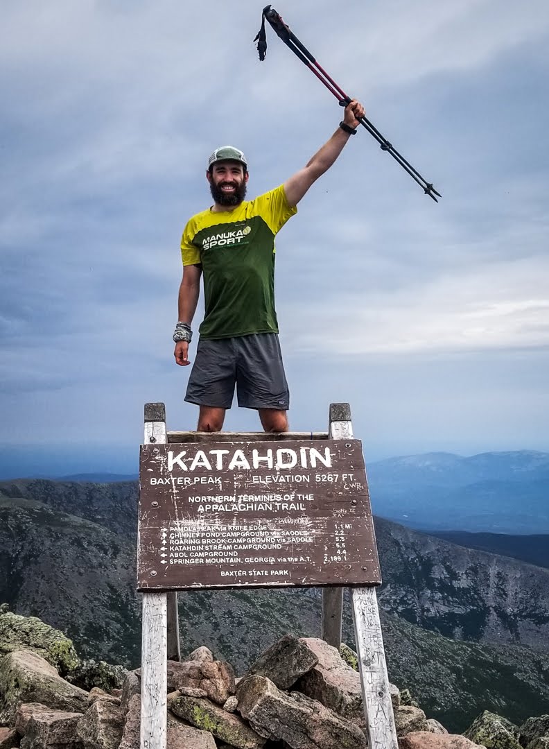
Done!
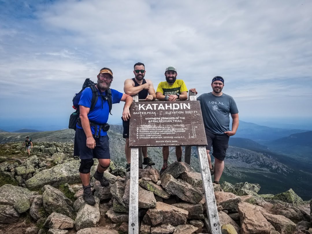
Left to right: Trout, Colby, me, Luke. Couldn’t have asked for a better crew to finish with.
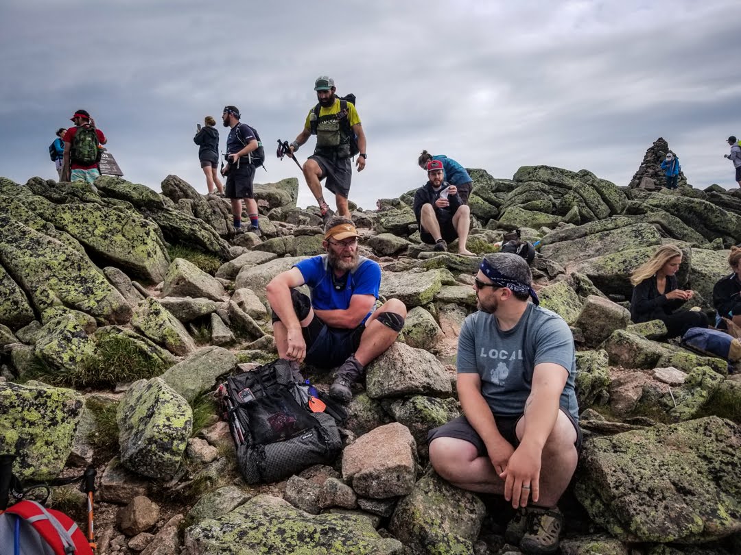
Hanging out at the summit.
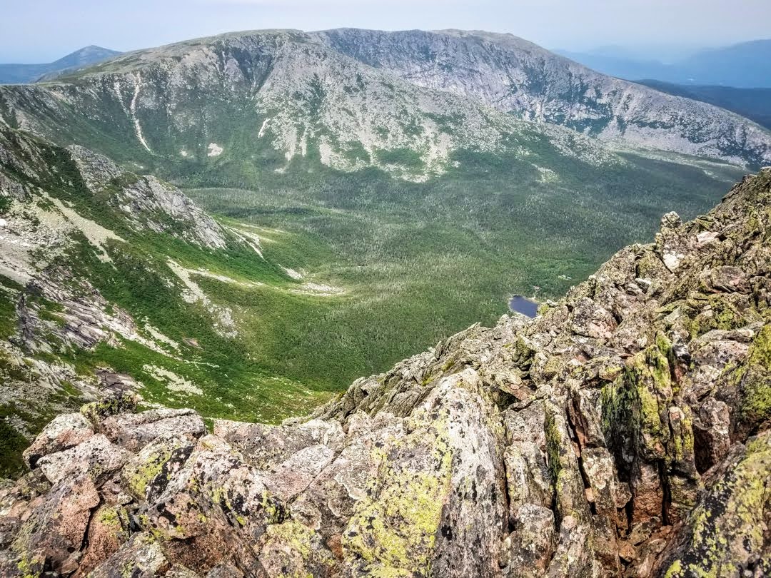
The Bowl, as seen from Baxter Peak.
After maybe 45 minutes we decided to continue on back down the trail via the Knife Edge to the Helon Taylor Trail. The Knife Edge is a 1.1 mile section of trail that, in some parts, is only 24 inches wide. It’s all rocks, which makes it extremely tough and slow to go over, but provides incredible views of the valley and a great challenge. We were all a bit fatigued, but we went for it anyway.
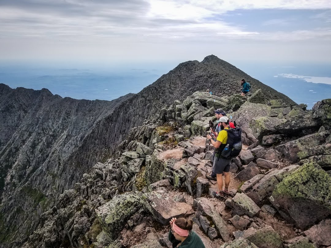
Starting our descent down the Knife Edge.
Don’t look down.
It took us about two hours to complete the section, but nobody got injured so that’s all that matters. It was indeed tough and very slow, but I’m glad I did it. Once we reached Pamola Peak (the end of the Knife Edge), we were on the Helon Taylor Trail and it was a bit easier.
Done with the Knife Edge, and ready to be off the mountain.
The descent, overall, took quite a bit longer than the ascent but wasn’t quite as technical. We really took our time and enjoyed the scenery, which is what it’s all about anyway. Toward the end, though, we were all ready to be done with it. We eventually made it down to Roaring Brook, which marked the end of the trail – finally.
Since Luke had left his truck at Katahdin Stream, he went to hitch a ride with someone back there to retrieve it. He got a ride quickly but we were quite far away, so it took him over an hour to get there and return. We finished at about 4 p.m. and were then on the road at about 5:30. We had considered staying another night in Millinocket outside the park (everything inside was booked) but decided not to – I was eager to get home and spend the night in a familiar place. We stopped by McDonald’s for dinner and scarfed down some burgers, then drove to Bangor where we dropped off Trout at the Motel 6. He’s flying to New Mexico soon, where he’s going back out to hike the rest of the Continental Divide Trail. More power to him – I couldn’t imagine starting another thru-hike right now. Then it was on to Mount Desert Island.
And just like that, my thru-hike is over. It’s a lot to process at the moment but it sure is a relief right now. Knowing my feet and body can rest for a while is great, and I can’t wait to lounge around the island for the next two weeks.
This was one hell of a journey, and I sincerely appreciate everyone who read my ramblings and sent me words of encouragement along the way. Thanks for your support.

This website contains affiliate links, which means The Trek may receive a percentage of any product or service you purchase using the links in the articles or advertisements. The buyer pays the same price as they would otherwise, and your purchase helps to support The Trek's ongoing goal to serve you quality backpacking advice and information. Thanks for your support!
To learn more, please visit the About This Site page.